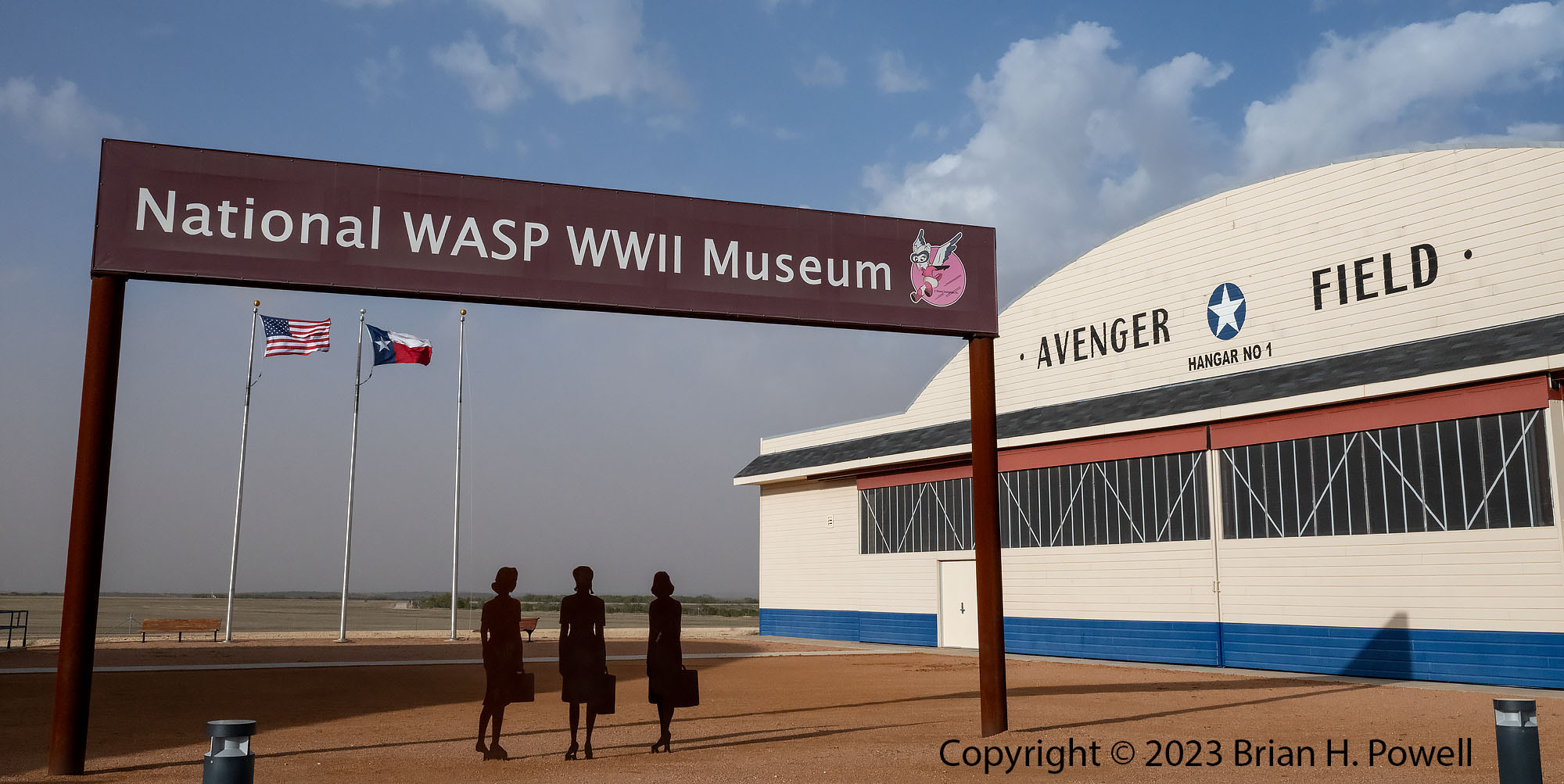
From Carlsbad, I drove east several hours to the National WASP WWII Museum in Sweetwater, Texas. This museum tells the story of the Women Airforce Service Pilot (WASP) program. In 1943 during World War II, the US Army took over Sweetwater Municipal Airport and made it the largest all-female training facility for pilots.
The women served a crucial homefront role, including the ferrying of aircraft, towing of gunnery targets, and transporting materiel.
The museum opened in 2005 and was expanded in 2021. I highly recommend a visit, even if it’s a bit out of your way.
Click any image to enlarge.
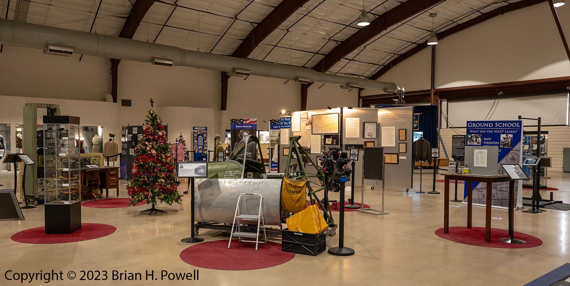
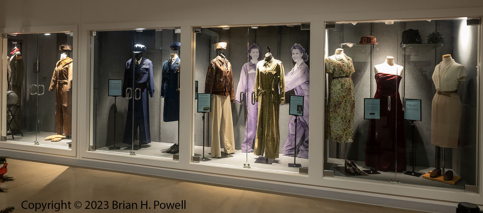
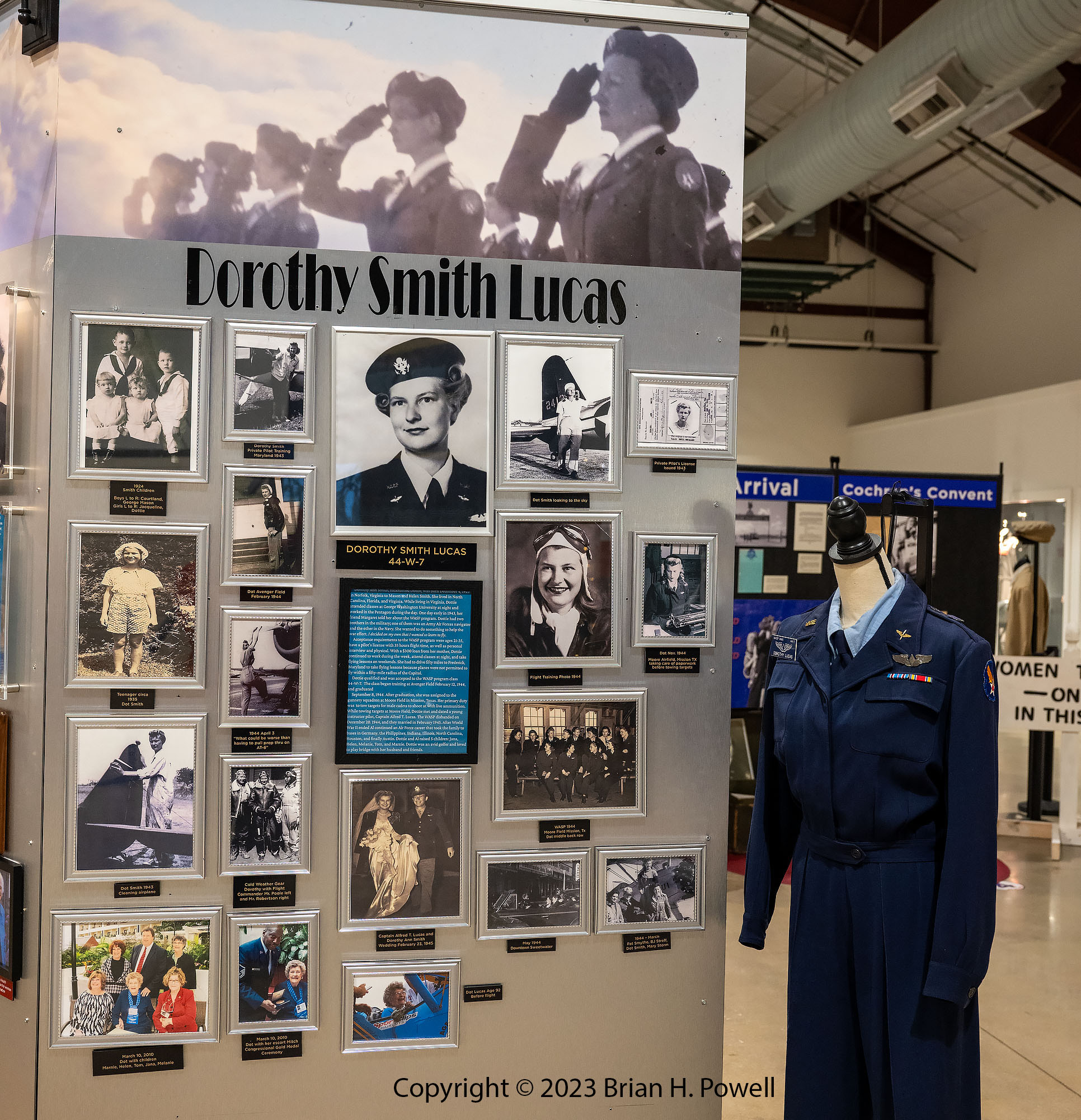
There are two hangars. The first contains several displays with information about the WASP program and a lot of personal memorabilia from women who served. A few years ago, I heard Dorothy Lucas (mother of a friend of mine) tell her story before she passed away in 2022 at the age of 99.
View of the inside of Hangar 1Historical clothing collectionDisplay of photos and memorabilia from Dorothy Lucas
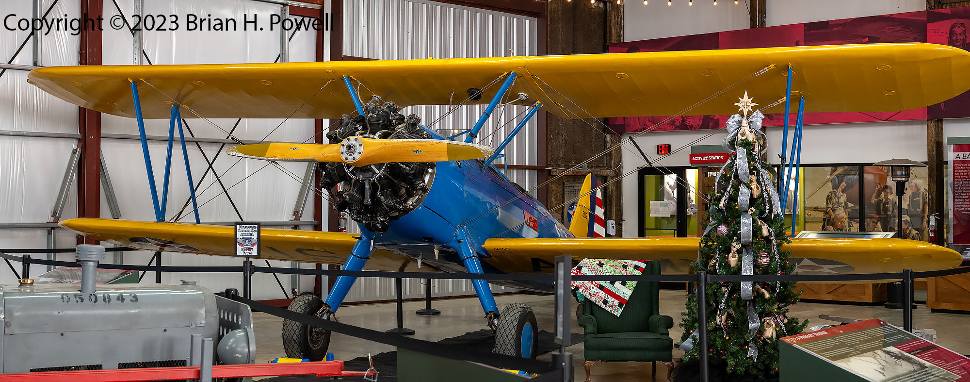
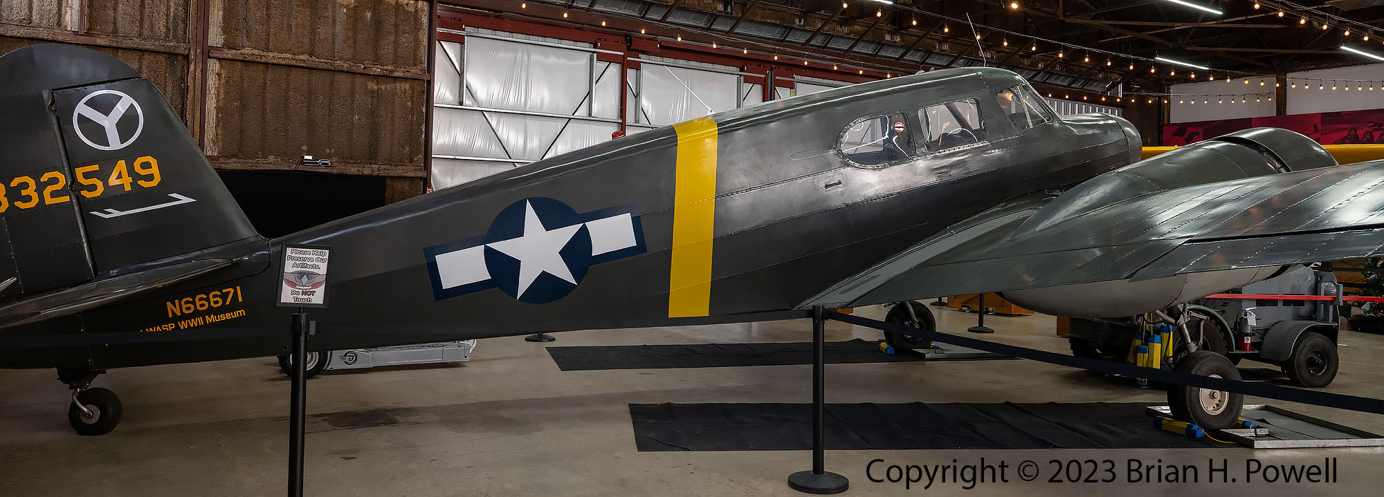
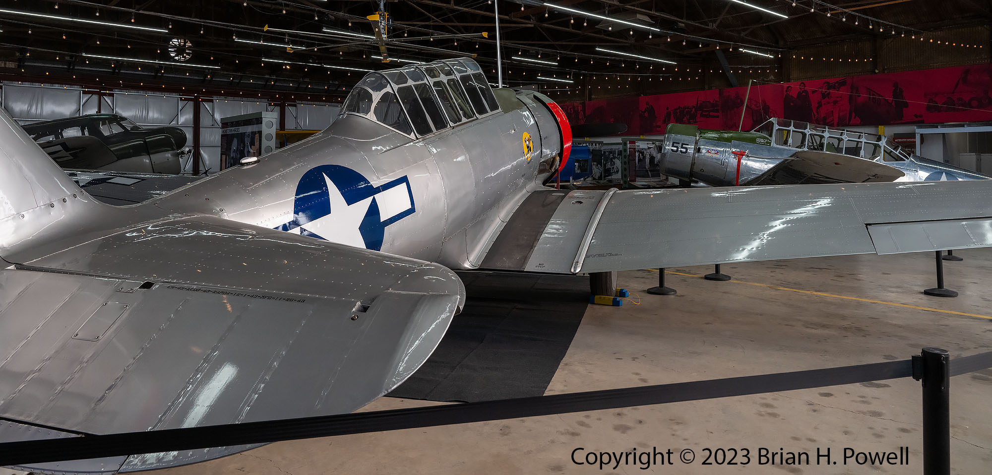
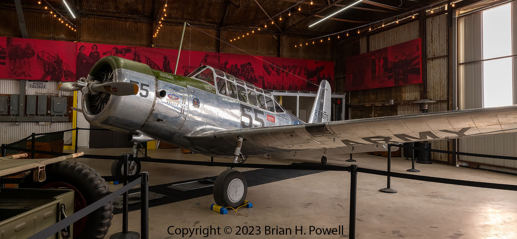
The second hangar contains four airworthy planes that represent the types of planes the WASP trained on during the war. This hangar also contains information about the everyday life as a WASP.
Boeing Stearman PT-17 TrainerCessna UC-78 TrainerNorth American AT-6 “Texan” TrainerVultee BT-13 Trainer
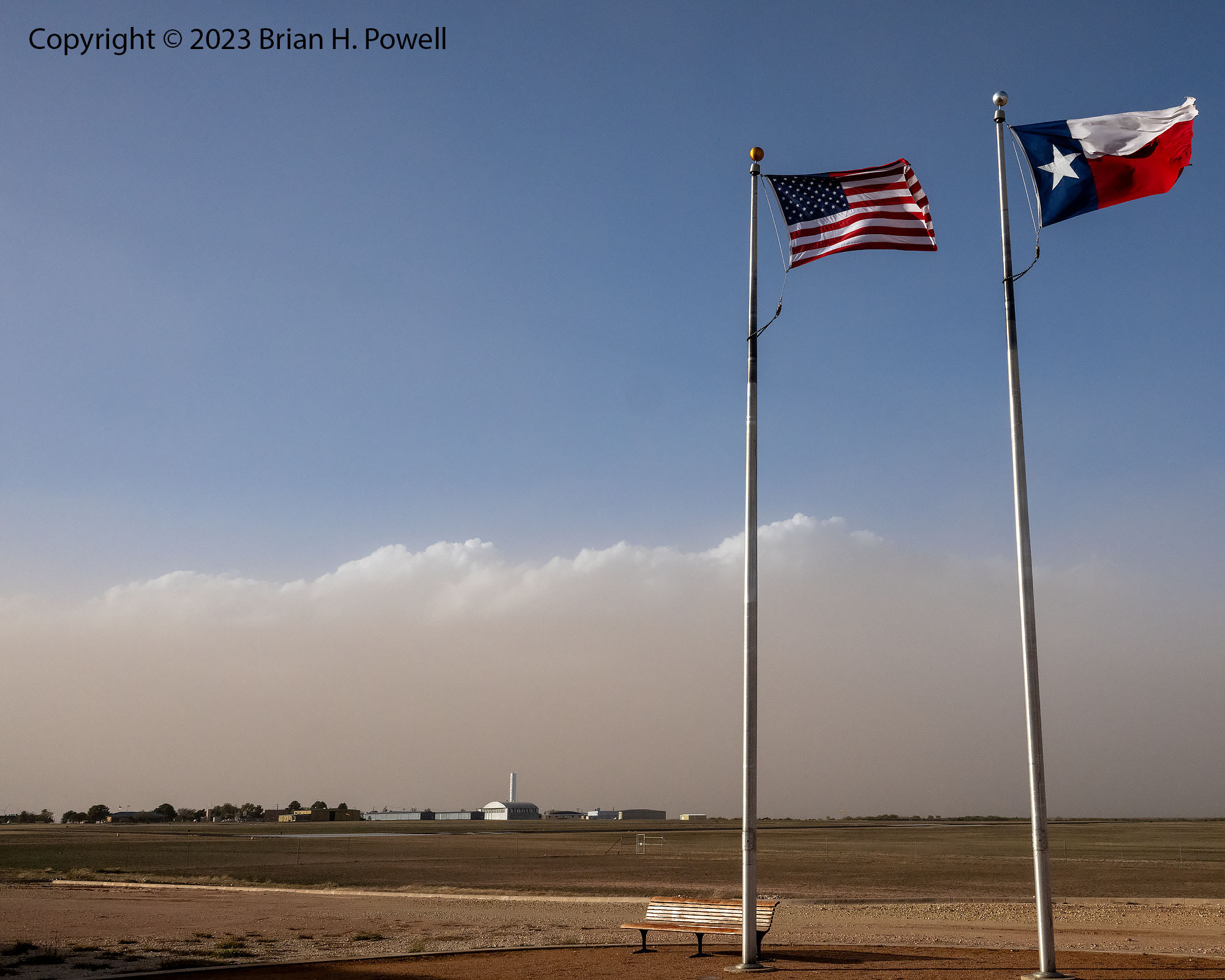
Ah yes, the photo below reminds me that I had a 30 mph tailwind on my drive from Carlsbad. I drove through some small dust storms, and had to dodge hundreds of tumbleweeds along the highway. (I couldn’t avoid them all!)
The photo below shows the airport with the general aviation facilities in the distance. A west Texas storm is on its way.
Avenger Field, Sweetwater Texas, with a storm approaching from the west
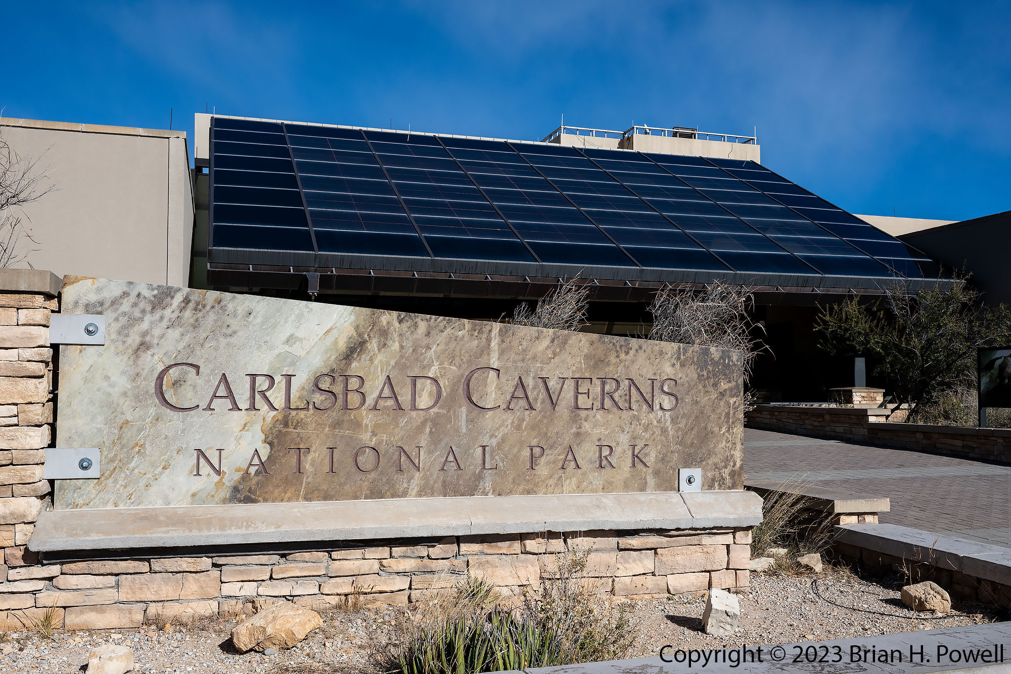
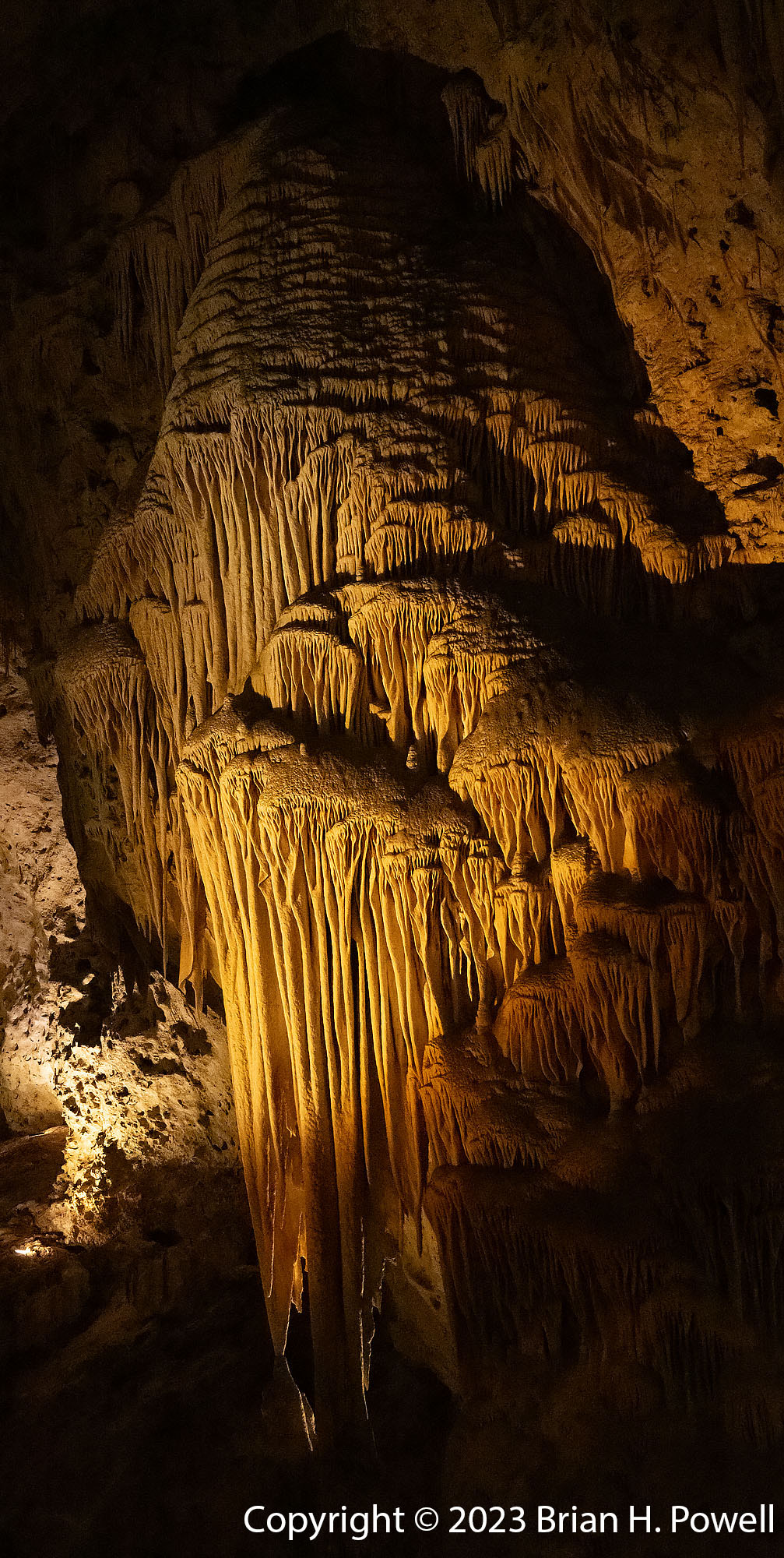
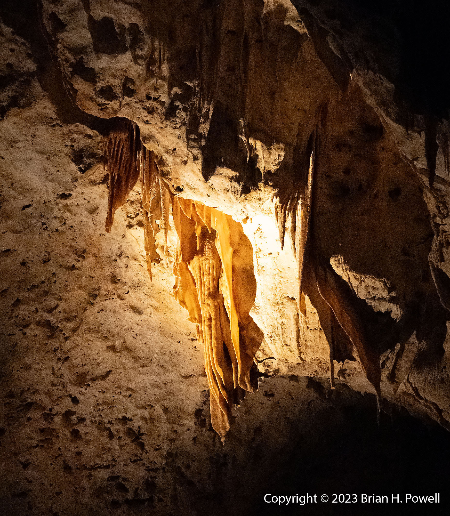
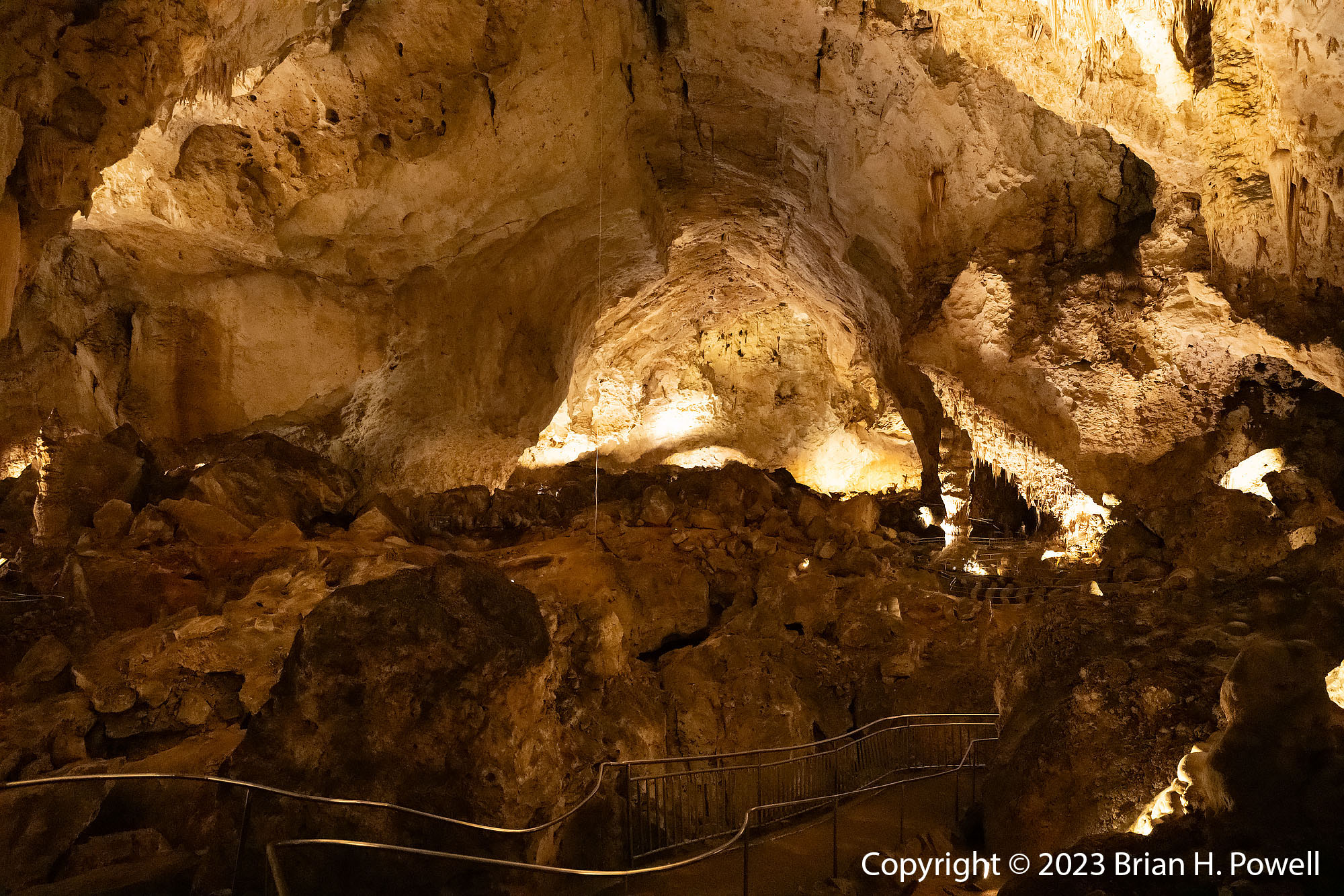
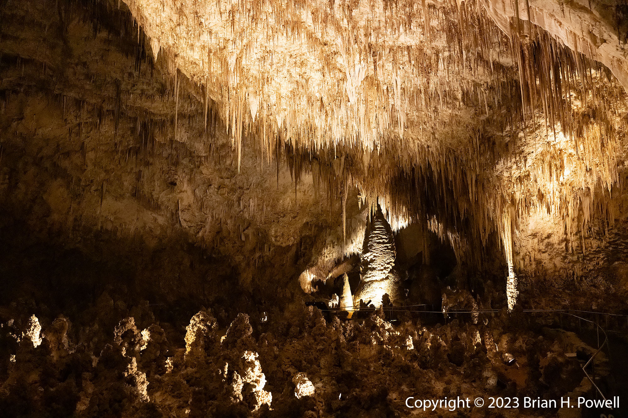
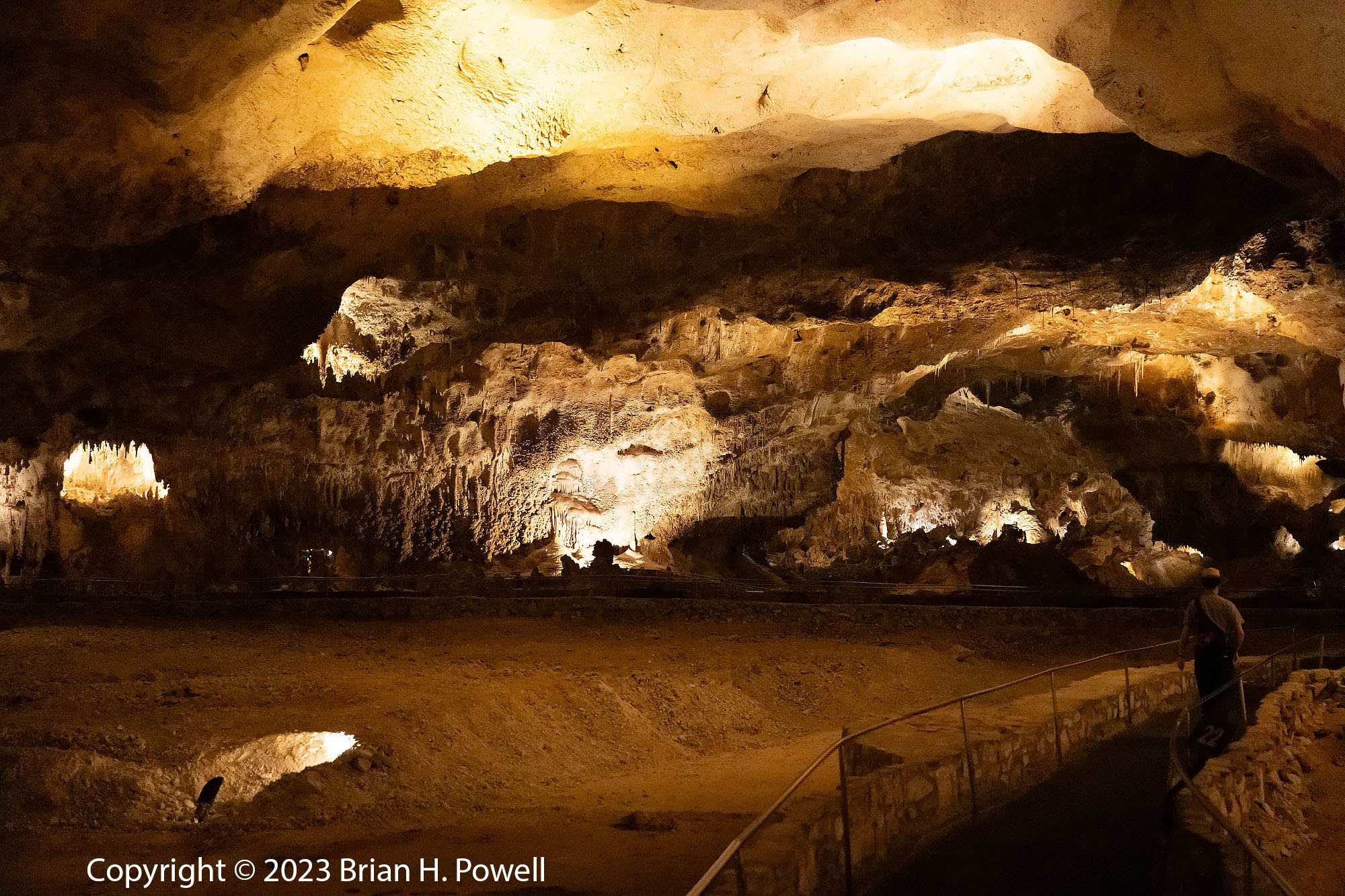
After spending the night in Carlsbad, New Mexico, I drove the half hour down to Carlsbad Caverns National Park. It has been 20 years or so since I last visited the caverns.
Visitors Center at Carlsbad Caverns National Park
I arrived early on a weekday morning in late November. Before going down into the cavern, the ranger said, “There aren’t many people here yet. It’s going to seem like you have the place to yourself.” And he was right. It was great to experience the cave in solitude.
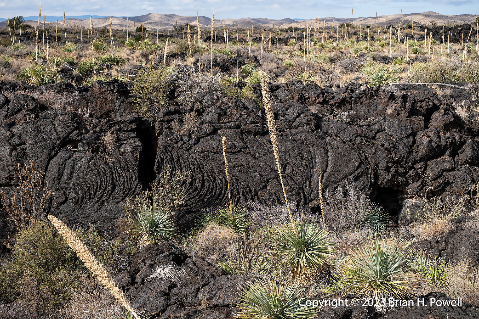
After some dawn photography at Bosque del Apache National Wildlife Refuge, I drove east to start the drive back to Texas. One stop I often make is at the Valley of Fires Recreation Area. This is part of the Malpais Lava Flow. It’s a nice place to get out and stretch during the long drive.
Click any image to enlarge.
Valley of Fires Recreation Area, New Mexico
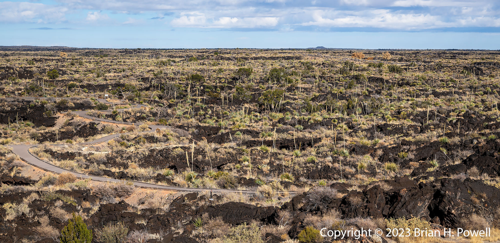
The lava flow happened about 5000 years ago. In the photo below, you can a small cone on the horizon. This is Little Black Peak, the source of the lava flow. It’s about 7 miles north of the visitors center. There’s a 1 mile paved footpath through the lava flow that you can see in the photo below as well.
Valley of Fires Recreation Area, New Mexico
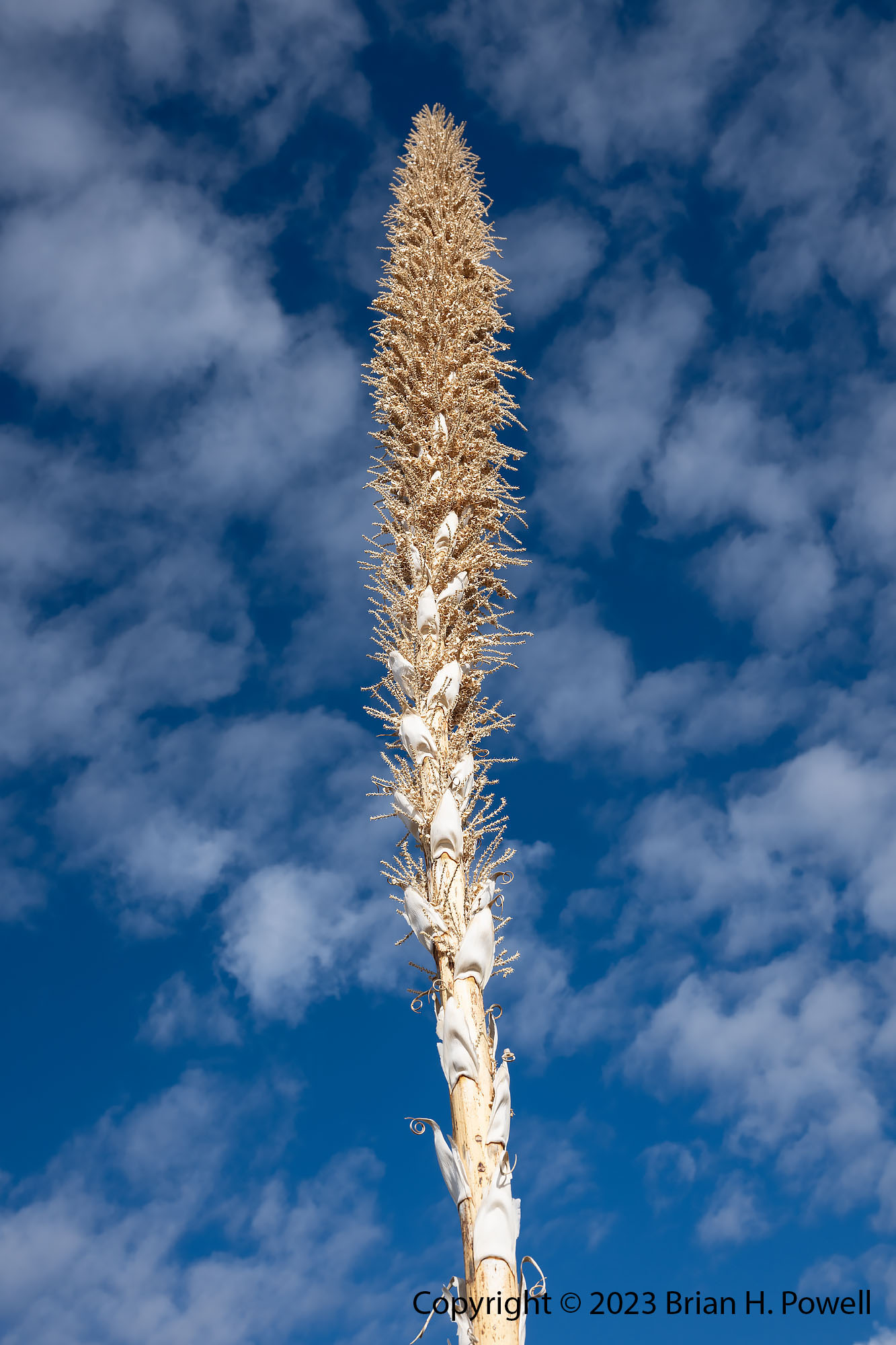
One common plant you see in all of these photos is Sotol (Dasylirion Wheeleri). They have a tall flowering stalk.
Sotol stalk, at Valley of Fires Recreation Area, New Mexico
Dasylirion Wheeleri (Common Sotol) flower stalk
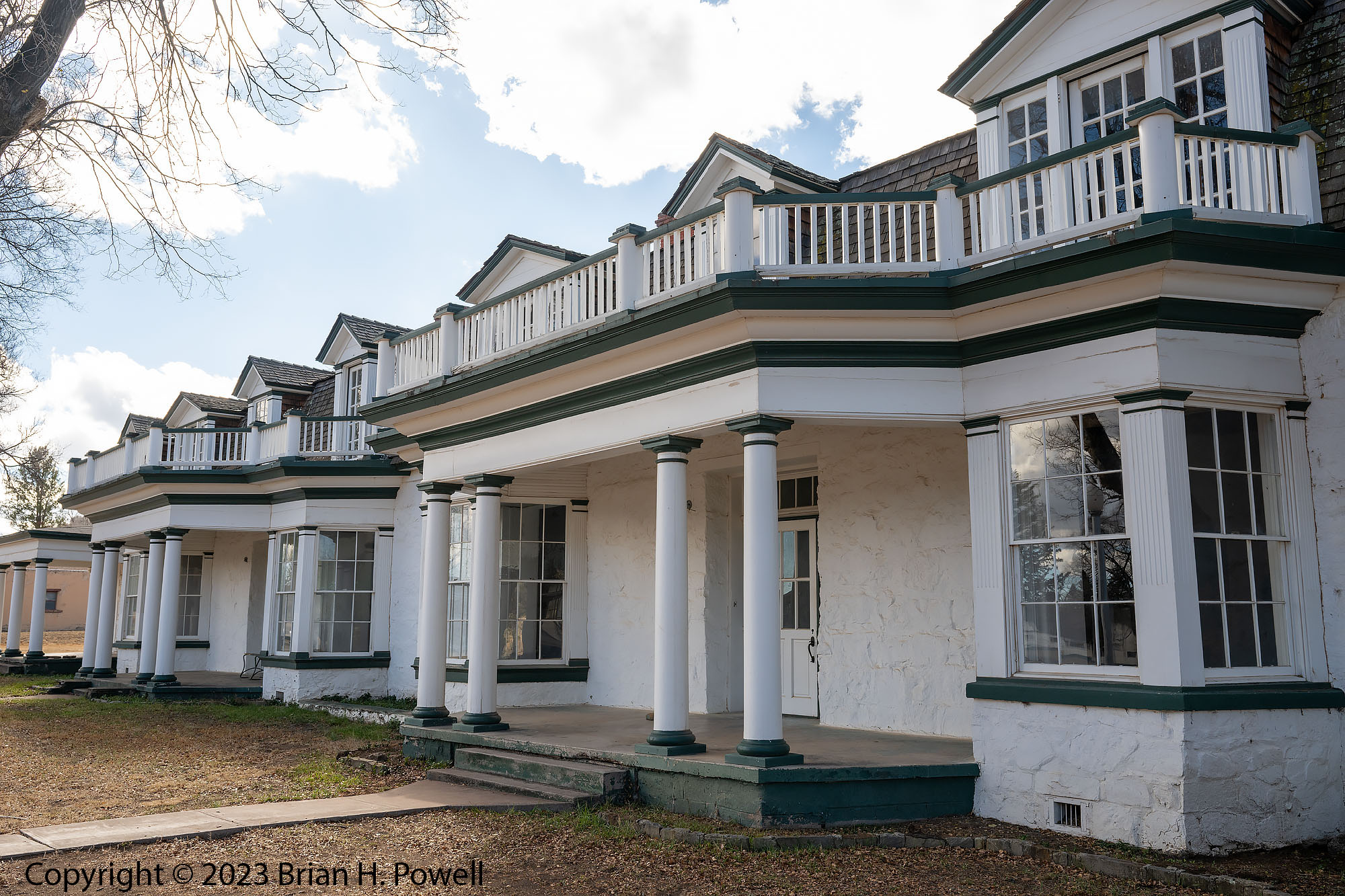
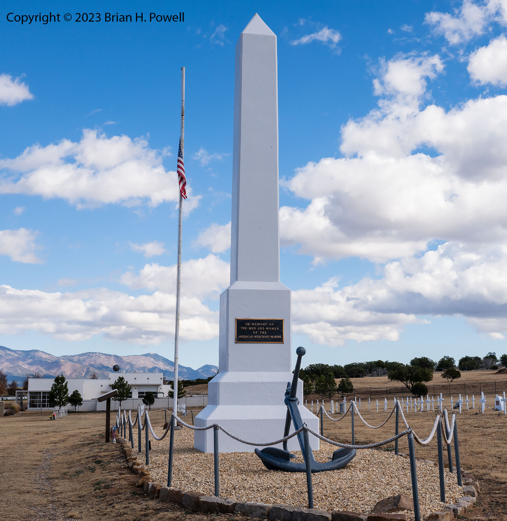
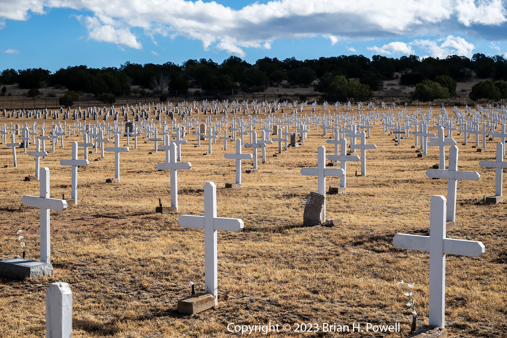
After walking the loop trail at Valley of Fires, I continued driving east. Going this direction takes me past Capitan (where I often stop to pay my respects at the grave of Smokey Bear). Nearby, there’s a road to the south that goes to Ruidoso. This time I stopped to see Fort Stanton, a historic site that started as a military outpost in the mid-19th century. In the 20th century it was used as a US Merchant Marine Tuberculosis Hospital, a Civilian Conservation Corps camp, a German POW internment camp, and a state hospital, among other things.
One day during my time in New Mexico, I drove north to find the Ladd S. Gordon Waterfowl Complex. After exiting I-25, I took a wrong turn and missed the entrance to the Waterfowl Complex. But I saw a sign for Salinas Pueblo Missions and kept on driving east about 30 miles.
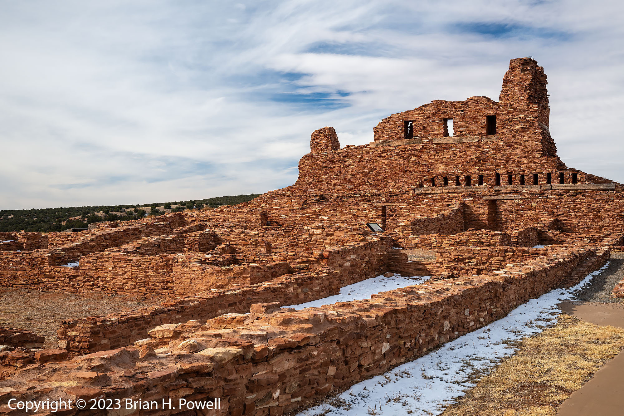
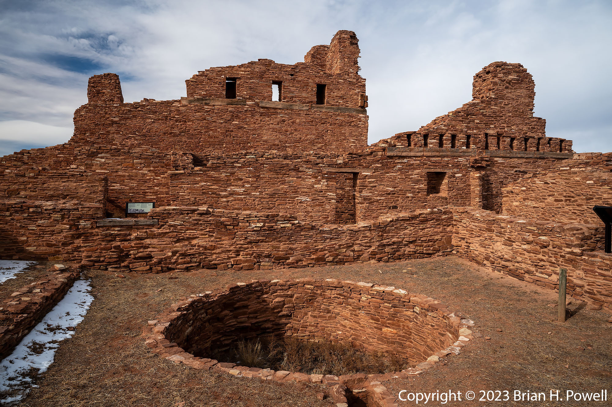
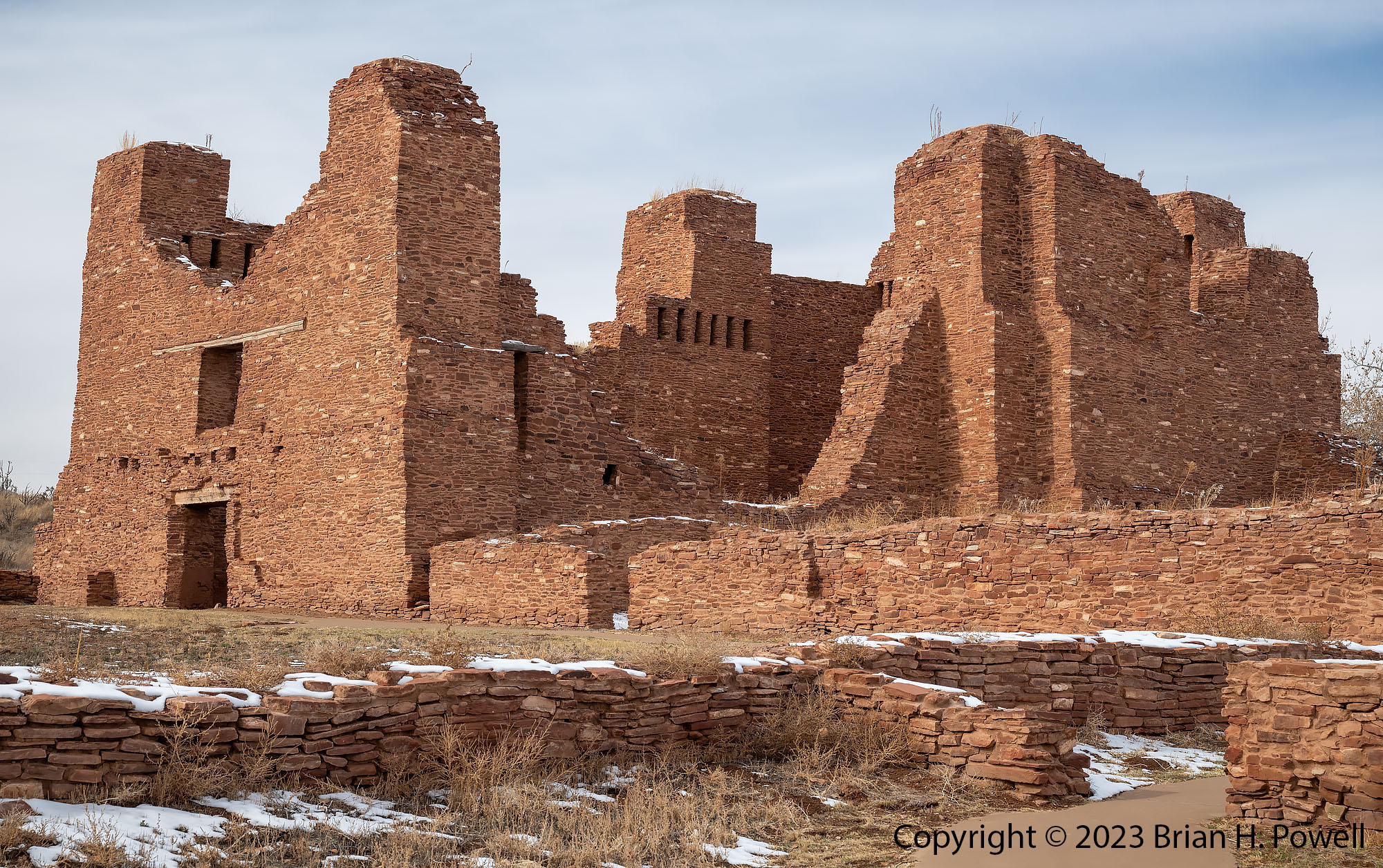
The Salinas Pueblo Missions were built as part of the Spanish influence of the 16th and 17th centuries. I visited these missions on my first trip to Bosque in 2005. There are three sets of ruins, along with a visitors center in the town of Mountainair. The area is part of the Salinas Valley, named for salt flats (Las Salinas) a few miles to the east of Mountainair. The salt was a valuable commodity for trade.
The first site I came to is is Abó.
Click any image to enlarge.
Ruins of the Mission of San Gregorio de Abó
Ruins of the Mission of San Gregorio de Abó
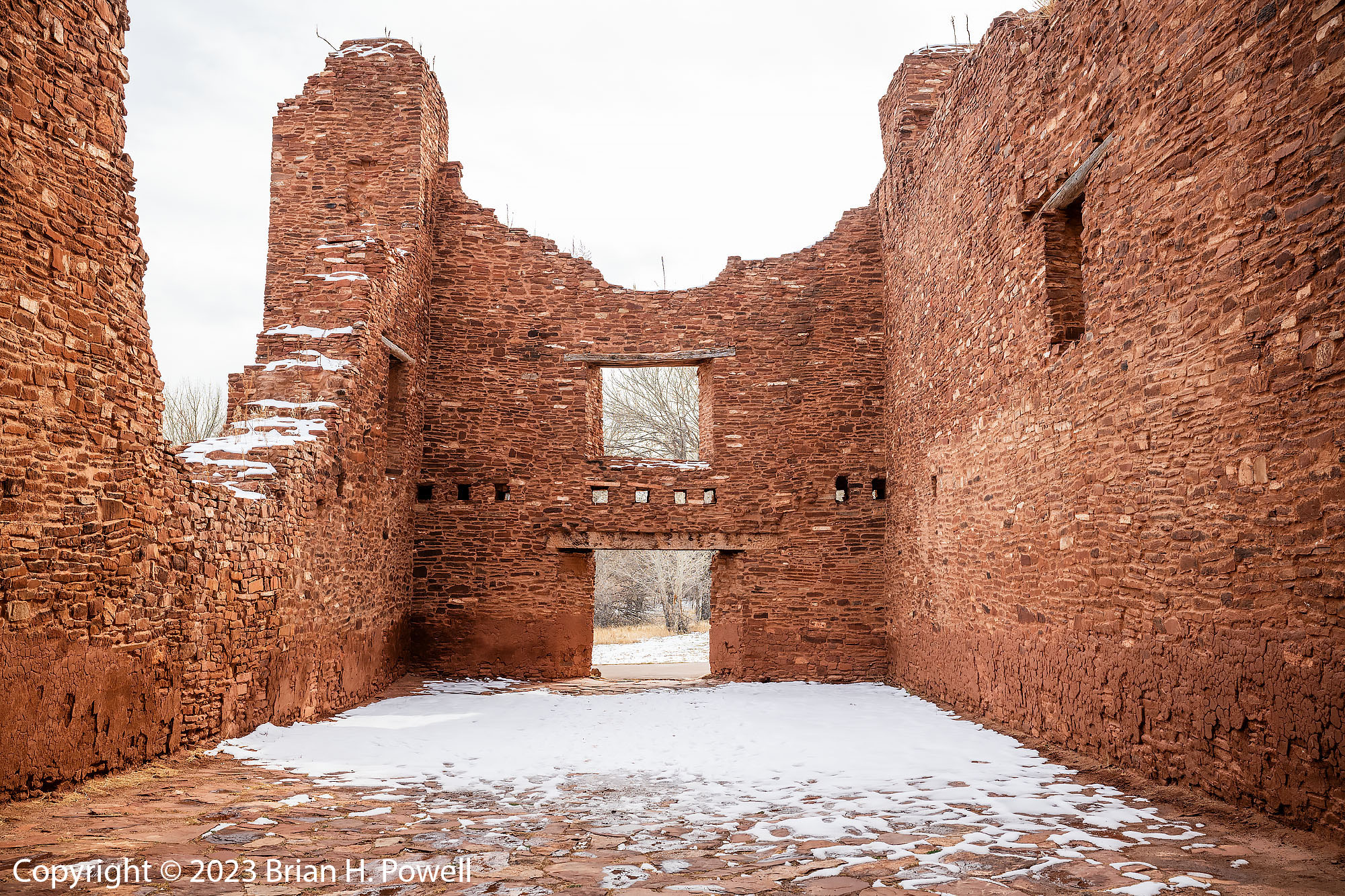
Another ten miles east is the town of Mountainair, where I visited the Visitors Center for the National Monument, and ate lunch at a small hotel nearby. Then I drove north to Quarai, another site of the National Monument.
Ruins of the church and convento of Nuestra Señora de la Purisima Concepción de Quarai
Ruins of the church and convento of Nuestra Señora de la Purisima Concepción de Quarai
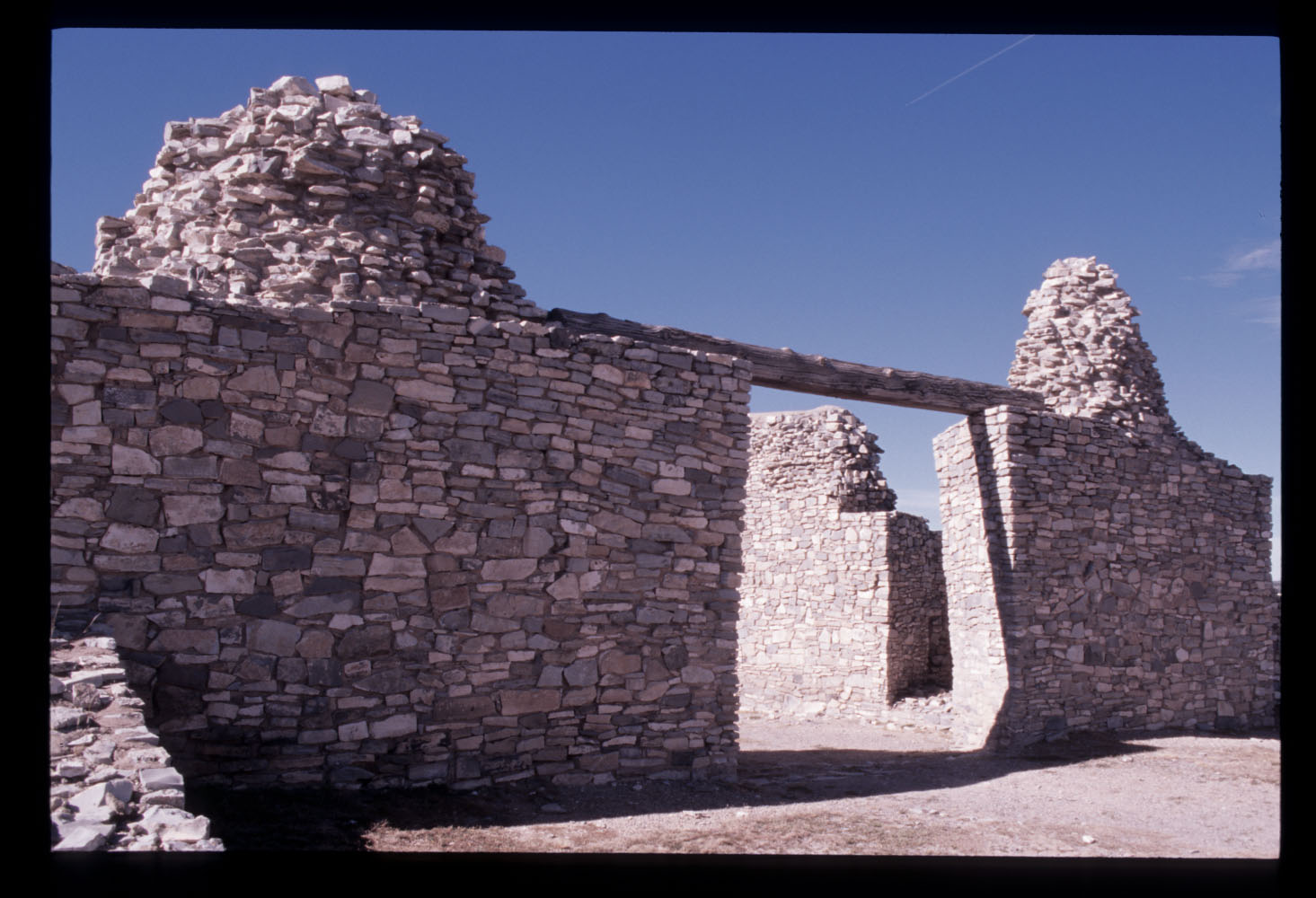
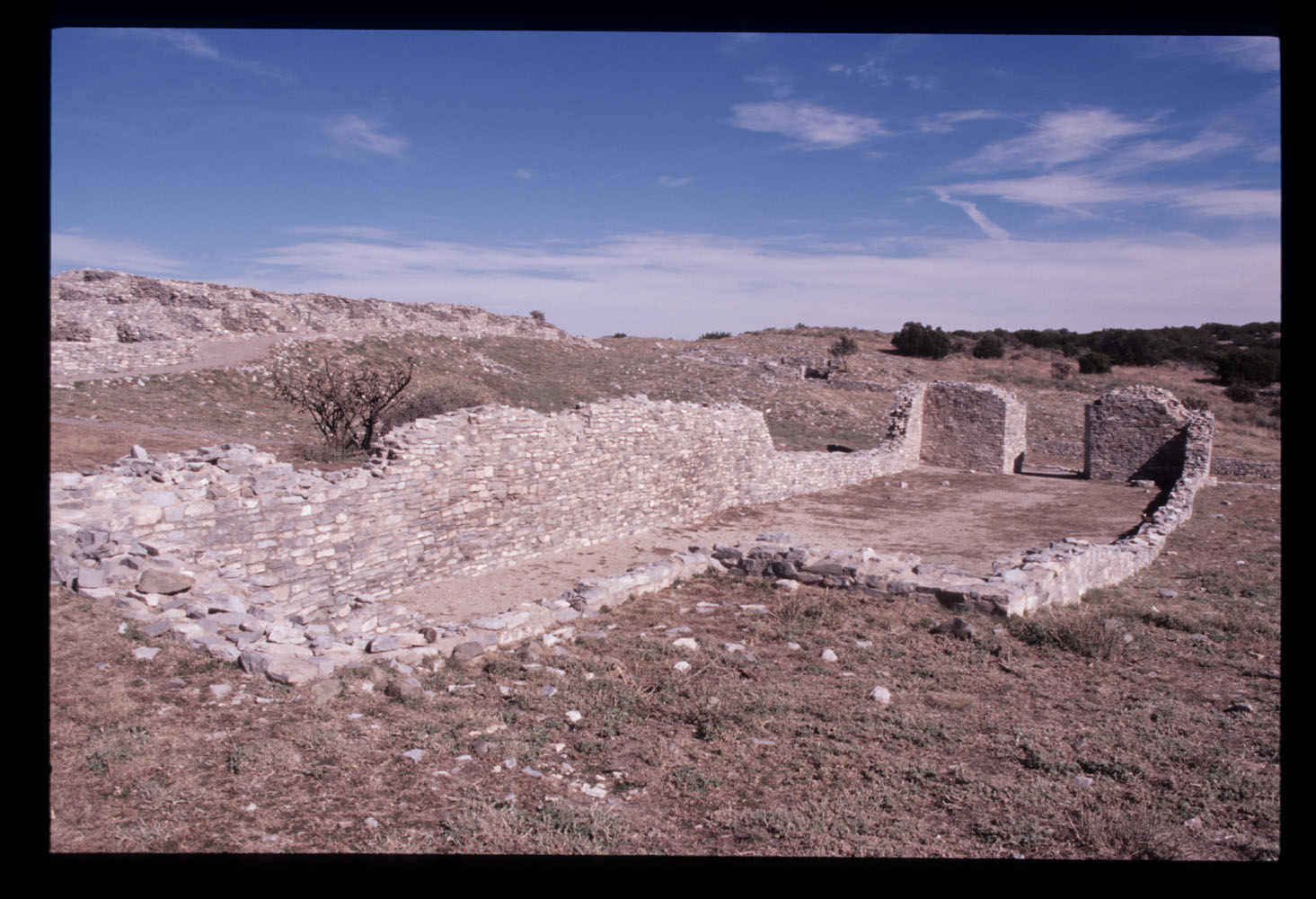
On this trip, I did not visit the third site, Gran Quivira, which was about 25 miles south of Mountainair. But I did visit that site in 2005. Here are scans of a couple of photos I took on film on that visit.
Ruins of church and convento of Gran QuiviraRuins of church and convento of Gran Quivira
On the way back from Salinas Pueblo Missions, I did find the correct road that took me to the Ladd S. Gordon Waterflow Complex. See my earlier post for photos from the refuge.
This reminds me that I never wrote about a trip I made to Pecos National Historical Park in 2021, so let me briefly write about it here.
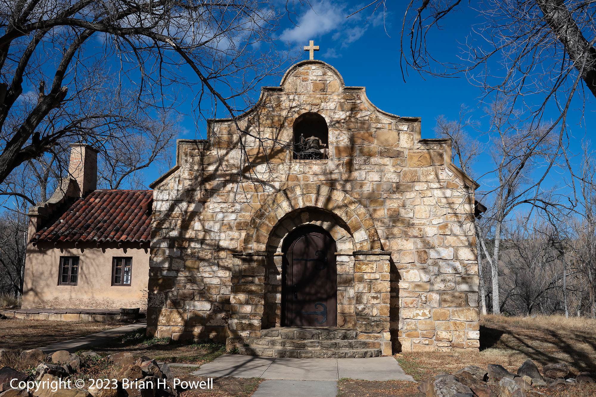
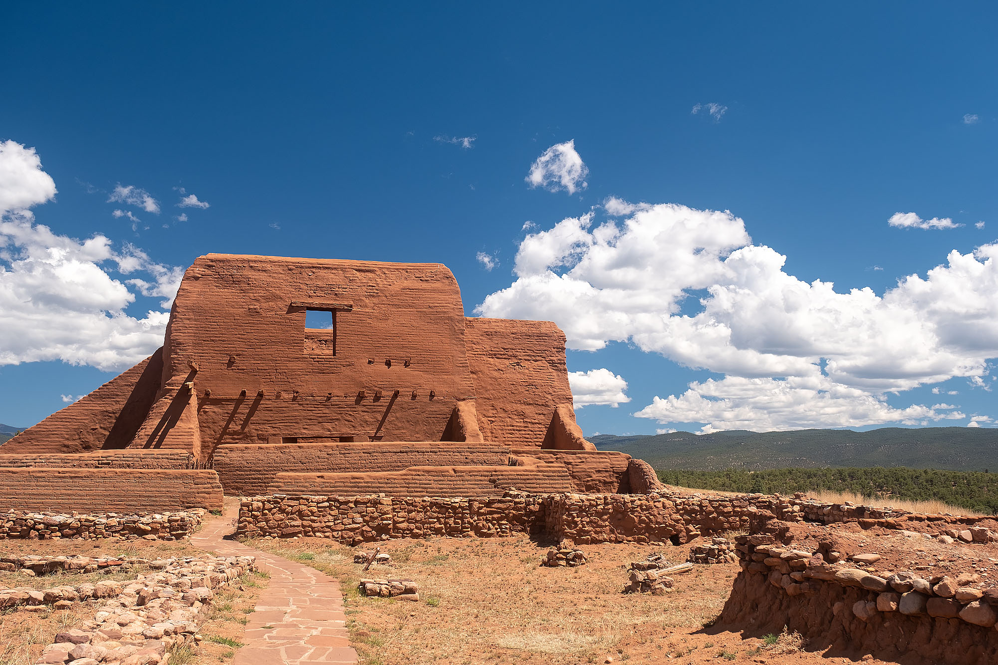
Pecos National Historical Park is east of Santa Fe, New Mexico, along the historic Santa Fe Trail, a vital trade route between Missouri and New Mexico. The park encompasses historic pueblo ruins as well as a US Civil War battlefield. Pecos Pueblo was inhabited from the 14th to 19th centuries.
Pecos Pueblo, New Mexico
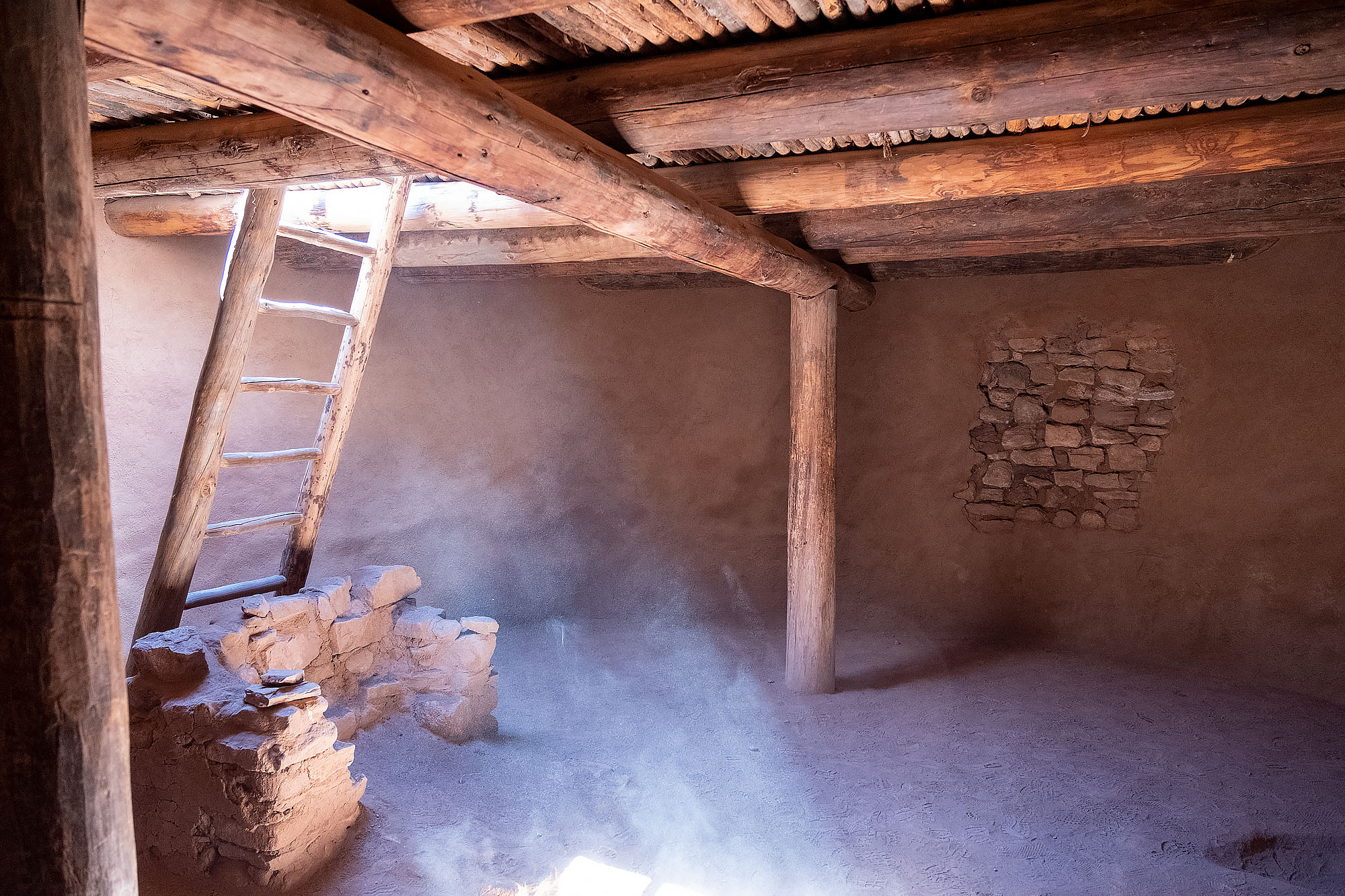
Reconstructed kiva at Pecos National Historical Park
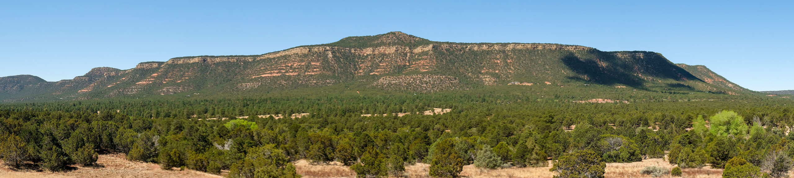
A few miles west of the pueblo is Glorieta Pass, the site of the westernmost battle of the US Civil War. It was fought mostly between Union infantry and cavalry from New Mexico and Colorado Territories and Confederate troops from Texas.
The battlefield itself is not particularly photogenic, though the mountainous area is beautiful. There’s a 2+ mile loop around the site with signage to help you imagine how the battle unfolded.
Bosque del Apache is a National Wildlife Refuge along the Middle Rio Grande Basin in central New Mexico. This area of the Rio Grande is a wintering ground for many birds, including tens of thousands of Snow and Ross’ Geese, and thousands of Sandhill Cranes.
I first visited the refuge in 2005 with a Nikon F100 film camera and shot six rolls of 36-exposure slide film. I went back each of the next four years with a digital camera, and shot thousands and thousands more photos at the refuge. I kind of got burned out visiting the place, and only went again in 2012, 2019, and this year, 2023. To see photos from some of these earlier trips, visit my posts tagged with Bosque del Apache NWR.
Once upon a time–the mid-1990’s to 2000’s–Bosque del Apache was an amazing hotspot for bird photography. The refuge was managed to have lots of food and marshes for the birds, and photographers had their choice of creative ways to spend sunrise, mid-day, and sunset. Many of the best wildlife photographers ran workshops there. Unfortunately, over the last dozen years or so, the refuge is intentionally being managed to reduce the number of birds that visit and encourage them to winter elsewhere. I suppose there must be reasonable science that justifies that, but it also means that the photographic opportunities are a shadow of what they used to be.
It’s not all doom and gloom. There are still good bird photos to be made. New Mexico sunrises and sunsets are still amazing. Many birds still winter here.
I visited the last week of November. The temperatures ranged from the upper 20’s (Fahrenheit) to mid 50’s. We had a consistently north wind and dry days. Some days were mostly cloudy. Some were mostly clear, with high clouds.
I woke up early on Sunday and drove about ten hours to the refuge. I managed to make it in time to drive around the refuge once. I was disappointed to see that it’s still not set up well for photography. Only a few areas are set up to attract birds, they are often set well back from the roads, and the grasses at the edge of the road are often six to ten feet high–obscuring the sightlines.
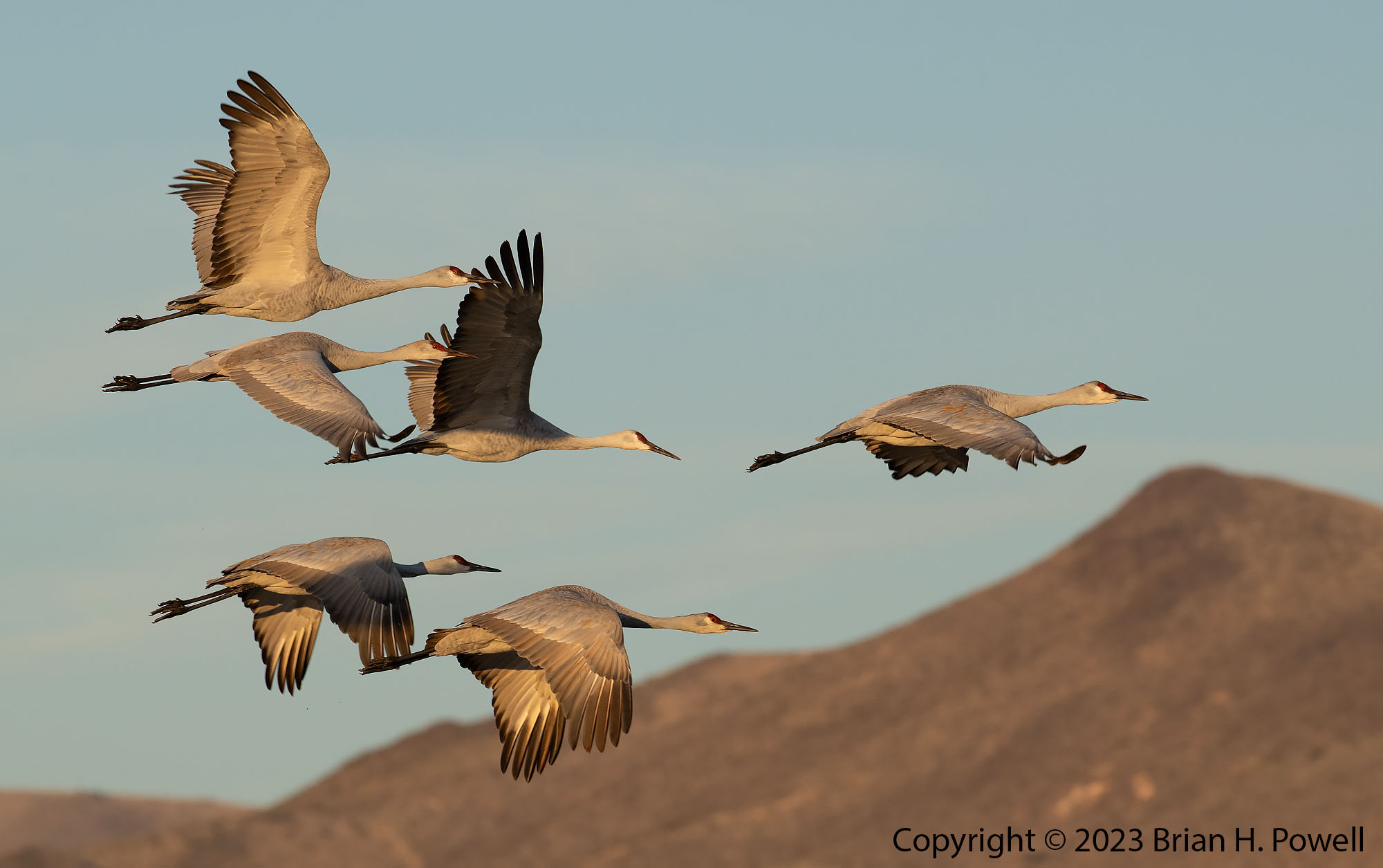
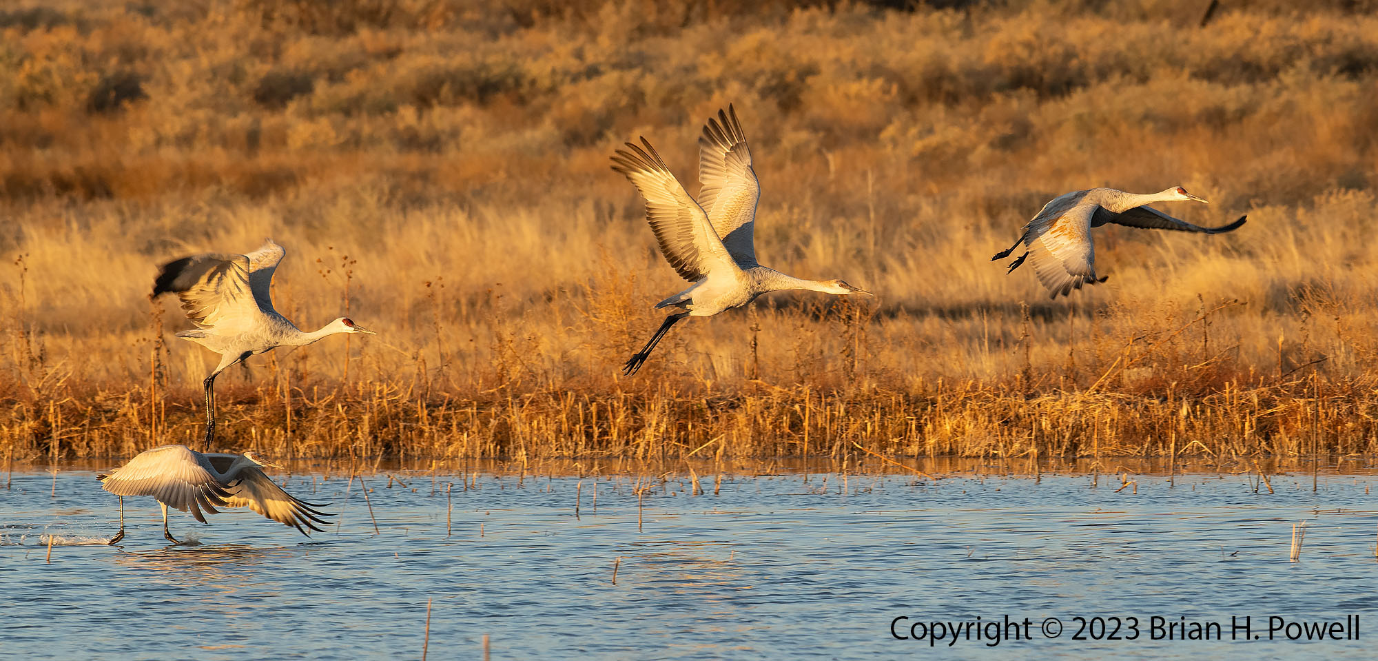
Anyway, I watched sunset from the last remaining crane pool that’s by the highway to watch Sandhill Cranes fly in for the night.
Click any of the images in this post to view them larger.
Sandhill Cranes at Sunset
Sandhill Cranes at sunset.
As is usual, I spend the first 24 hours or so figuring out what the birds are doing at different times of day. It all depends on where the water is, where the food is, where the wind is coming from, how cold it is, and other factors. The birds don’t always follow a fixed plan, but they are fairly consistent from day to day.
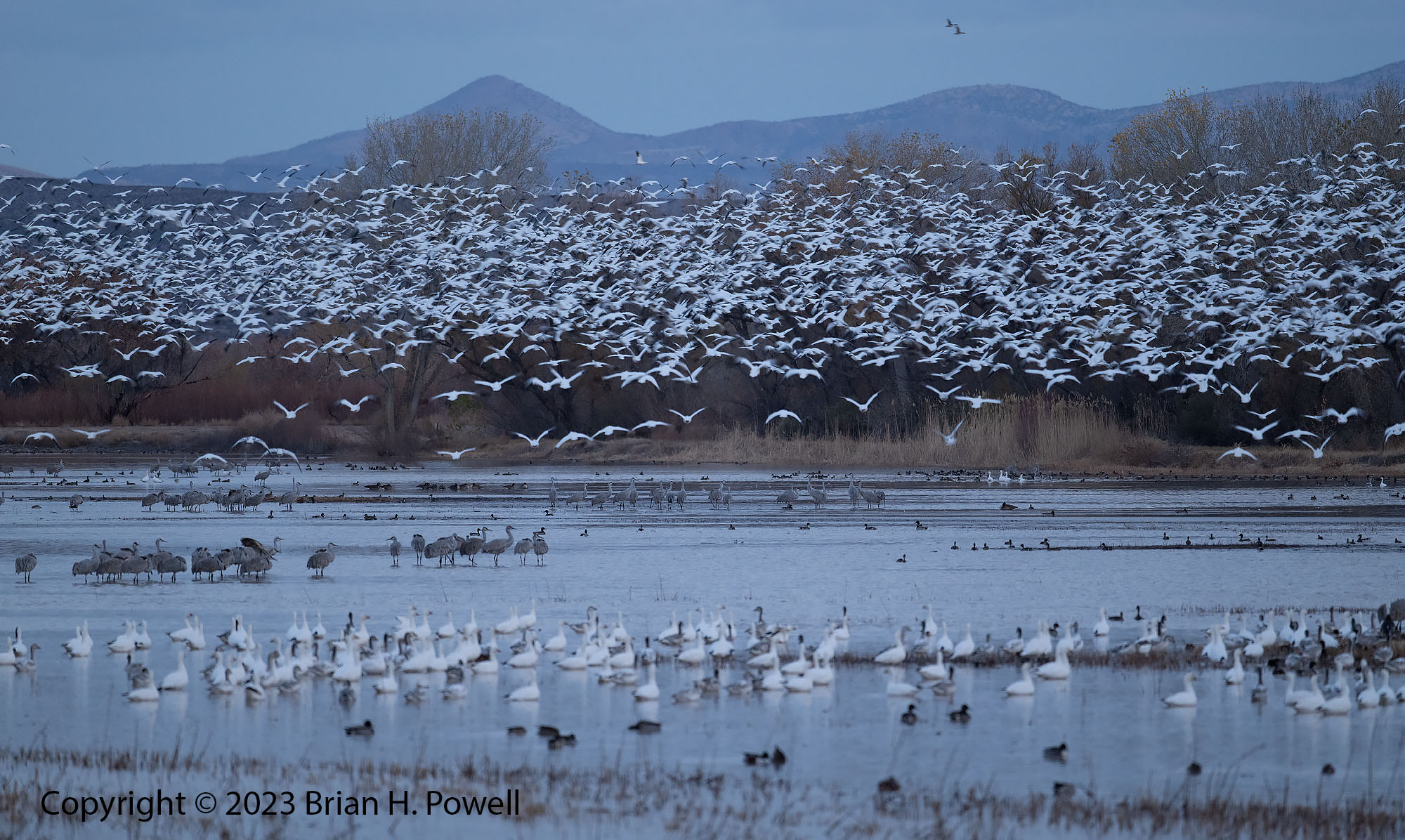
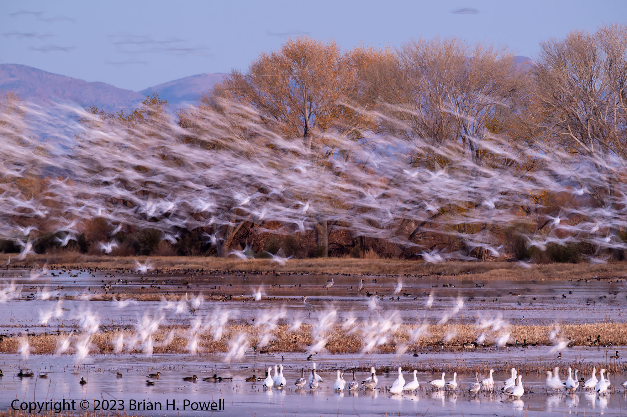
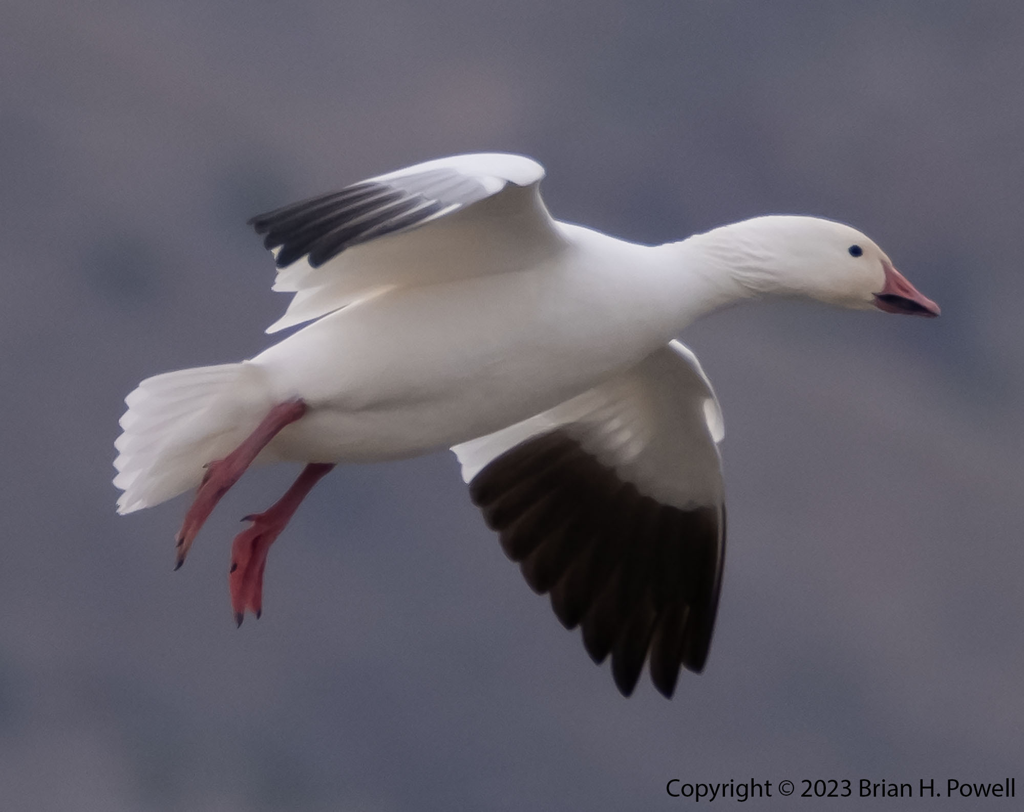
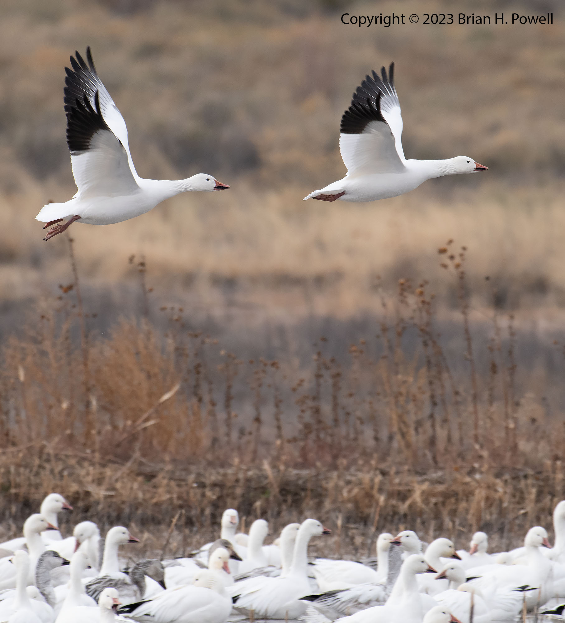
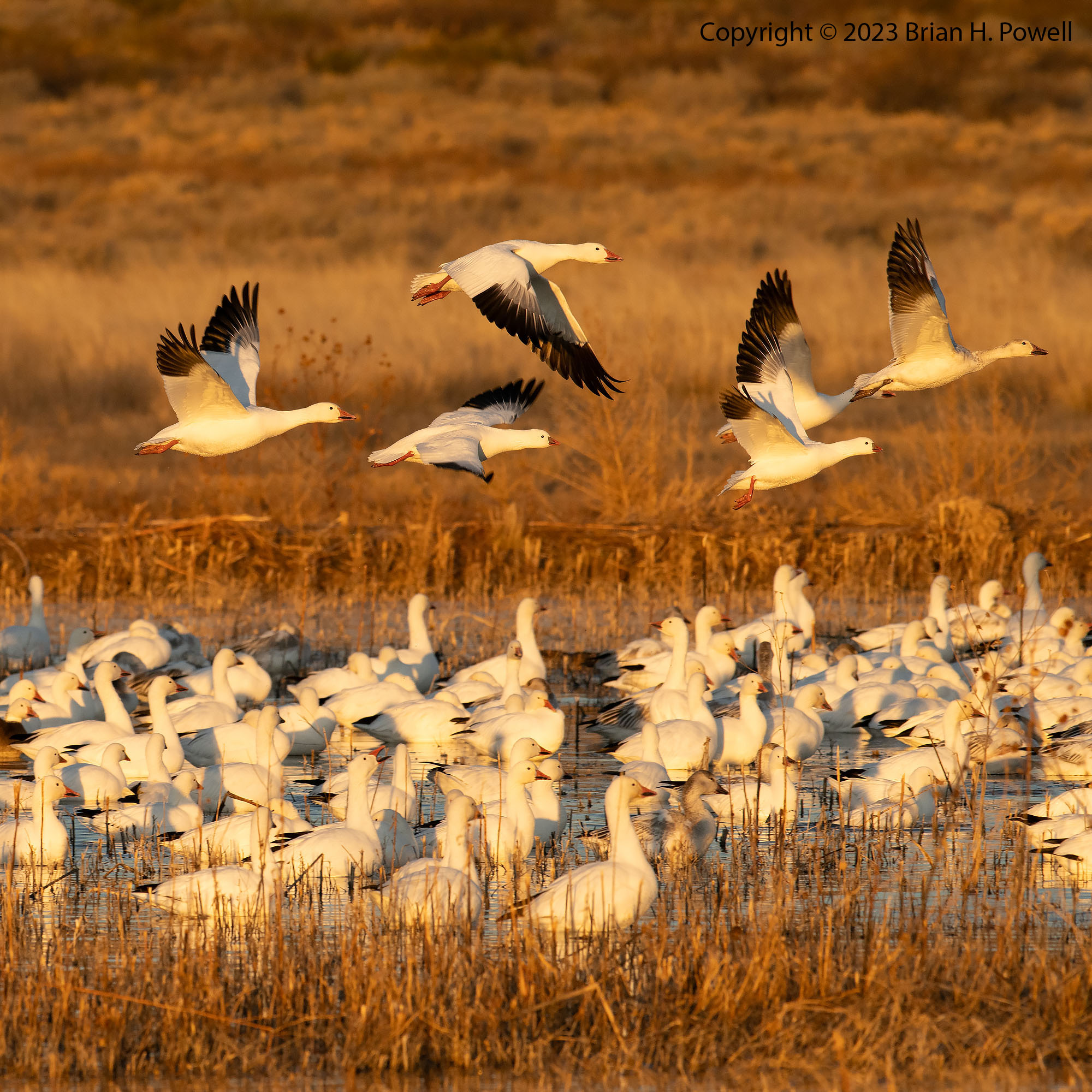
On Monday morning about an hour before dawn, I drove around the north half of the refuge again and–unsure of the best place to start–ended up near the Flight Deck area inside the refuge. There weren’t a ton of birds there, but there were dozens of photographers getting set up. I set up, too, and waited to see what would happen. Soon there was a flock of snow geese blasting off from the back (east side) of the refuge and they worked their way over to us and landed in the water near the Flight Deck. I made a mental note to try to find their overnight location so I could see them before they flew off. Each of the next two mornings, I set up on the east side–with almost no one else around. Well, it was me and several thousand birds.
Thousands of Snow Geese taking flight before sunrise
A blur of Snow Geese taking off before sunrise
As you can see from the photos above, it was warm enough (mid 20’s) that the snow geese took off before sunrise. If it is ten degrees or so colder, the geese often wait until after the sun is up to take off, giving more color from the sun and sky.
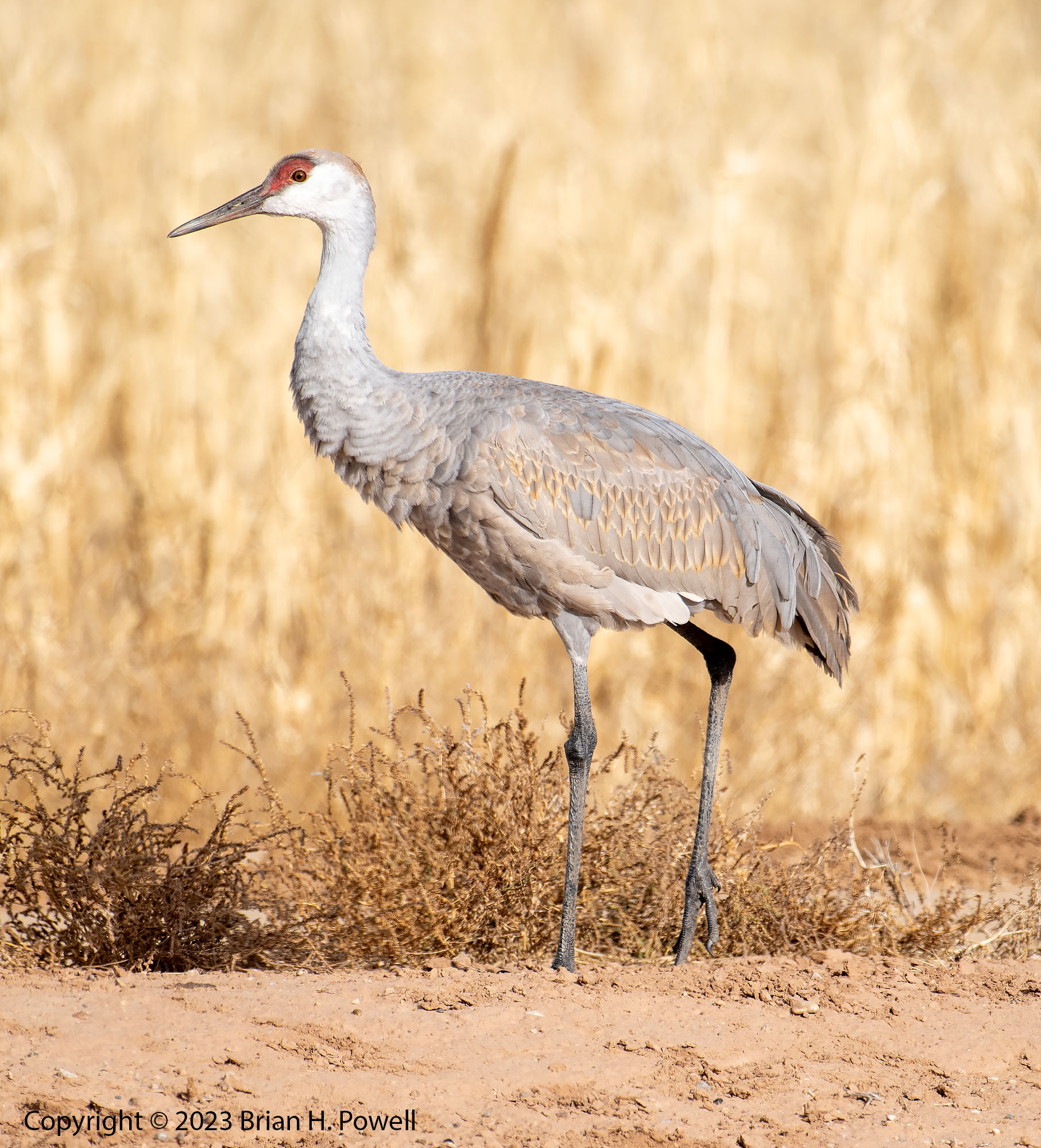
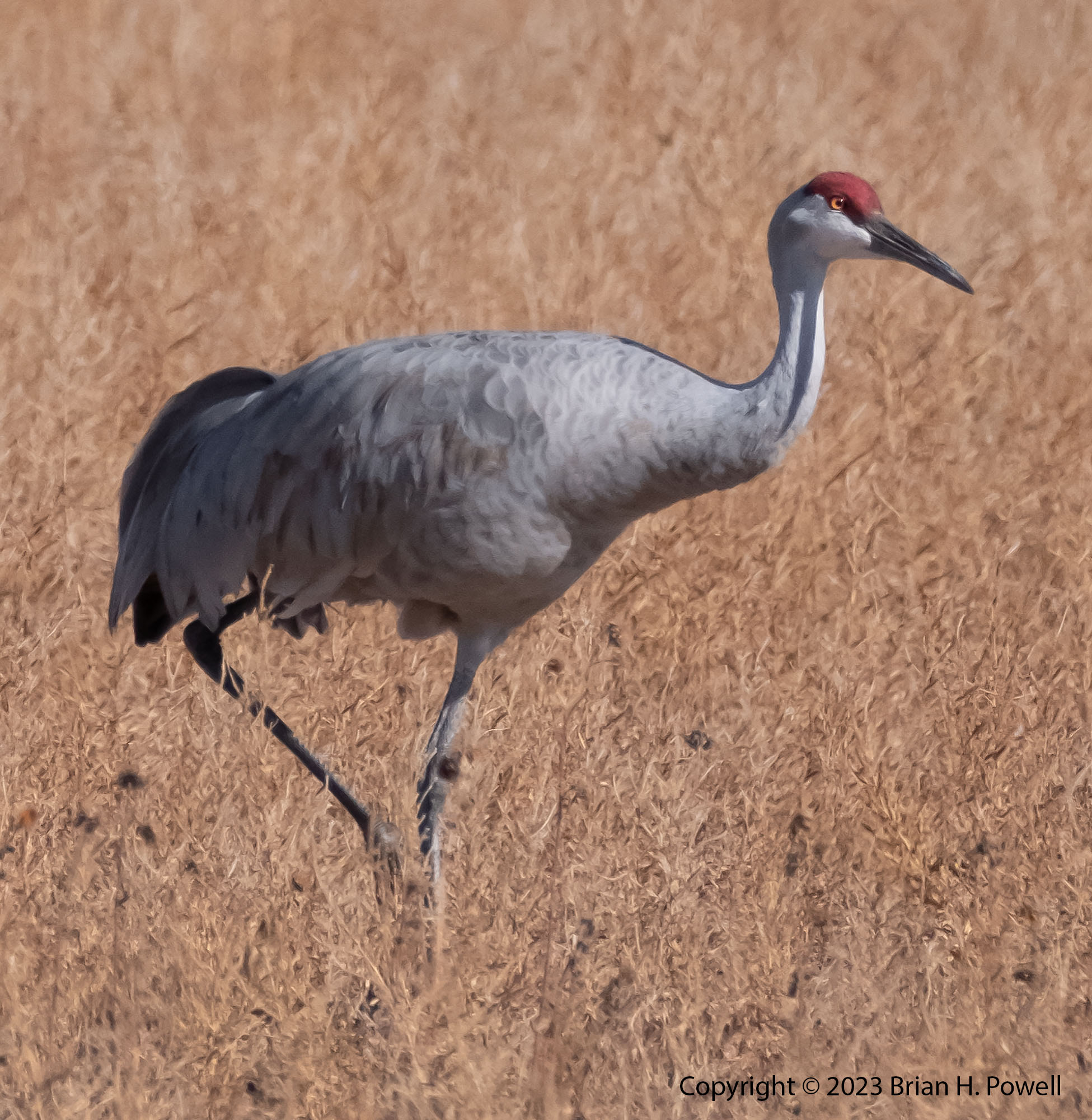
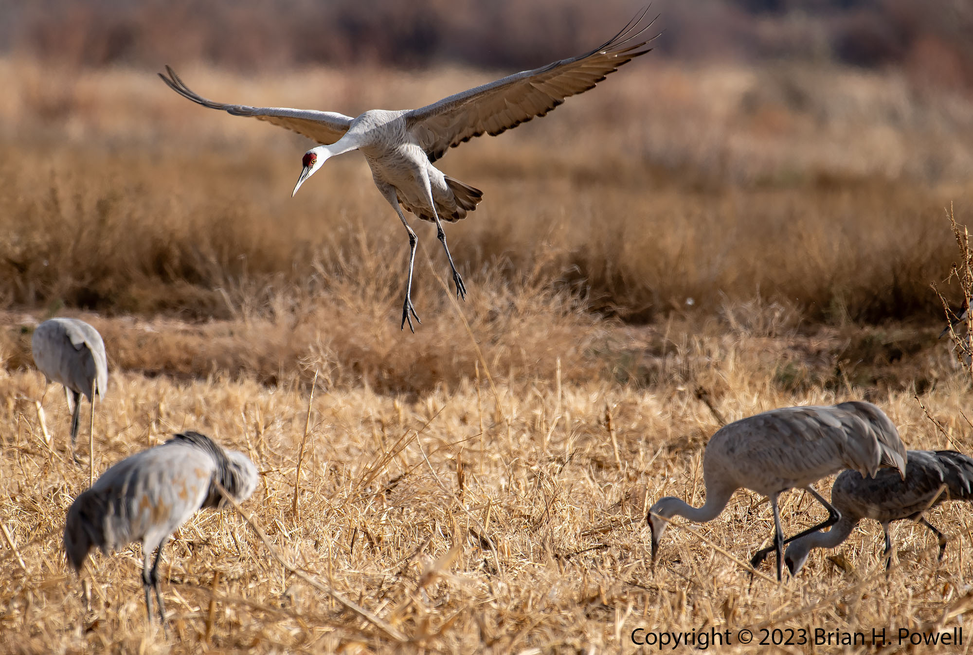
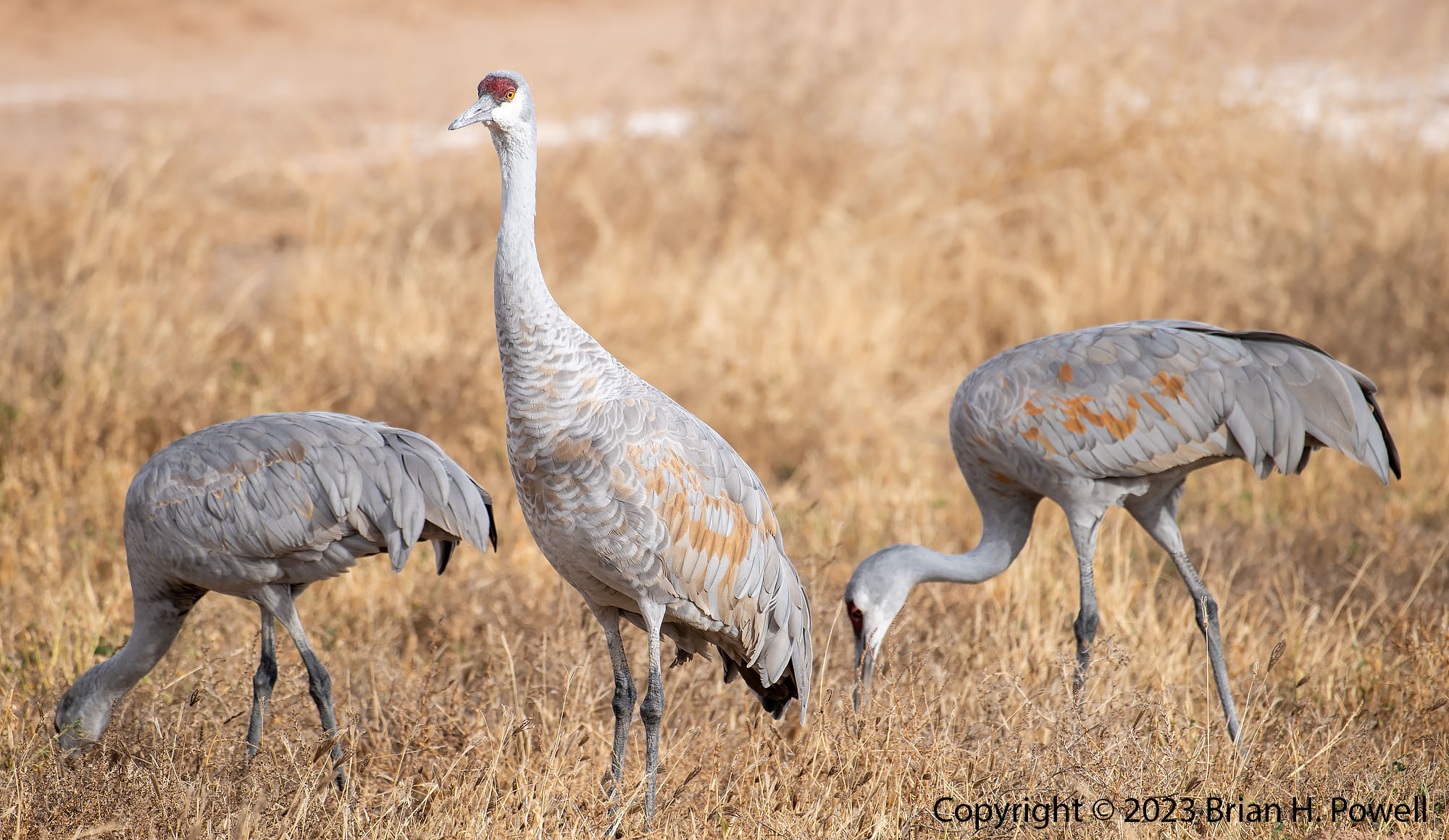
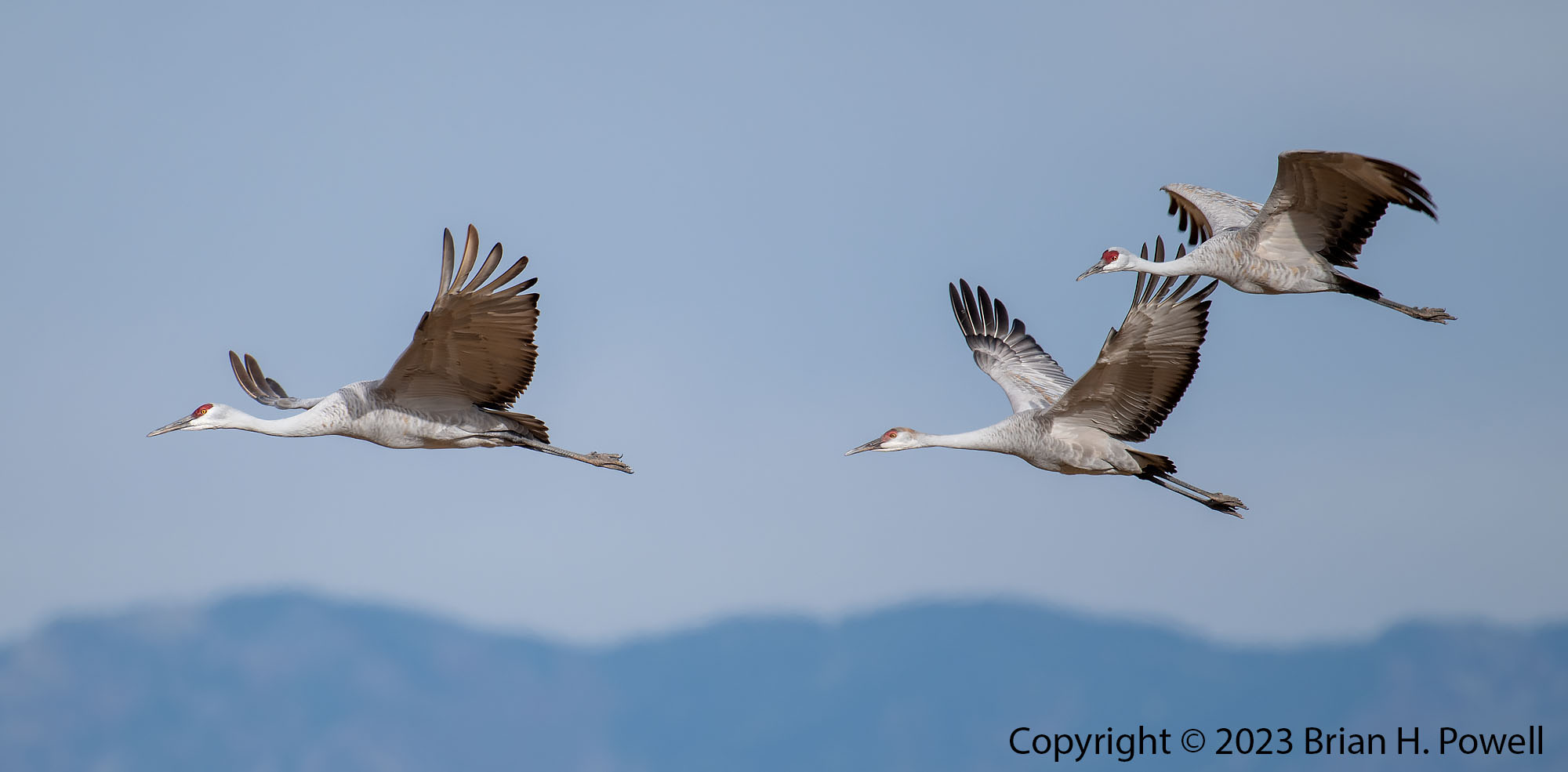
During the day on Monday, not much was happening with birds in Bosque, so I drove about 45 miles north to the Ladd S. Gordon Waterfowl Complex, another one of the refuges along the middle Rio Grande. It’s run by the New Mexico Department of Game and Fish. I am glad I visited–a thousand or more Sandhill Cranes were there. In a lot of ways, it reminded me of a small version of how Bosque used to be–corn close to the roads and clear views to where the birds are.
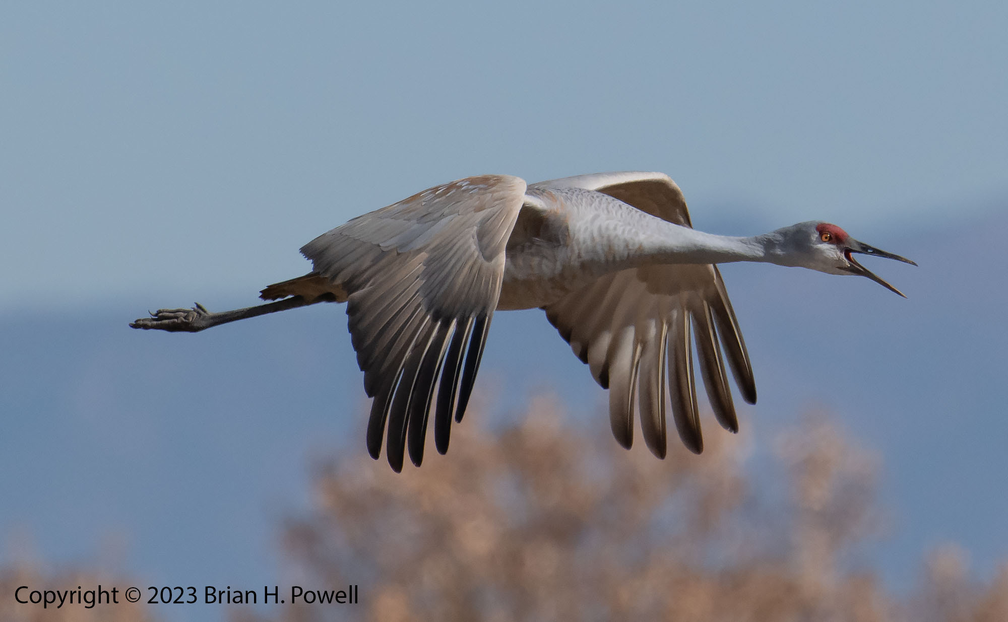
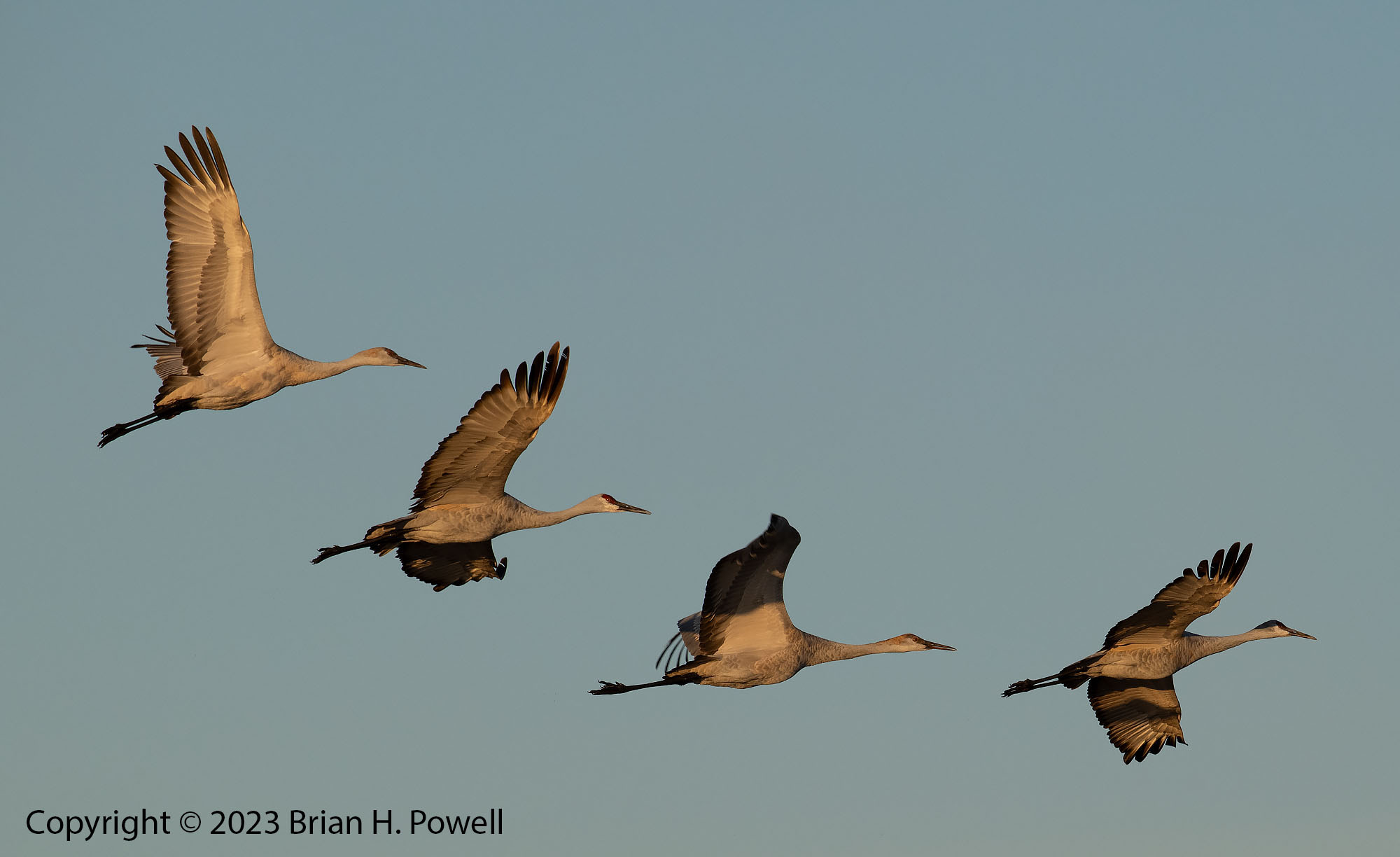
Sandhill Crane
Sandhill Crane
Sandhill Crane landing
Sandhill Cranes
Sandhill Crane
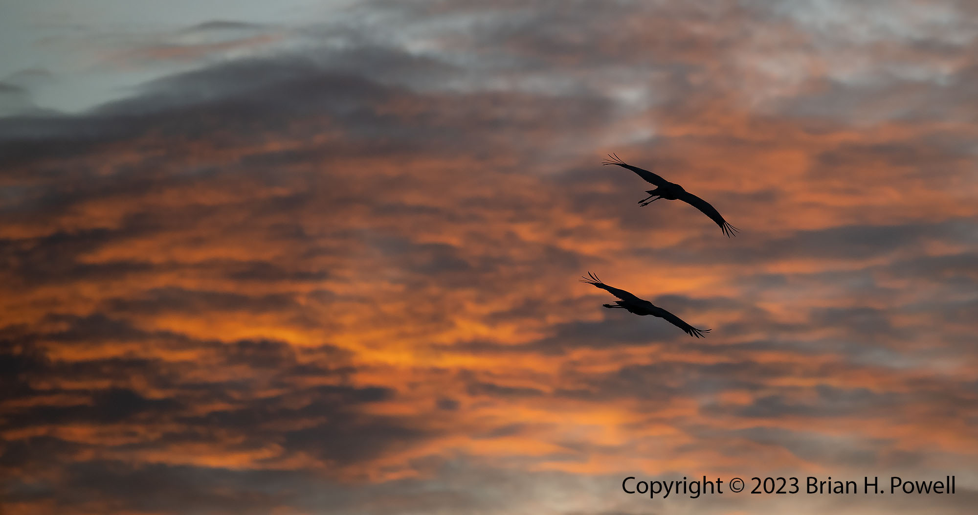
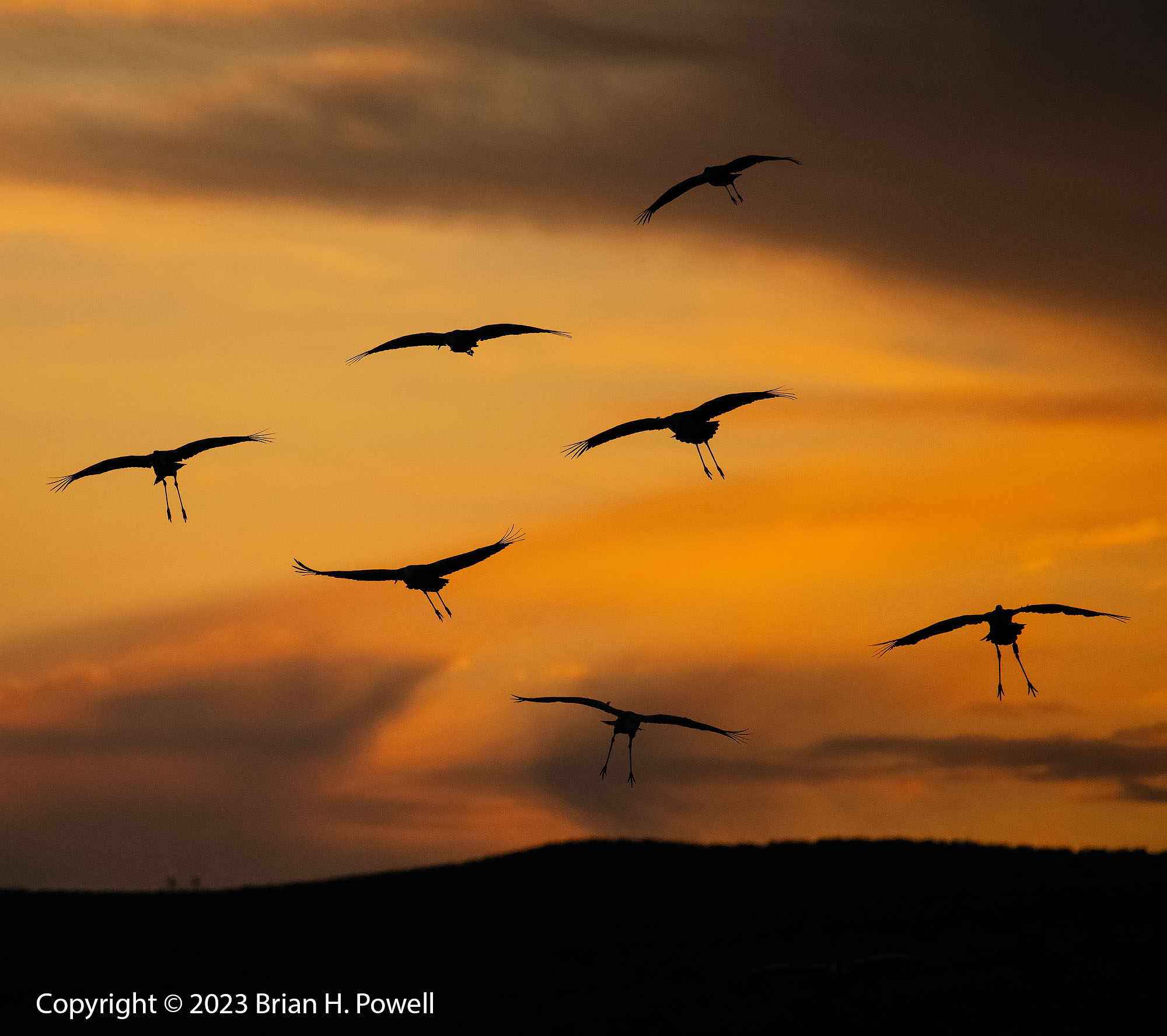
I’d end each afternoon back at the one crane pool along the highway to watch for geese and cranes to fly in. On Monday, the high clouds in the sky had me hoping for a beautiful sunset. But, it looked like it would consist of only a small patch of amber sky. I made the best of it–I’d wait for cranes to pass in front of the amber color to land.
Sandhill Cranes landing
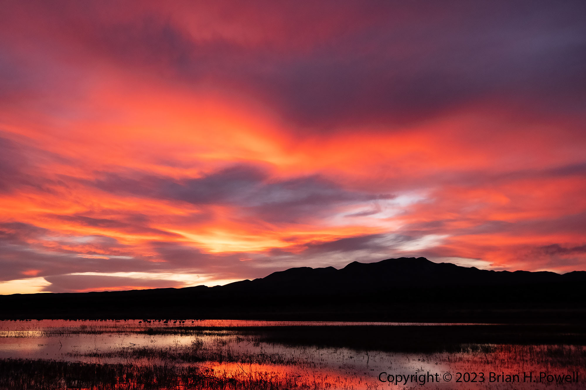
But soon enough, the sky lit up red, the way New Mexico sunsets sometimes do. I grabbed my other camera with a wide-angle lens so I could capture it. It was a beautiful end to a good day.
Sunset with Sandhill Cranes
Despite my disappointment that the refuge isn’t as good for photography as it once was, I’m still glad I visited for a few days. Below are a few more photos. (Click to enlarge.)
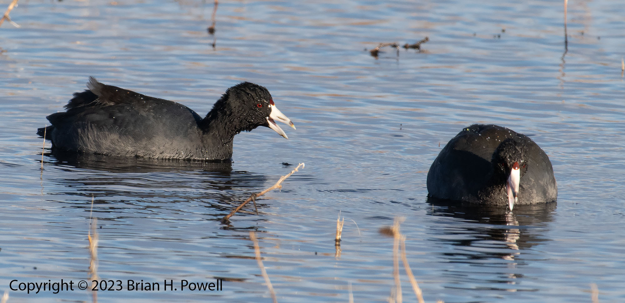
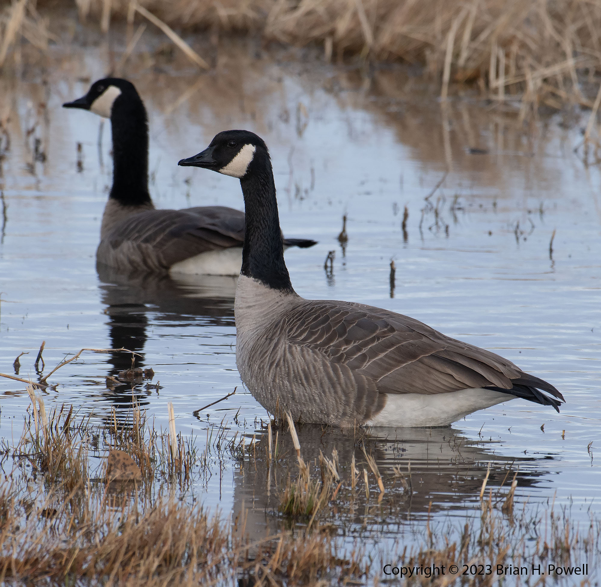
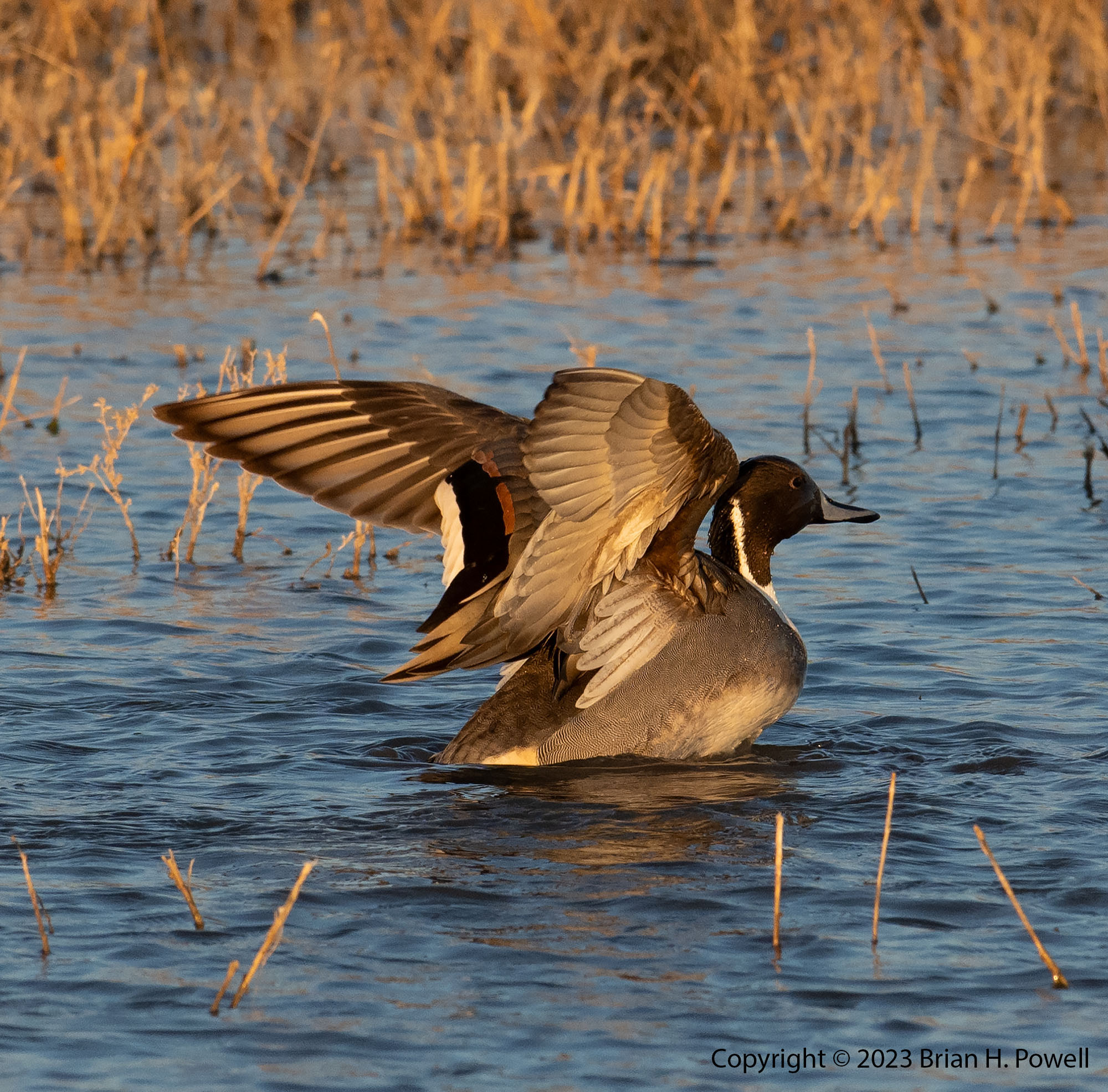
Sandhill Cranes in flightSnow Goose preparing to landAmerican CootsCanadian GeeseSandhill Crane in flightSnow Geese in flightSandhill Cranes in flightPintail DuckSandhill Cranes in flightSandhill Cranes taking offSnow GeeseSnow Geese taking off