Skip to content

Posts tagged ‘Europe’

Hiking in the Dolomites, Part 6

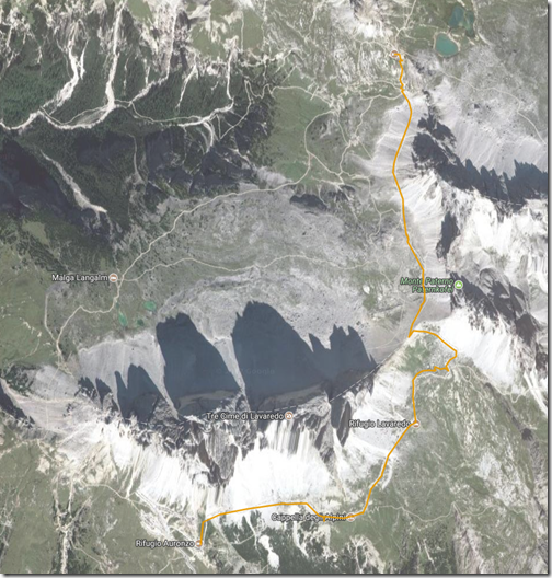
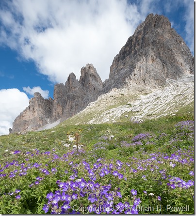
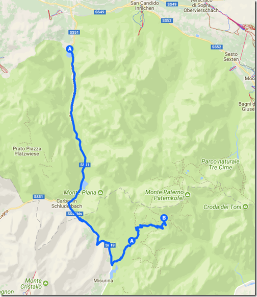
The Tre Cime de Lavaredo are the three mountain peaks that are the highlight of the Tre Cime Natural Park.  (In German, they are called Drei Zinnen.)  From the end of the road at Rifugio Auronzo, we began our three mile hike around Tre Cime to Rifugio Locatelli.  The hike took us up to 8000 feet, to a saddle between Tre Cime and the nearby Monte Paterno (Paternkofel), where we had lunch.  The trail descended from the pass back down a few hundred feet, before ascending again to Locatelli, back at 8000 feet elevation.  Temperatures were in the 50’s, and it was somewhat windy.

TreCimeHike

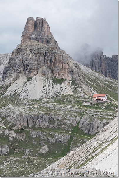
Shown below, the Locatelli hut, with the Torre di Toblin behind it.

(Click any image to enlarge.)

_DSF1594

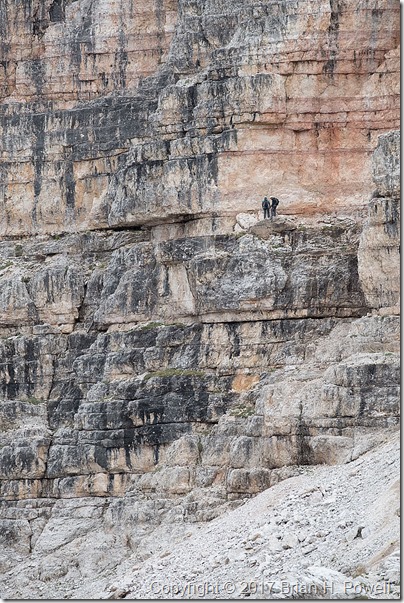
On the side of the Monte Paterno, we saw some climbers on a Via Ferrata (Italian for “Iron Road”).  These are hiking and climbing routes that have a cable, fixed to the rock every few meters.  You wear a harness with two carabiners.  As you reach one of the iron stays in the rock, you unclip one carabiner and reattach it to the cable on the other side of the stay, then follow with the other carabiner.  Thus, you are always attached to the cable.

Many of the Via Ferrata in the Dolomites are left from World War I.  The Dolomites were a major battleground in the war between Austria-Hungary and Italy.

In the photo below, you see a couple of people on a fairly flat, easy section of Via Ferrata on Monte Paterno.

_DSF1602

We continued on to the Locatelli hut.  This is a much larger hut than the Resciesa hut we stayed in earlier—I’d guess they have room for over 100 people.  But note that they only have one shower, and it costs €5 to use it for six minutes.  (None of our group bothered with a shower that night.)

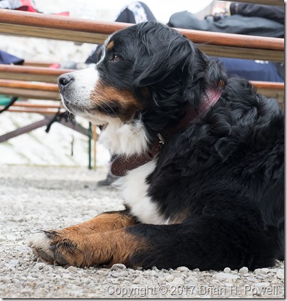
Many dayhikers come for lunch or dinner in the cafe.  Along with a lot of people, we saw a few dogs of all sizes on the trail.  Here’s a photo of a beautiful Bernese Mountain Dog.

_DSF1613

That night, the barometric pressure began to rise, and we set our alarms in hopes of clear skies for night photography.  We got started a little bit late, so this turned into a bit of night photography combined with pre-dawn photography.  Here’s a time-lapse sequence showing the transition from night to twilight.

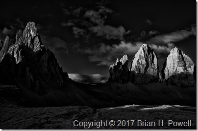
We returned to bed for an hour of sleep before heading out for sunrise.  Here’s one of my favorite infrared images of the dawn light hitting Monte Paterno and the Tre Cime.

_DSC6473

We returned again to bed for another hour of sleep before breakfast, and then began our hike back to Rifugio Auronzo, where we waited for our taxi that would take us to Cortina.

_DSF1803

Up next, Cortina and Venice.
Hiking in the Dolomites, Part 5

(This is my 100th post on this blog.  Thank you all for reading.)

The morning of July 1, we left Selva/Wolkenstein for Lago di Dobbiaco.  I kind of think of this as a rest day between our weather-challenged hike from yesterday, and the 8000-foot-elevation hiking of tomorrow.  We also swapped out our guides–trading Hayden for Jake, who would be with us until the official end of the trip.  Both guides provided by AlpineHikers were excellent.

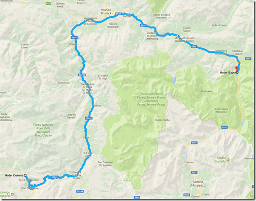
As we drove over to Dobbiaco, we saw many bicyclists preparing for the following day’s Maratona dles Dolomites, an 85-mile bike race with nearly 14,000 feet of elevation gain.  (The winner averaged 18.6 mph.)  Nearly 30,000 cyclists apply each year for one of the 9,000 starting positions.

ToDobbiaco

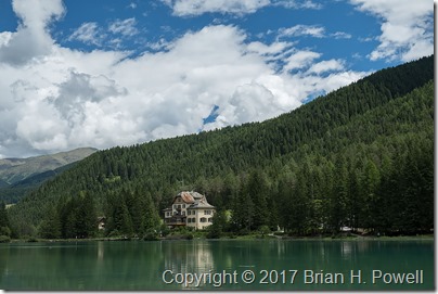
We checked into the116-year-old Hotel Baur, which sits right on the lake.

_DSF1455

(Click on any image to enlarge.)

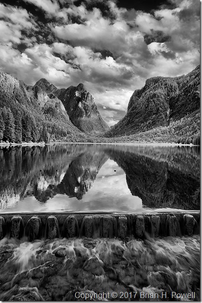
We walked around the lake, then I settled on a view facing south for most of my images.  We played around with reflections, and slow shutter speeds as the water flowed over a dam at the north end of the lake.  Here’s an infrared photo from late in the day.

_DSC6433

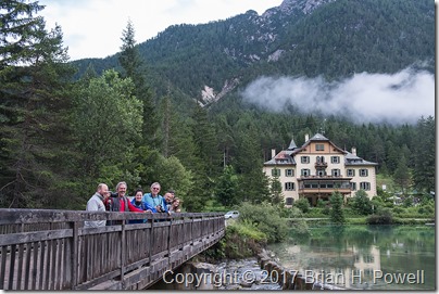
Here’s a group shot of all of us on a bridge near the hotel.

_DSF1516

The next morning, we drove into the Tre Cime Natural Park and began our hike to Rifugio Locatelli.  Stay tuned for more.

ToTresCime

Hiking in the Dolomites, Part 4

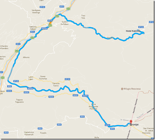
The next day—June 29 if you’re keeping score—we took a taxi down to the ski village of Ortisei.  We spent a little time walking around the town and enjoying time at a cafe near the Hotel Adler before taking a funicular up into the mountains.

ToOrtisei

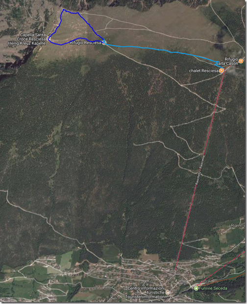
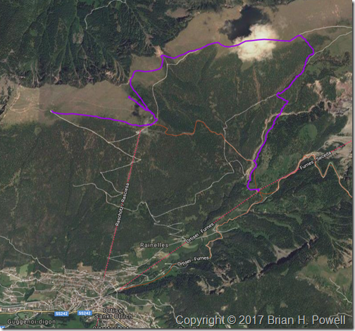
From the top of the funicular, it’s about a mile traverse (light blue route below) over to Rifugio Resciesa, where we’d stay for the evening.  Unfortunately, I fell ill with intestinal pain that afternoon, so once I got to the hut, I just rested.  As I look for a silver lining to being sick, the afternoon views were hampered by a whole lot of clouds.  My body chose a good time to demand rest.

The Resciesa hut is one of many different mountain huts scattered all over the Alps.  It’s a combination bar/restaurant and guest house.  The Resciesa hut is one of the smaller huts, with room for about 40 people.  We had a room of bunk beds for all eight of us.  Some rooms are larger; some smaller.  There were two showers and two bathrooms shared for everyone at the hut.  I was pretty pleased with the experience, and people who had been at other Alpine huts agreed that this was among the nicer ones.

Resciesa

The next morning, the weather and my health had both improved.  I decided to hike the approximately one-mile loop from the hut, to the peak, and then over to a small chapel.  (This is the darker blue route on the map above.)  The temperatures were in the 50’s and windy.  I’d typically wear three to five layers of clothes to maintain comfort.

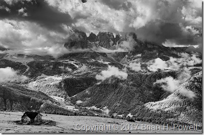
On my way up, I took this infrared photo of the Resciesa hut in the lower left, with the Langkofel Group of mountains in the distance.  There are still plenty of clouds around, but at least we could see for miles around.

_DSC6283

Click any image to enlarge.

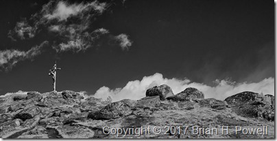
It’s pretty common for hikable mountains in this area to have wooden crosses at their summits.  Here’s an infrared view of the cross above the Resciesa hut.

_DSC6288

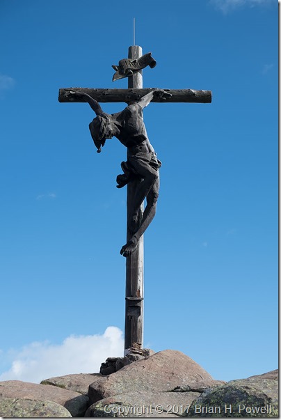
And a closer look from my regular camera:

_DSF0848

I turned around the other way, and took this panorama.  The Resciesa hut is on the far left of the photo, and the chapel is to the right of the sign near the middle.

_DSF0849

In the late morning, we left the hut and started a traverse eastward.  The plan was to get a better perspective on the Geislergruppe, also to our east.  We would then take a trail down to the middle station of aerial gondolas ascending up to the Seceda ski area.  We could then take the gondola down to Ortisei, where we left the day before.

LeavingResciesa1

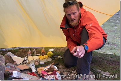
A typical lunch for us was a lunch sack prepared by our guide containing snacks and an always-excellent sandwich prepared that morning from local cheeses, meats, and vegetables.  On this day, it was more of a “build-your-own” affair.  Here’s a photo of our guide, Hayden, with the lunch preparations spread out under his tarp.

_DSF1196

We had lunch near one of the peaks above the funicular station.  We spent quite a bit of time there making time lapse videos.  Here’s an infrared time lapse of the Geislergruppe, to our east.

I would love to tell you that the rest of our day was uneventful.  But it was not to be.

The weather turned again.  Soon after we left our lunch spot, it looked like we might have a brief shower.  We put our rain covers over our packs, and donned our rain jackets.  Most of us had rain pants with us, but none of us felt like it was going to be necessary to put them on.  We were wrong.

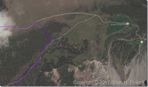
The sleet started first.  Some called it hail.  The temperatures dropped to around 40 degrees Fahrenheit.  Then rain mixed in.  And then thunder.  If it weren’t for the thunder, we might have stopped to put on our rain pants.  On the map below, our travel route enters from the upper left, and we headed due east.  We were originally aiming for the intersection of trails just right of center.  With the rain, we debated going on to the Rifugio Malga Brogles a bit further on the trail to wait out the rain and sleet.  But it was the thunder that convinced us that it was time to exit the mountain as quickly as possible.

We went off trail, heading down an embankment to take us down below tree line to pick up the return trail.  It was steep and slippery, but it was the fastest way out of danger from possible lightning.  Once we got to the return trail, the hike finally met its promise of being uneventful, except for the part about being soaked.  The thunder stopped; the rain abated.  The temperatures rose as we descended.

LeavingResciesa2

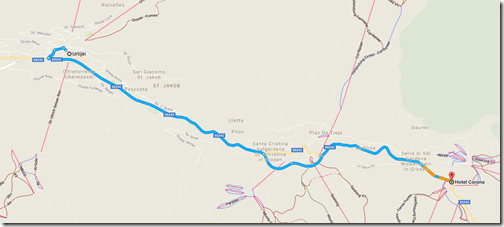
We made it to the cable car and descended to Ortisei to catch the bus to continue our journey.  We stayed overnight that night in Selva (known in German as Wolkenstein).

ToSelva

Coming up, a visit to Lago di Dobbiaco, and on to the highlight of the trip, Tres Cime.

Hiking in the Dolomites, Part 1

From June 23 to July 5, I was in Europe, mostly hiking and photographing around the Dolomites, in the Alps of Northern Italy.

I met my friend and travel partner, Jennifer, in Munich.  She and I have been on several photography trips together—Utah, Alaska, Vermont, New Mexico, Hawaii.  Once we got to Italy, we would meet our friend and pro photographer, Kerrick James (http://kerrickjames.com/ and http://kjphotosafaris.com/) and a few others for the remainder of the trip.

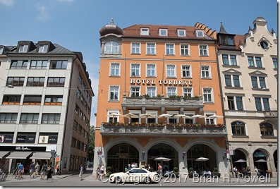
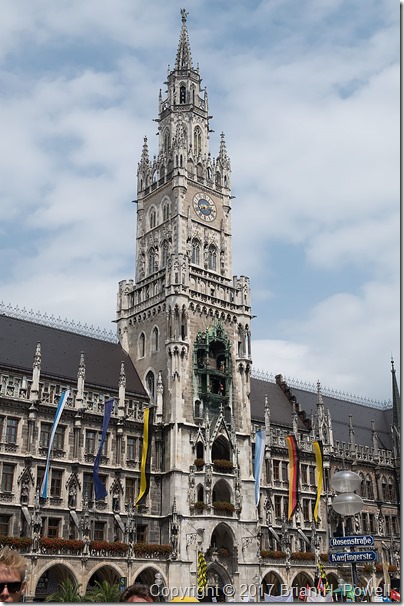
But first, we spent the day in Munich.  We stayed at the Hotel Torbraü, near Isartor, and not far from the Marienplatz.  Despite advertising itself as the oldest hotel in the heart of Munich (since the year 1490), it was quite nice and convenient.

_DSF0045Hotel Torbraü

_DSF0044Marienplatz

After lunch, we met my friend, Rahman, and toured parts of the city that I’d never been to before.  We finished with a walk around part of the Englischer Garten, before returning to the hotel to get an early dinner and some much needed sleep.

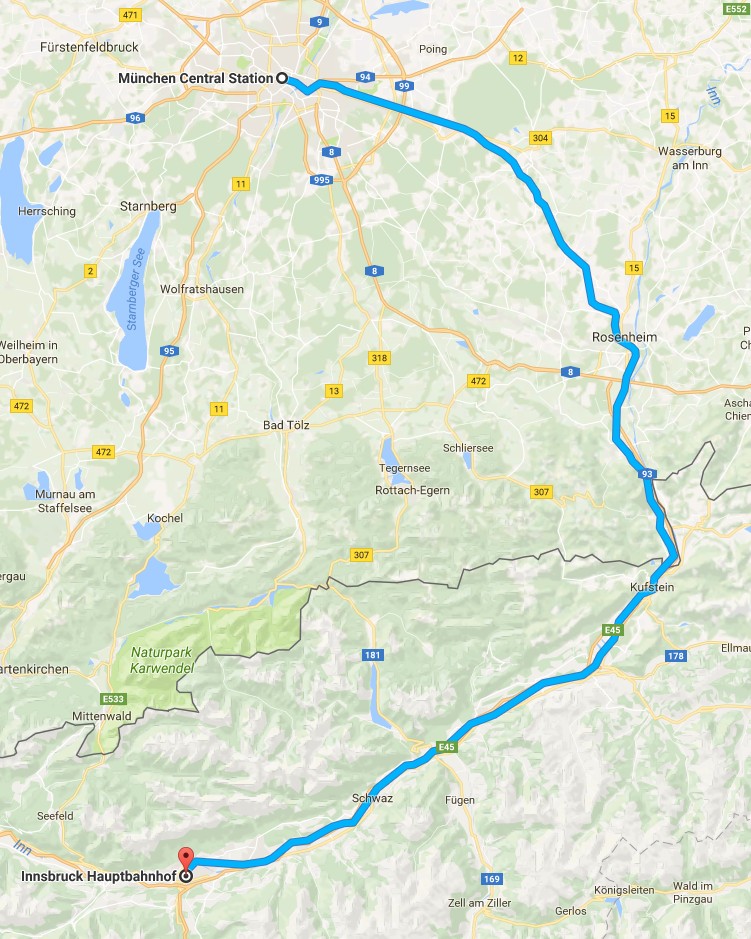
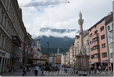
The next morning, we departed by train for Innsbruck.  I’d been to Vienna, Graz, and Salzburg before, but never Innsbruck, and this was a convenient halfway point between Munich and our starting point in Italy.

_DSF0078Central Innsbruck

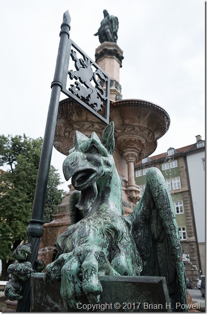
_DSF0070Griffon at Rudolfsbrunnen.  The statue behind, from 1863, commemorates the 500th anniversary of Tyrol joining Austria.

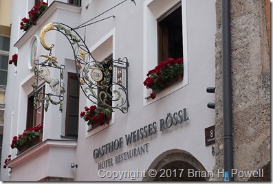
We had a difficult night’s sleep at the hotel, the Gasthof Weisses Rössl.  It was a warm day in Innsbruck, and the hotel was not air-conditioned.  Further, the windows did a better job of keeping the warm air in, and the cooler air outside out.

_DSF0081Hotel of the White Horse.

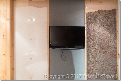
Still, the rooms were nicely and interestingly done on the inside.  Here’s a photo of one of the walls.  To the left of the television is a wall with a plexiglas front, with the gap filled with salt.  To the right, a similar panel, with the gap filled with peppercorns.

_DSF0096The Salt and Pepper Walls

Next stop, Italy.  Stay tuned.