Skip to content

Posts tagged ‘sunrise’

Bosque del Apache 2023

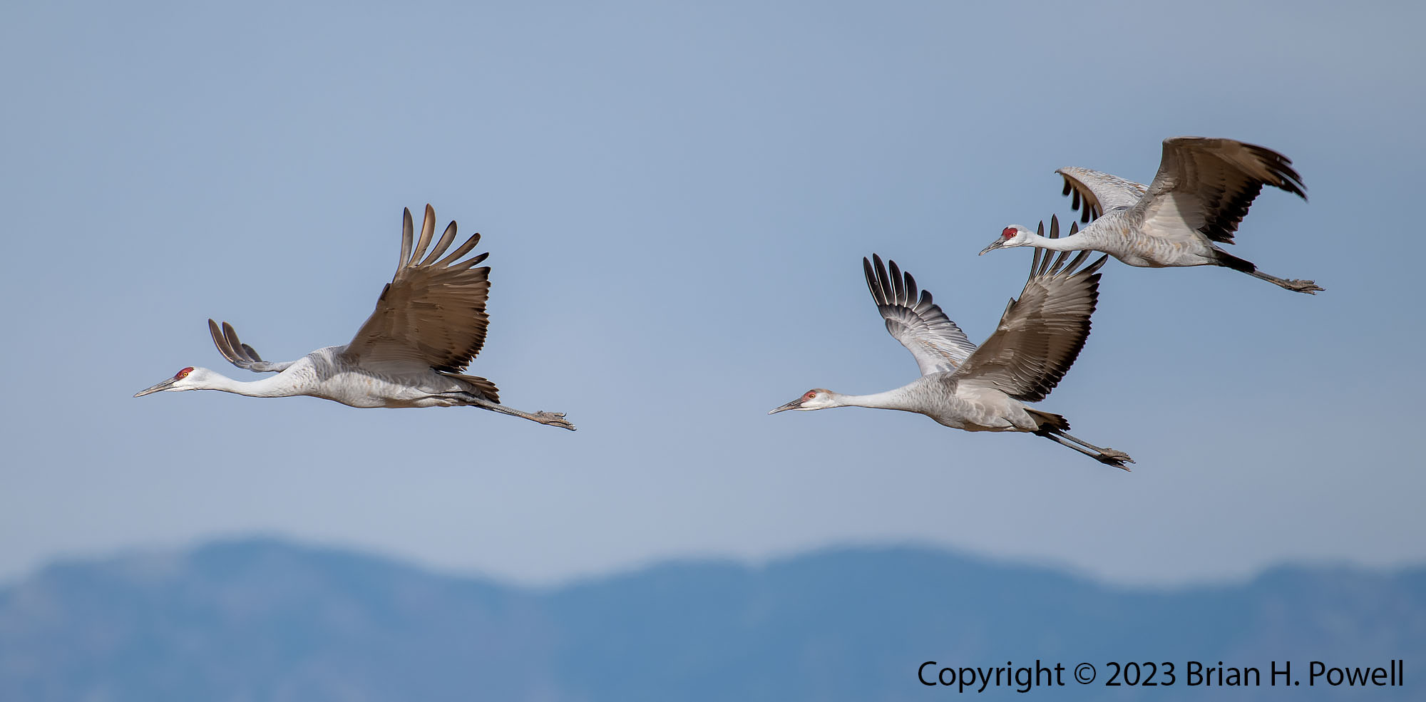
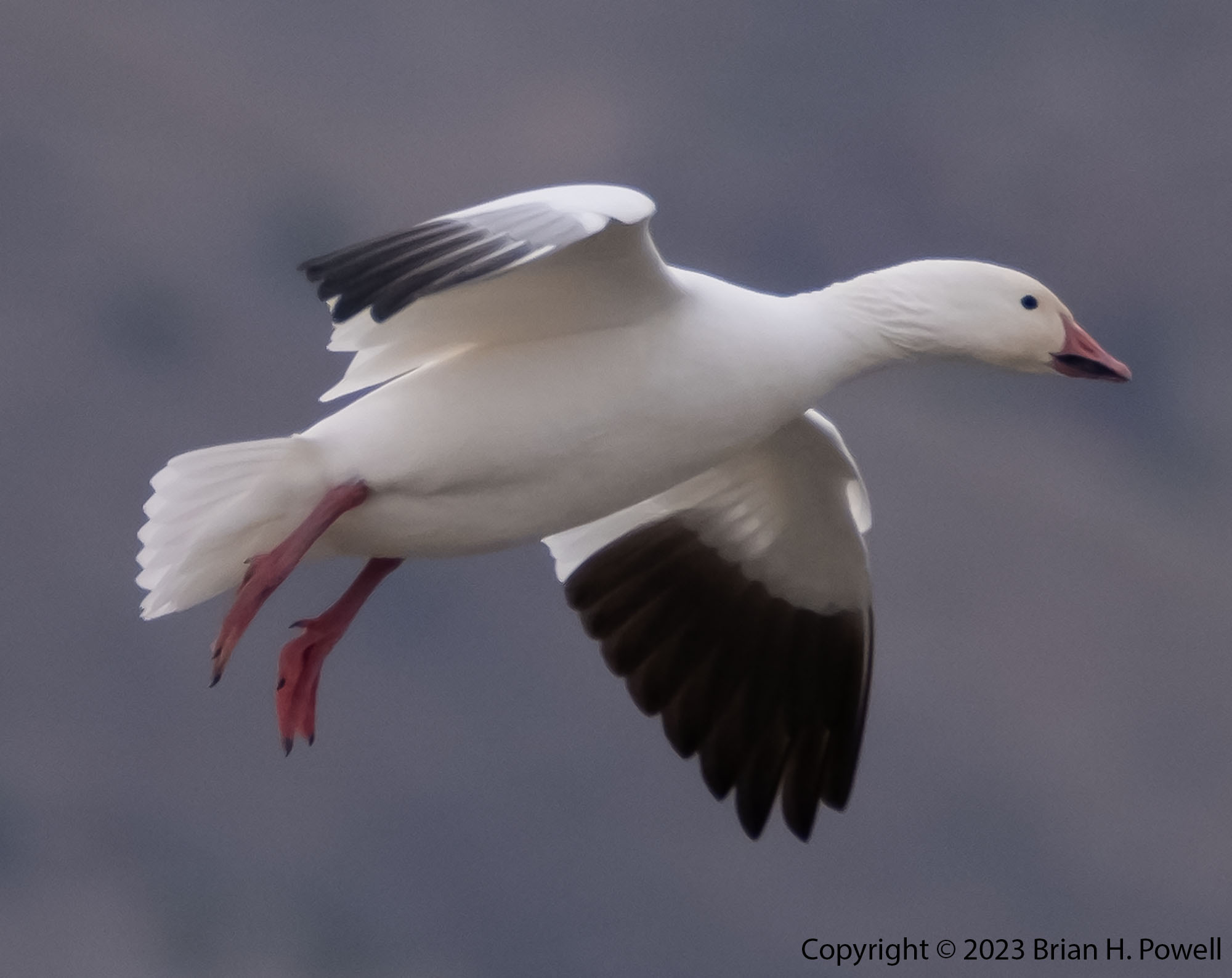
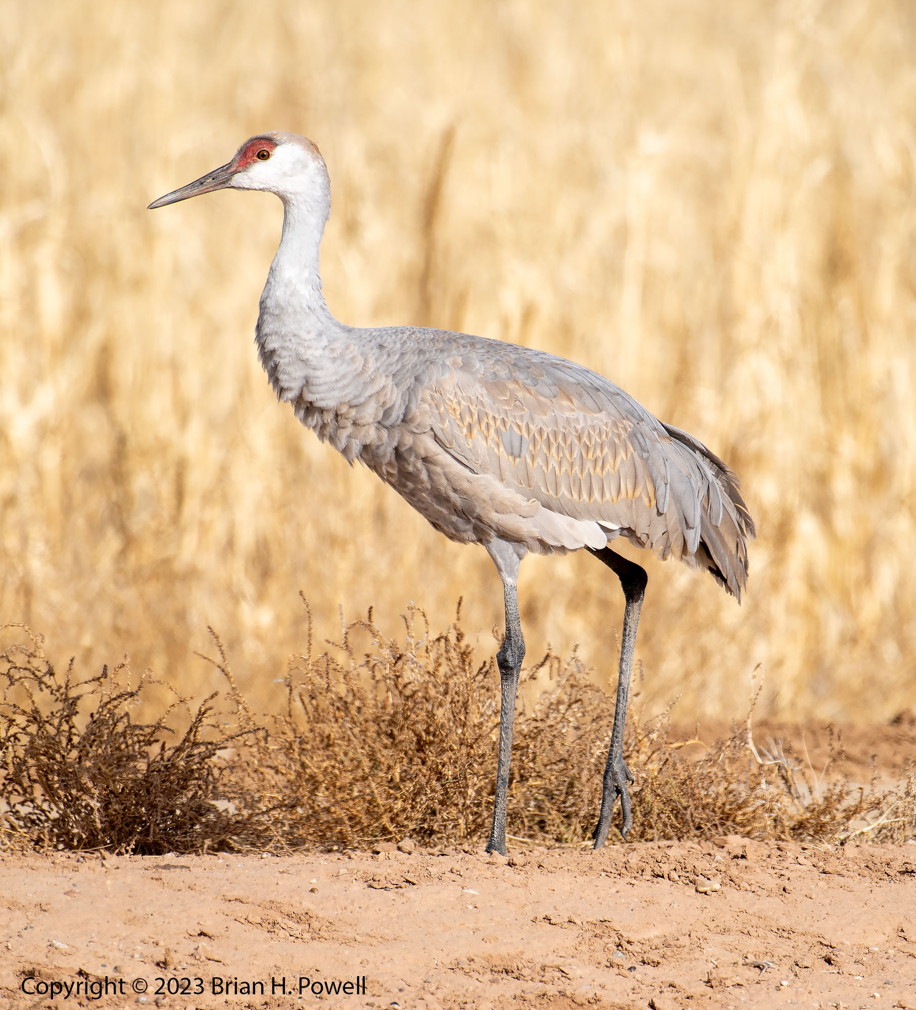
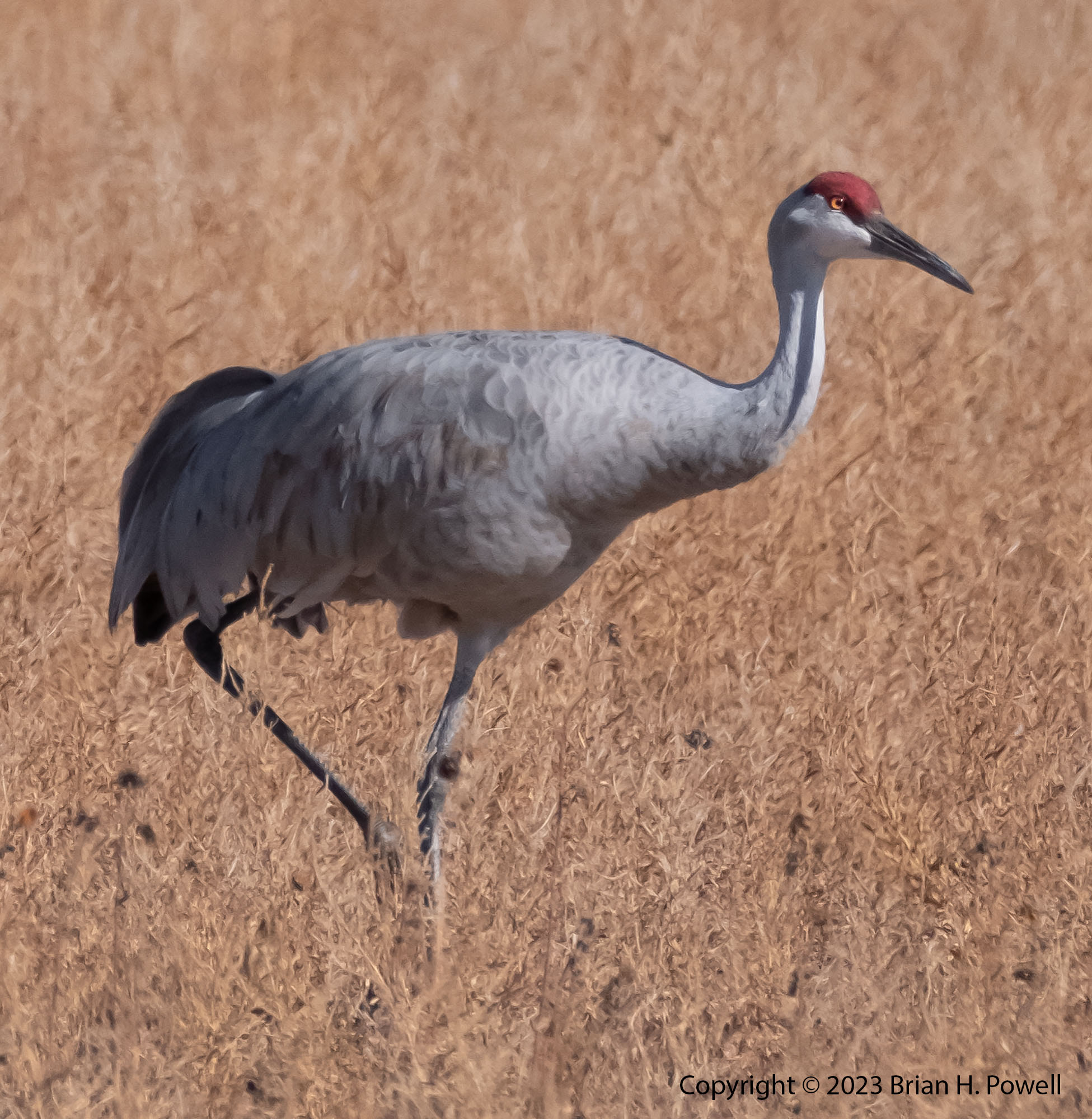
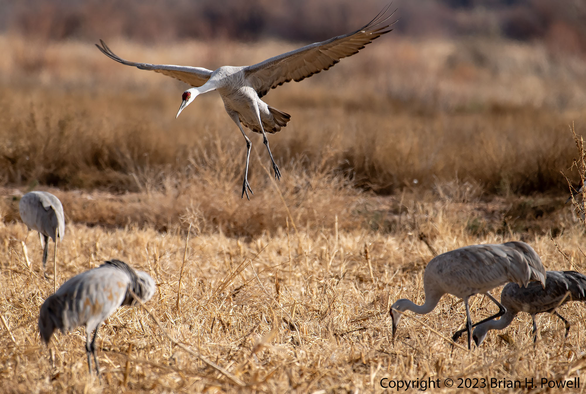
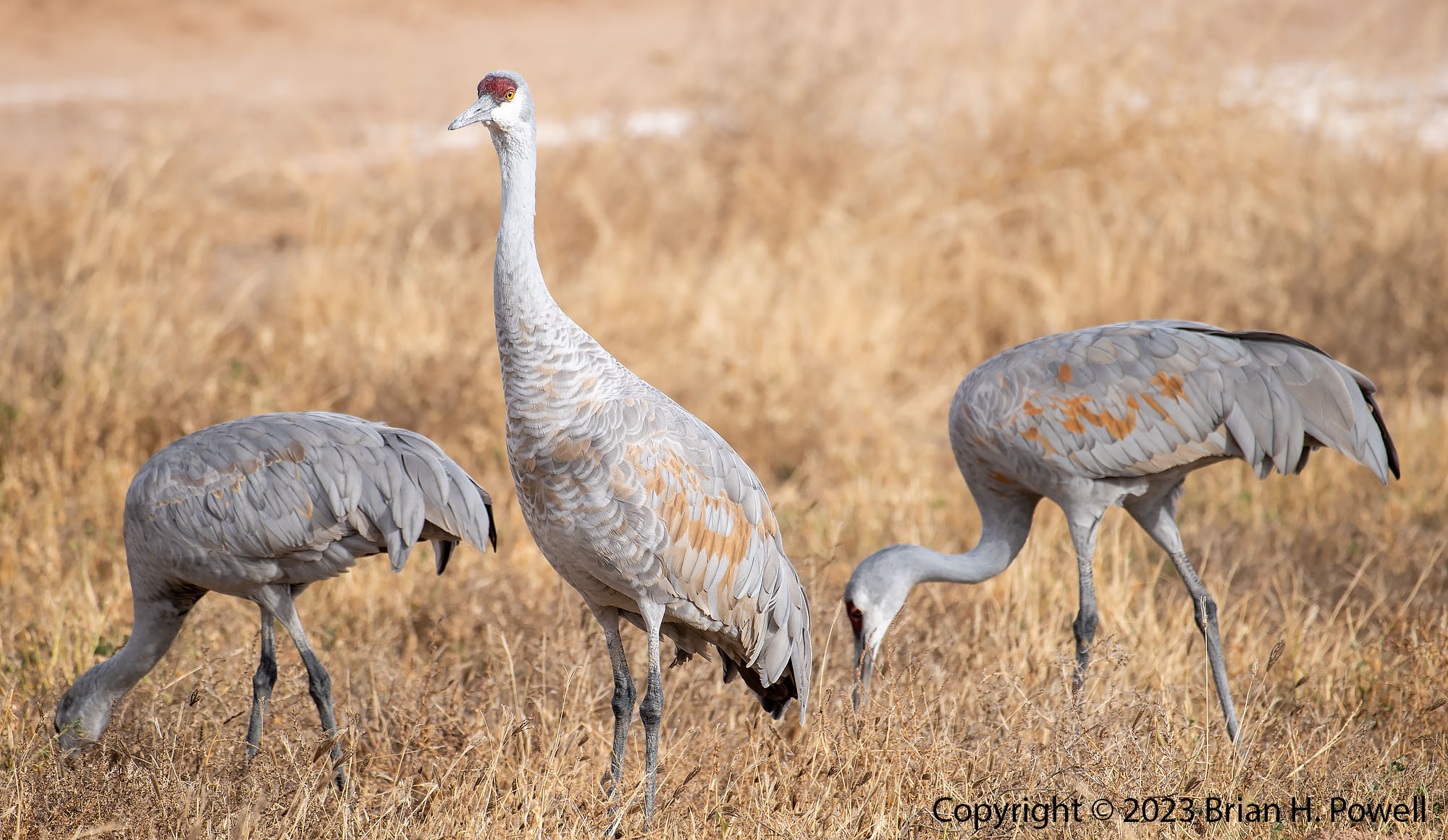
Bosque del Apache is a National Wildlife Refuge along the Middle Rio Grande Basin in central New Mexico. This area of the Rio Grande is a wintering ground for many birds, including tens of thousands of Snow and Ross’ Geese, and thousands of Sandhill Cranes.

I first visited the refuge in 2005 with a Nikon F100 film camera and shot six rolls of 36-exposure slide film. I went back each of the next four years with a digital camera, and shot thousands and thousands more photos at the refuge. I kind of got burned out visiting the place, and only went again in 2012, 2019, and this year, 2023. To see photos from some of these earlier trips, visit my posts tagged with Bosque del Apache NWR.

Once upon a time–the mid-1990’s to 2000’s–Bosque del Apache was an amazing hotspot for bird photography. The refuge was managed to have lots of food and marshes for the birds, and photographers had their choice of creative ways to spend sunrise, mid-day, and sunset. Many of the best wildlife photographers ran workshops there. Unfortunately, over the last dozen years or so, the refuge is intentionally being managed to reduce the number of birds that visit and encourage them to winter elsewhere. I suppose there must be reasonable science that justifies that, but it also means that the photographic opportunities are a shadow of what they used to be.

It’s not all doom and gloom. There are still good bird photos to be made. New Mexico sunrises and sunsets are still amazing. Many birds still winter here.

I visited the last week of November. The temperatures ranged from the upper 20’s (Fahrenheit) to mid 50’s. We had a consistently north wind and dry days. Some days were mostly cloudy. Some were mostly clear, with high clouds.

I woke up early on Sunday and drove about ten hours to the refuge. I managed to make it in time to drive around the refuge once. I was disappointed to see that it’s still not set up well for photography. Only a few areas are set up to attract birds, they are often set well back from the roads, and the grasses at the edge of the road are often six to ten feet high–obscuring the sightlines.

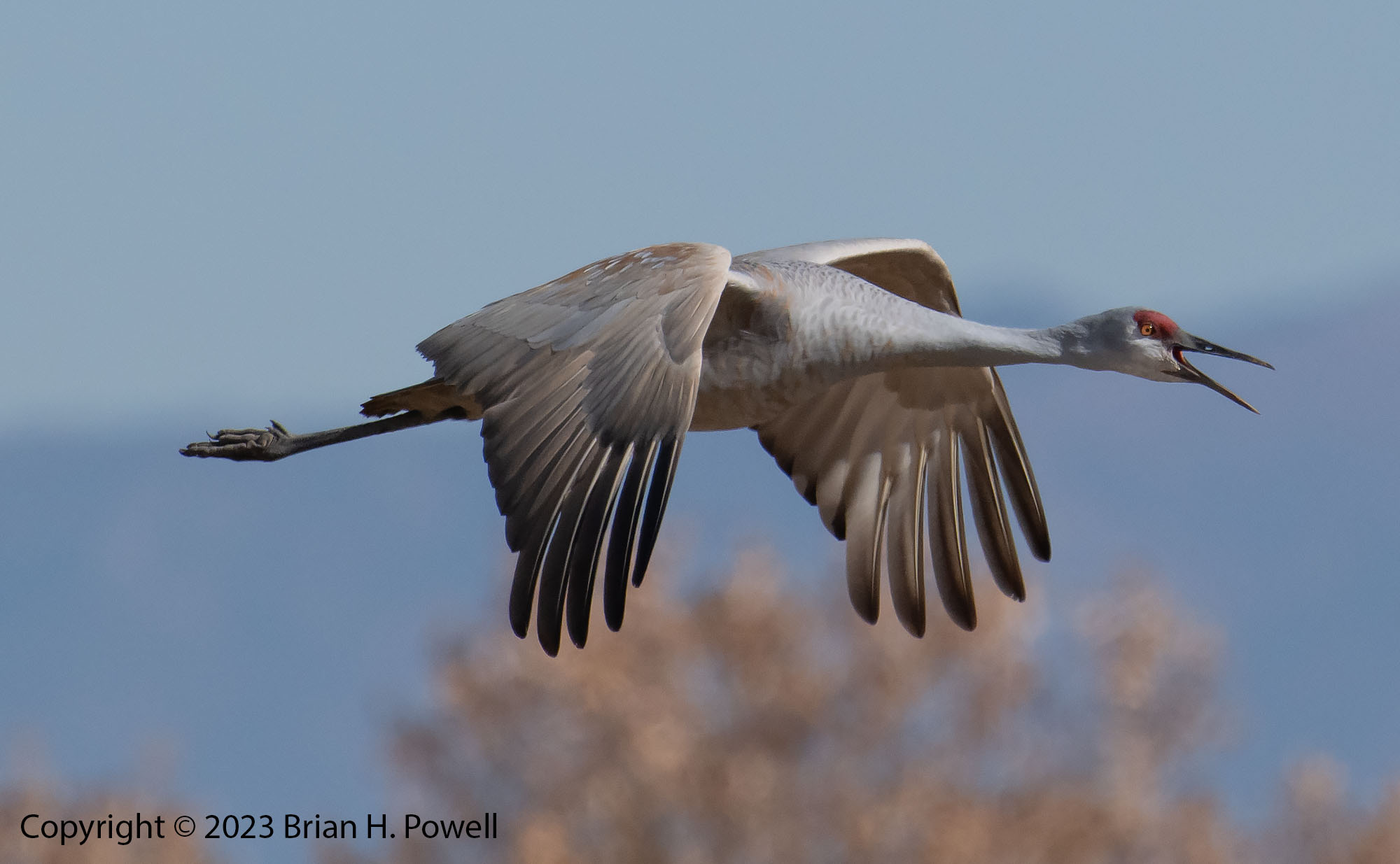
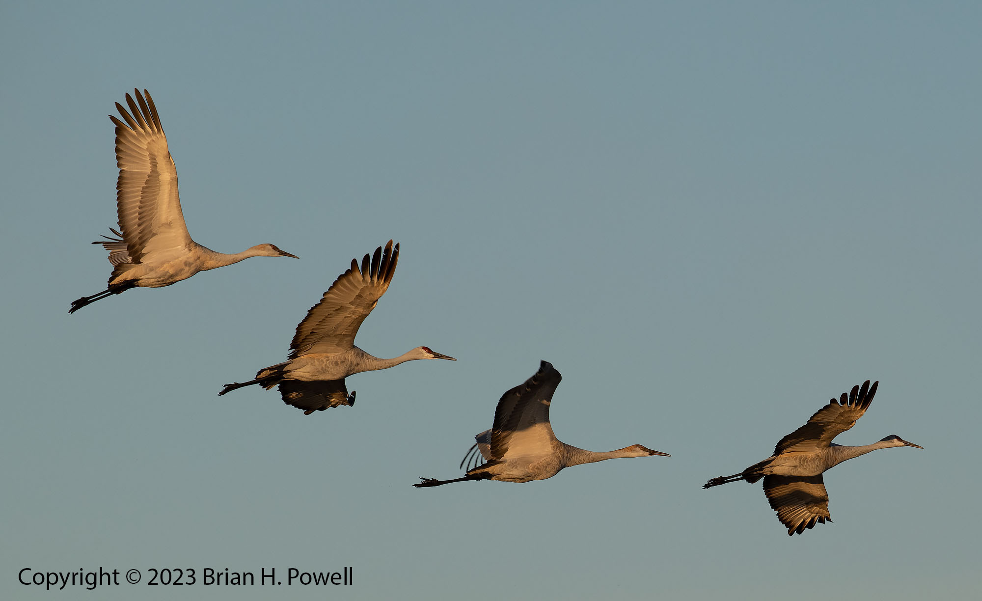
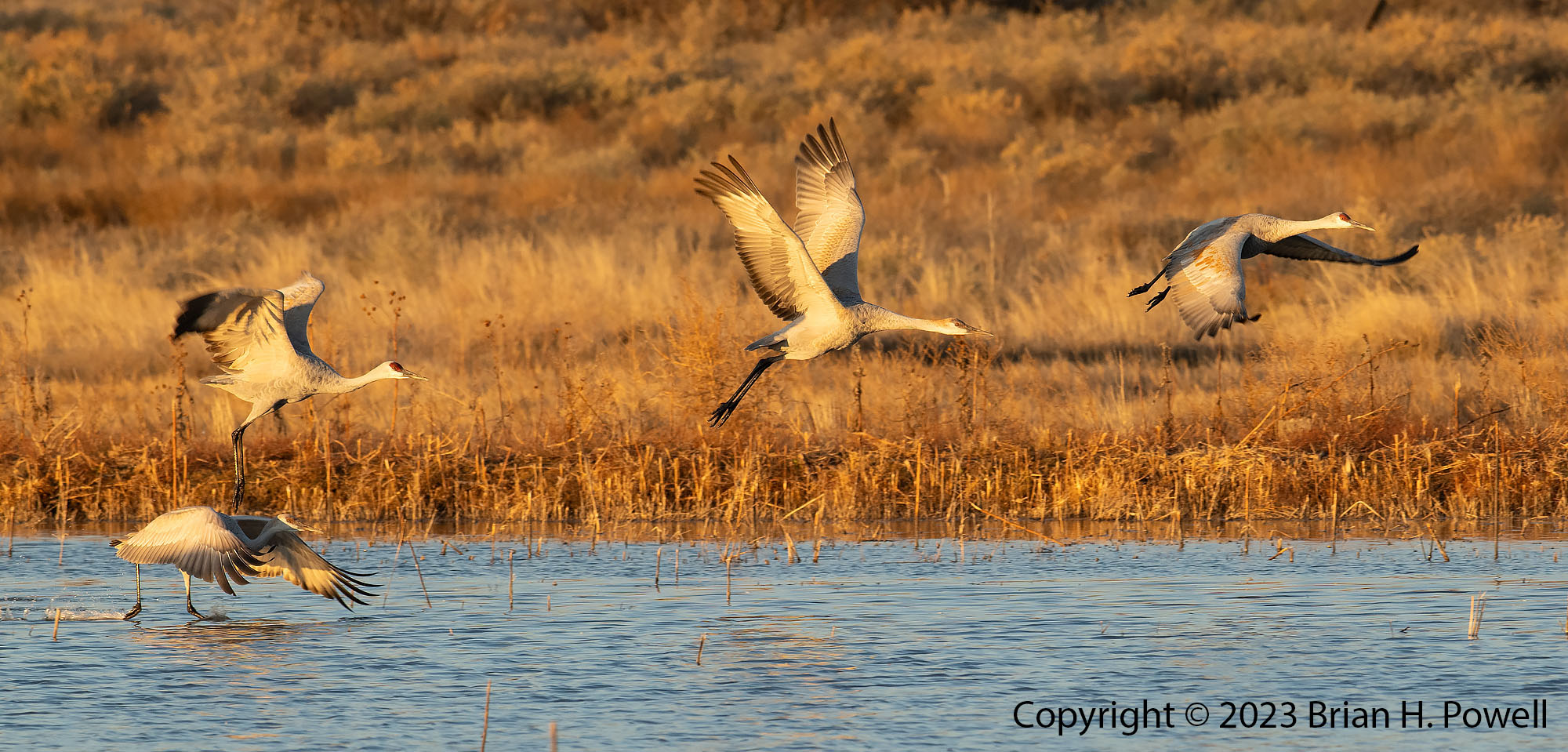
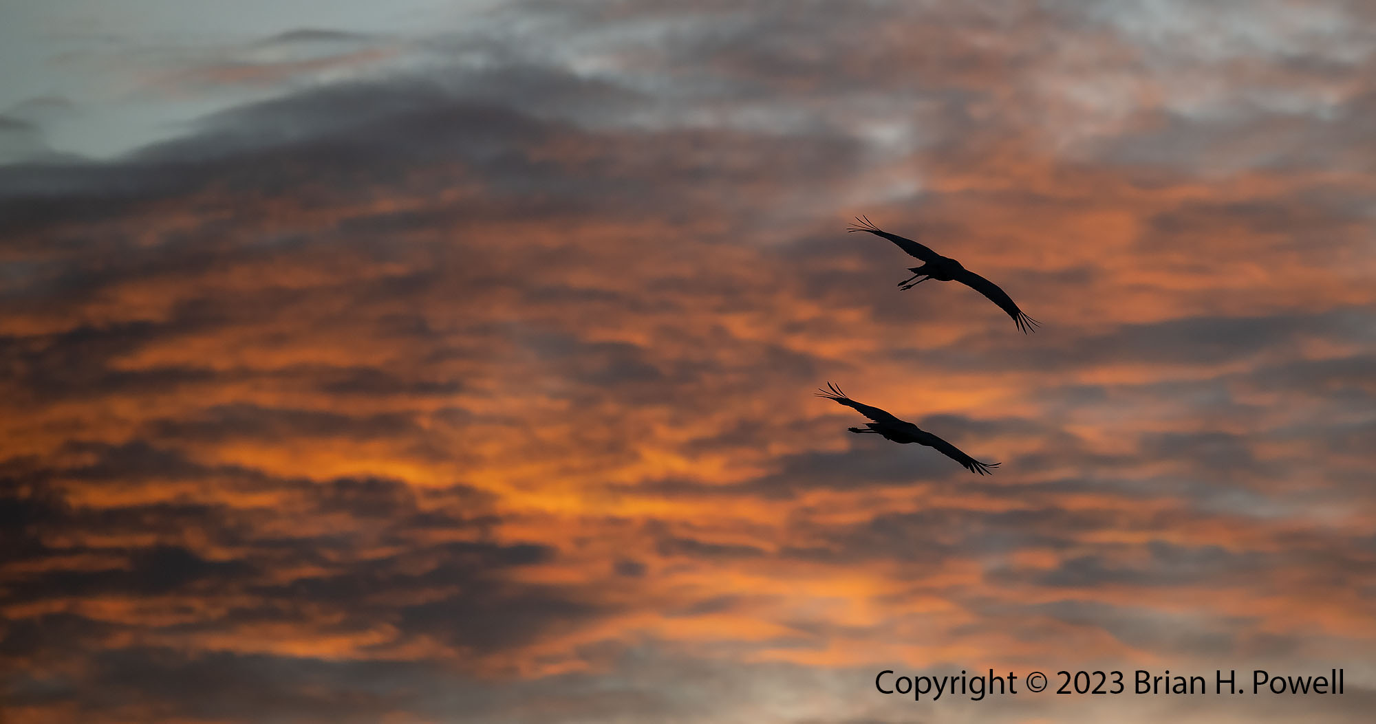
Anyway, I watched sunset from the last remaining crane pool that’s by the highway to watch Sandhill Cranes fly in for the night.

Click any of the images in this post to view them larger.

Sandhill Cranes at Sunset
Sandhill Cranes at sunset.

As is usual, I spend the first 24 hours or so figuring out what the birds are doing at different times of day. It all depends on where the water is, where the food is, where the wind is coming from, how cold it is, and other factors. The birds don’t always follow a fixed plan, but they are fairly consistent from day to day.

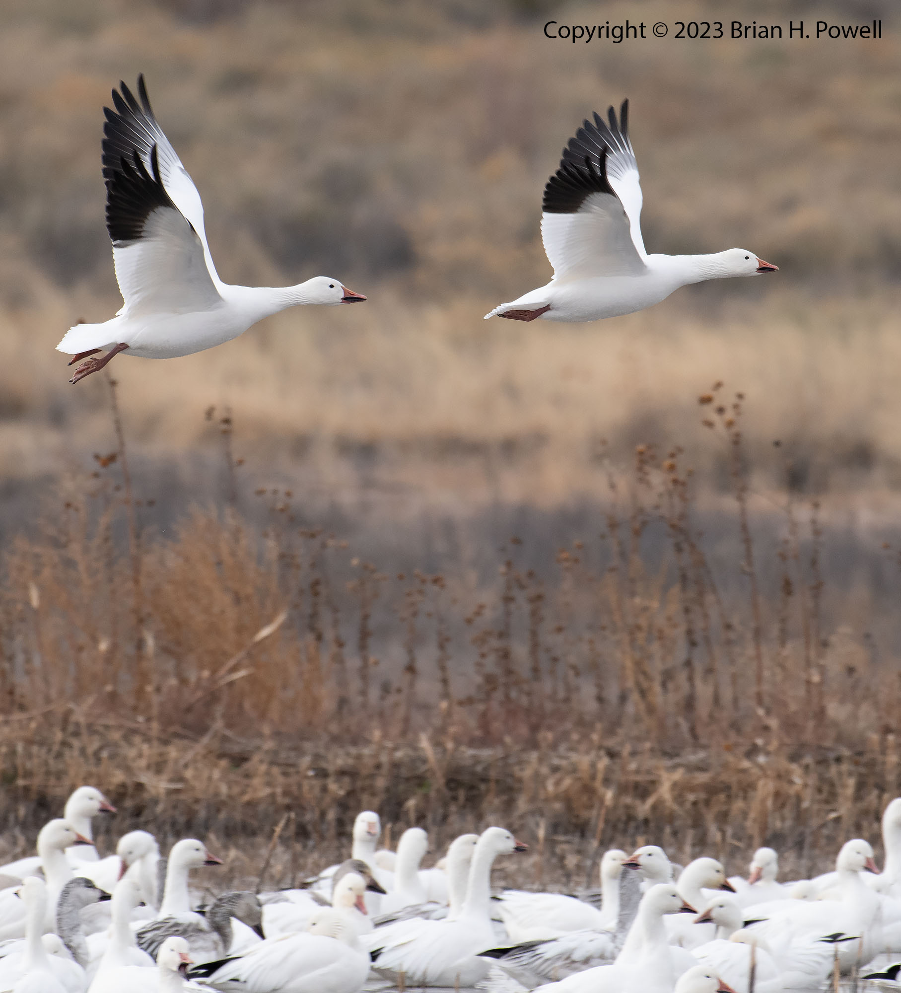
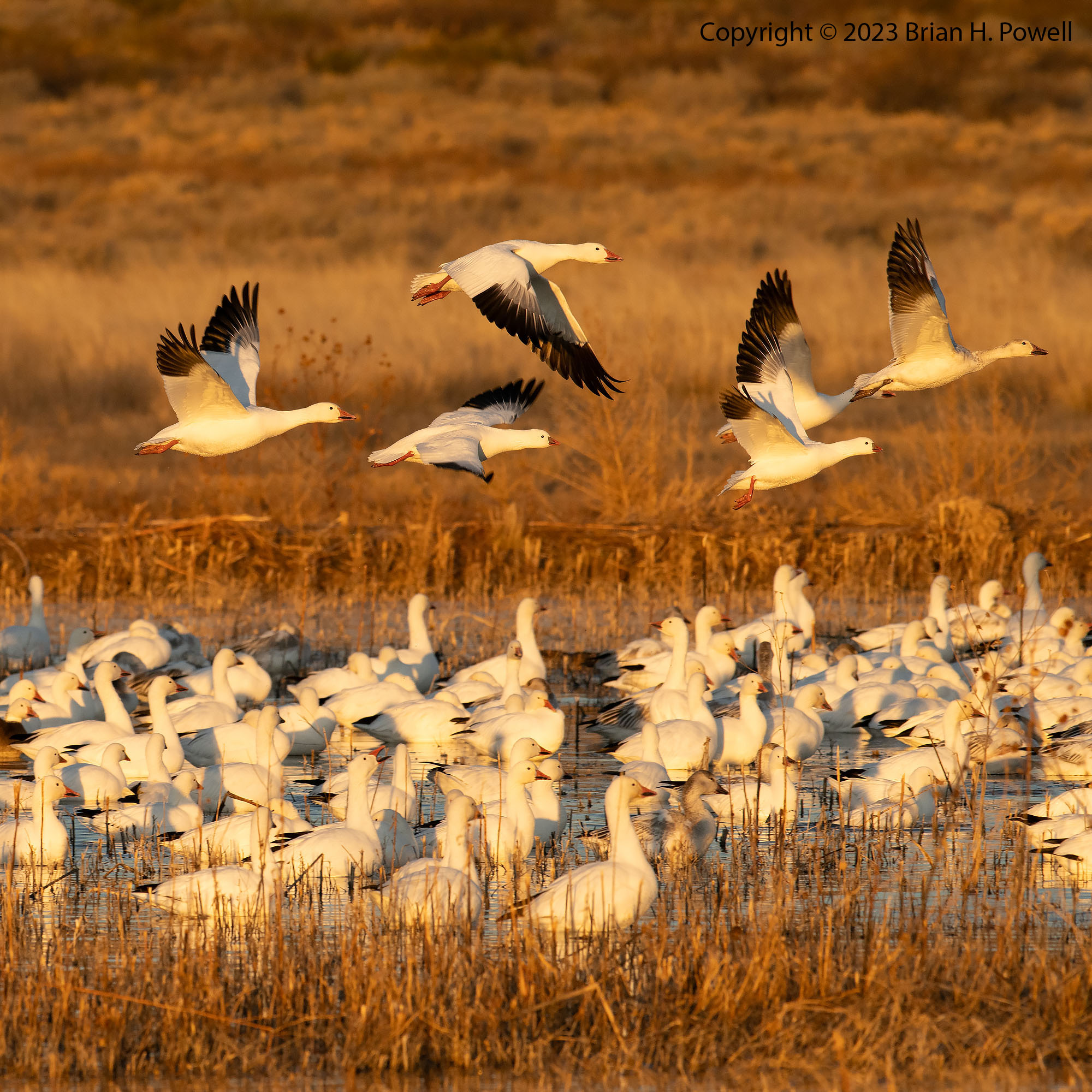
On Monday morning about an hour before dawn, I drove around the north half of the refuge again and–unsure of the best place to start–ended up near the Flight Deck area inside the refuge. There weren’t a ton of birds there, but there were dozens of photographers getting set up. I set up, too, and waited to see what would happen. Soon there was a flock of snow geese blasting off from the back (east side) of the refuge and they worked their way over to us and landed in the water near the Flight Deck. I made a mental note to try to find their overnight location so I could see them before they flew off. Each of the next two mornings, I set up on the east side–with almost no one else around. Well, it was me and several thousand birds.

Thousands of Snow Geese taking flight before sunrise
A blur of Snow Geese taking off before sunrise

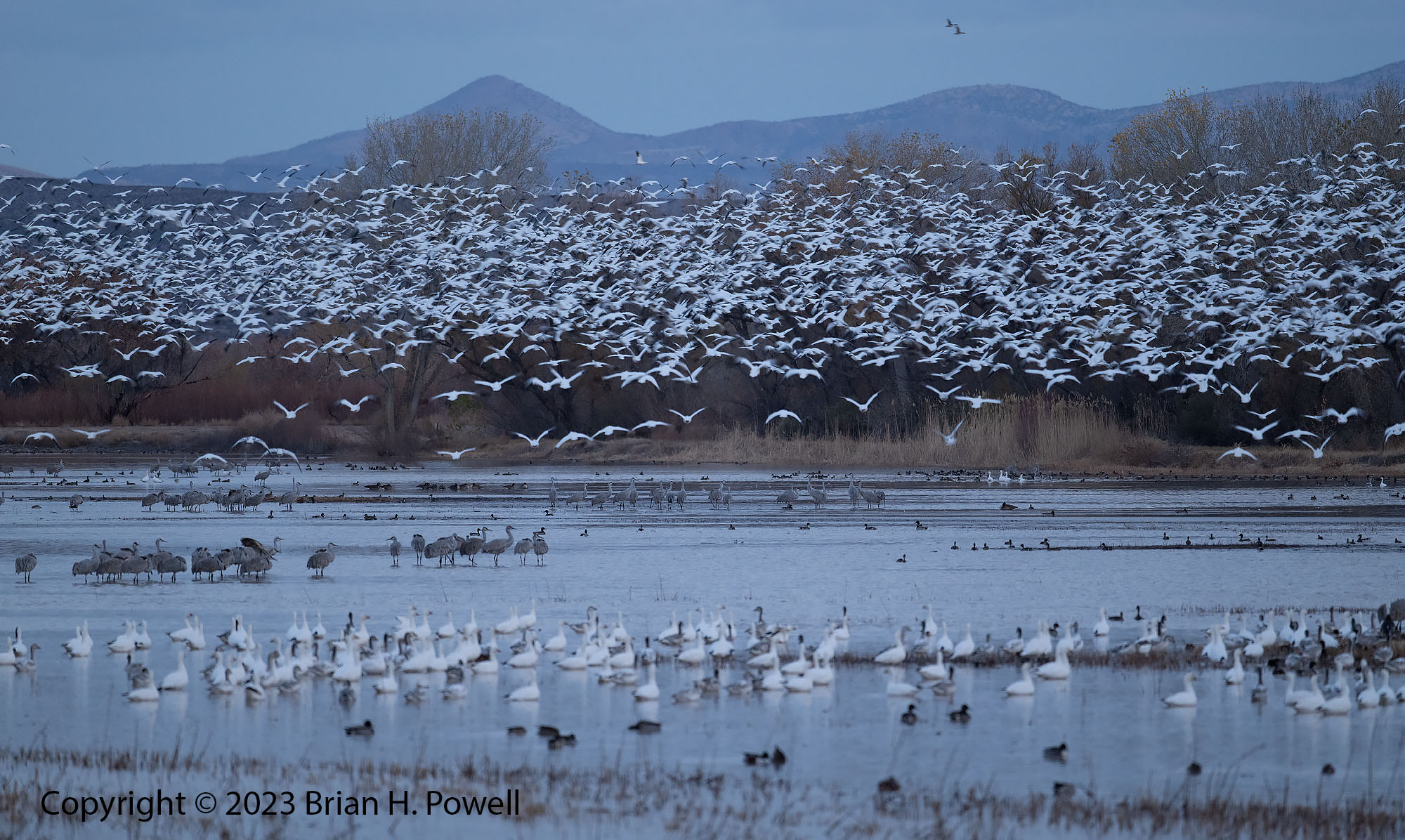
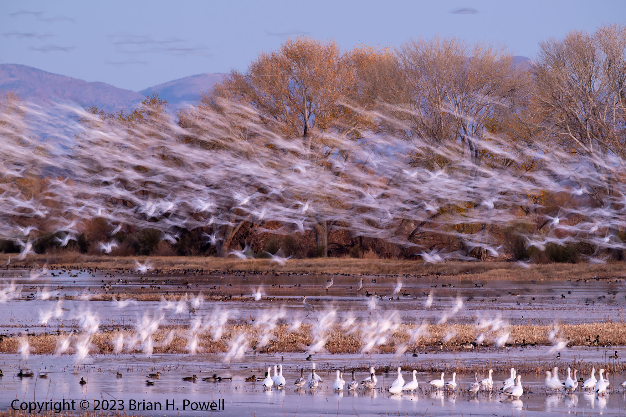
As you can see from the photos above, it was warm enough (mid 20’s) that the snow geese took off before sunrise. If it is ten degrees or so colder, the geese often wait until after the sun is up to take off, giving more color from the sun and sky.

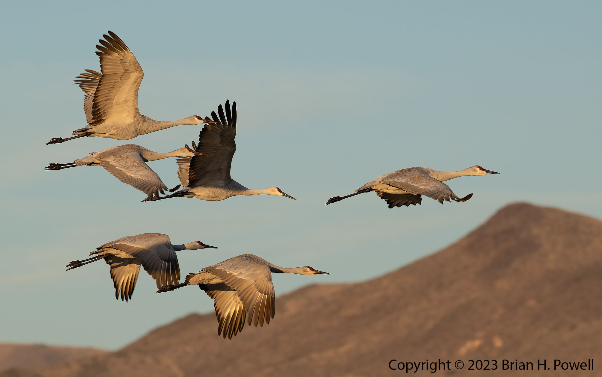
During the day on Monday, not much was happening with birds in Bosque, so I drove about 45 miles north to the Ladd S. Gordon Waterfowl Complex, another one of the refuges along the middle Rio Grande. It’s run by the New Mexico Department of Game and Fish. I am glad I visited–a thousand or more Sandhill Cranes were there. In a lot of ways, it reminded me of a small version of how Bosque used to be–corn close to the roads and clear views to where the birds are.

Sandhill Crane walking
Sandhill Crane
Sandhill Crane standing on one leg as it walks through grass
Sandhill Crane
Sandhill Crane landing in field with two Sandhill Cranes eating
Sandhill Crane landing
Three Sandhill Cranes standing in grass
Sandhill Cranes
Sandhill Crane with wings spread
Sandhill Crane

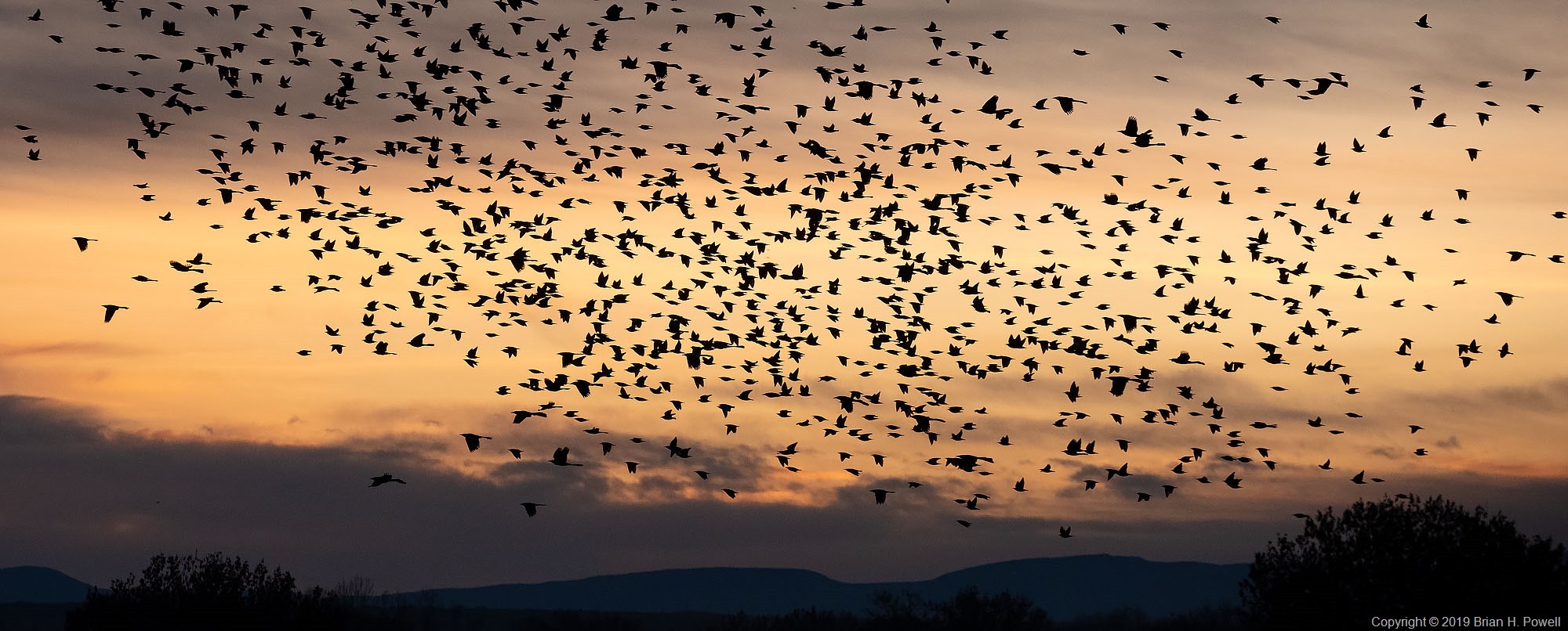
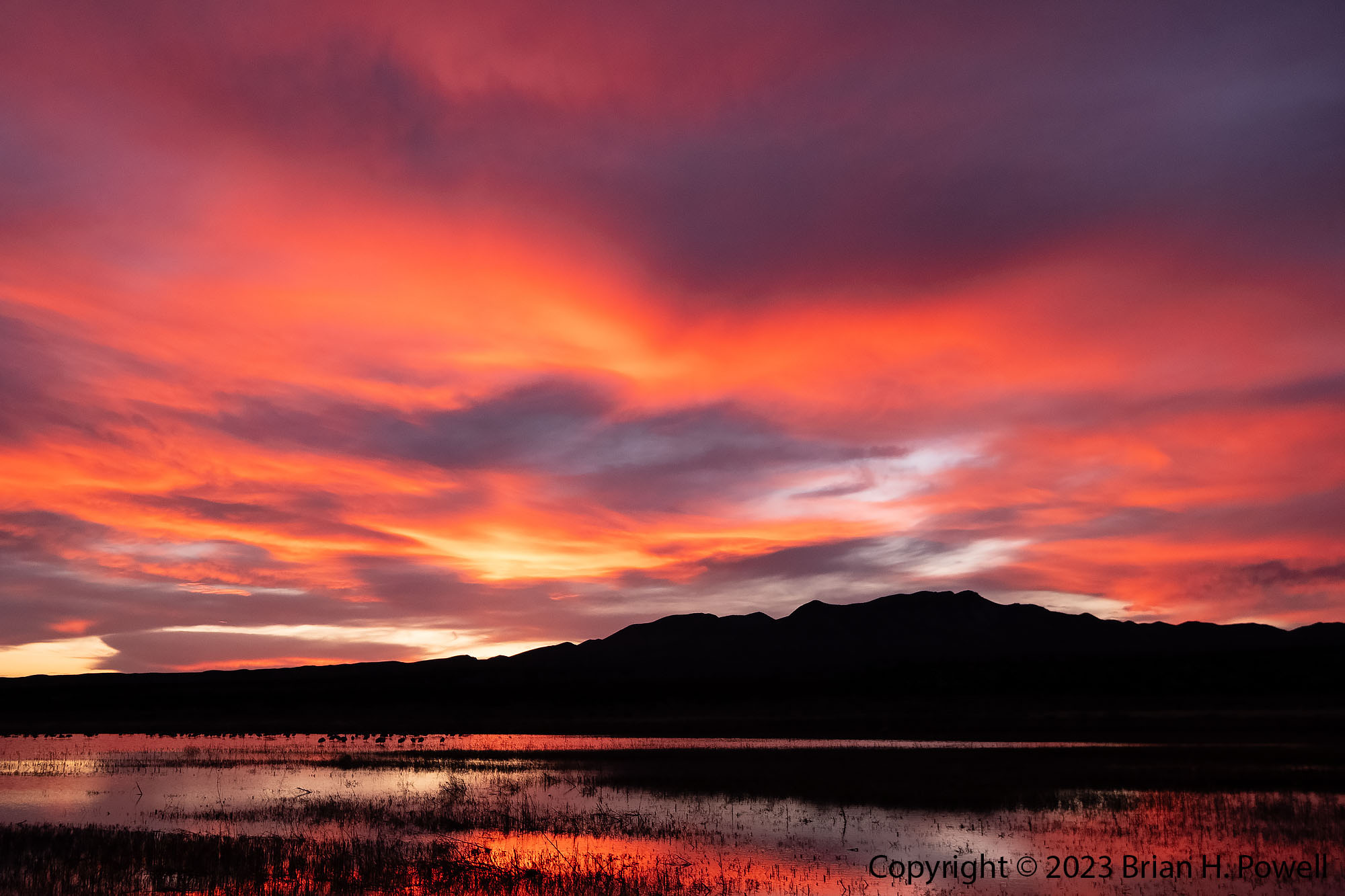
I’d end each afternoon back at the one crane pool along the highway to watch for geese and cranes to fly in. On Monday, the high clouds in the sky had me hoping for a beautiful sunset. But, it looked like it would consist of only a small patch of amber sky. I made the best of it–I’d wait for cranes to pass in front of the amber color to land.

Silhouettes of several Sandhill Cranes landing against an amber sky
Sandhill Cranes landing

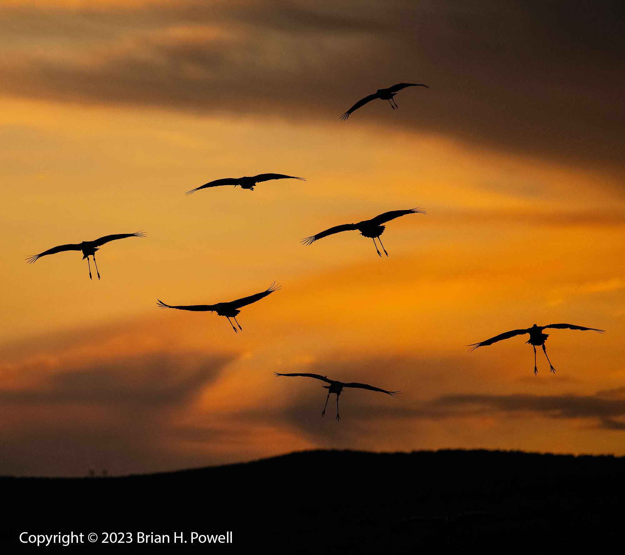
But soon enough, the sky lit up red, the way New Mexico sunsets sometimes do. I grabbed my other camera with a wide-angle lens so I could capture it. It was a beautiful end to a good day.

Sunset with Sandhill Cranes in a pond
Sunset with Sandhill Cranes

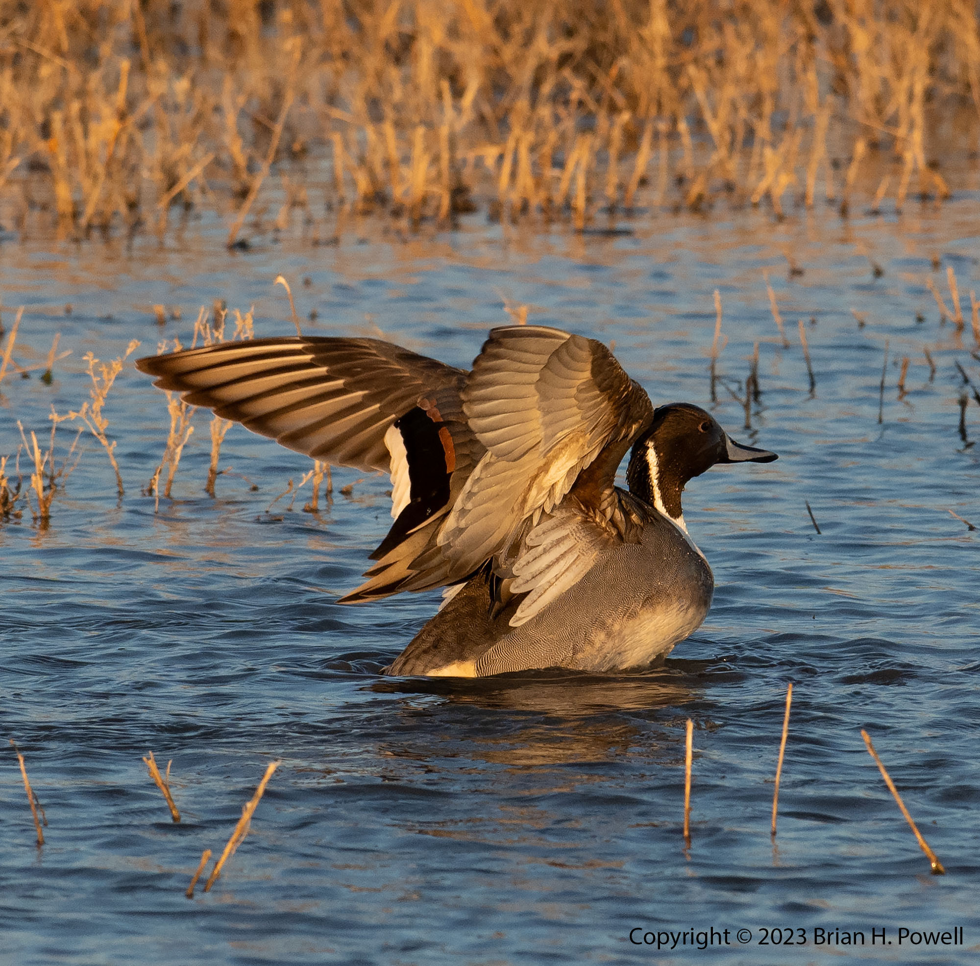
Despite my disappointment that the refuge isn’t as good for photography as it once was, I’m still glad I visited for a few days. Below are a few more photos. (Click to enlarge.)

Bosque del Apache National Wildlife Refuge

Snow geese at sunrise, Bosque del Apache NWR

Bosque del Apache, a wildlife refuge in south central New Mexico, is one of the premiere locations for bird photography in the United States.  It’s a wintering spot for thousands of sandhill cranes and snow geese (and dozens of other species of birds).  Its 57,000 acres straddle I-25, the Rio Grande, and El Camino Real.

I first came here in 2005—with a 35mm film camera, a few rolls of film, and with an 80-200mm f/2.8 as my longest lens.  I came back with a digital camera and better lenses every year for awhile.  After a few years, I got burned out and stopped coming.  It was getting more crowded, and I felt like the refuge was being managed in a way that made the photography harder.

I’d been wanting to come back; I’d heard reports that the refuge was in better shape for photography.  I had a window of time right before Thanksgiving where I could drive to Socorro, spend a couple of days photographing, and then drive back.  It’s a long drive, but driving let me bring more gear than I would been comfortable flying with.

Here’s my gear list:

Read more

A Final Night and Morning in the Grand Tetons

I got up early on Friday to drive the three hours from Canyon Village in Yellowstone, through West Yellowstone, and then down to Idaho Falls.  Why?  Because of some upcoming international travel, I needed a Yellow Fever immunization.  Due to timing, and a nationwide shortage of said vaccines, it was most convenient for me to make an appointment with Eastern Idaho Public Health.

I arrived early (as planned, just in case), so I went down to see the eponymous falls.  A Mormon Temple is in the background on the left.

Click any image to enlarge.

_DSF5238

After my immunization, I had lunch, and headed eastward to go over Teton Pass.  From the top, you can see a nice view of Jackson Hole.

_DSF5239

I drove on down to Jackson and got settled into the Jackson Lake Lodge in Grand Teton National Park for my final night.  I did a little infrared photography in the bright afternoon sun, before heading back to Jackson to meet with a couple of friends for one final night.

_DSC6561


Because of the great location and view from near my hotel room, I set up my camera for star trails.  I did a couple of 35-minute captures from about 11 PM to a little after midnight..  Here’s one of the photos.  The moon was waxing gibbous, and provided plenty of illumination for the snow on the mountains.

merge 2

Despite the late night, I rose early in hopes of great color at sunrise.  I got a little bit of pink in the sky, much like earlier in the week.  Here are a couple of photos—one of Mount Moran, and one of Mount St. John.

_DSF5471


_DSF5475

Before I knew it, it was time to leave for the airport and fly home.

The general consensus at the Nature Photography Celebration (organized by The North American Nature Photography Association) is that it was a successful event that we should repeat in new locations in the future.  We heard from great photographers presenting about their latest projects, and we had plenty of free time to go out and photograph great locations on our own.  (And we even had a small trade show with support from many camera manufacturers, camera stores–especially Gary Farber at Hunt’s Photo & Video–and other organizations.)

A big thank you to my friend Charlotte for sharing wine, cheese, and a hyperactive dog in her beautiful home, and for including me in her network of friends, who all made me feel welcome a long way from home.

I am grateful for the beautiful places like the Grand Tetons and Yellowstone, and all the other National Parks and National Monuments we are blessed to protect for future generations.

More Time in the Grand Tetons

I’m back in Austin now.  I chose not to keep up with the blog as I went.  A combination of 16+ hours of light for photography each day, lots of travel time, time with friends, and a little bit of allergies all conspired to help me choose sleep instead of half-hearted writing into the night.  But I’m back, and have four more blog posts in the works after this one.

Sunrise each morning was about 5:50 AM, so I’d get up every morning about 5:00 and head out to see what the sunrise would bring.  We never had any truly spectacular colors in the morning, but it was still beautiful to be in this amazing place to see how the sun would first light the mountains.

Click on any image to enlarge.

_DSF4263

Balsam Root, the yellow flower in the foreground of the photo below, was blooming in many places in the valley.

_DSF4272

Some mornings would start with fog in low-lying areas.  Clouds in the mountains were constantly changing.  This infrared photo is from the same day as those in my earlier blog post about the Snake River Overlook.  It was taken about fifteen or twenty minutes before the images I posted last week.

_DSC6548


I dropped by another couple of famous places for photography.

Oxbow Bend, below Jackson Lake on the Snake River often has still water in the mornings, great for reflections of Mount Moran, and to its left, the mountain known, at least for now, as Mount Woodring.  (And further left are Mount St. John and Rockchuck Peak.)

_DSF4250


Mormon Row is a section of Grand Teton National Park that I suspect most people don’t visit, but is famous among photographers.  A group of Mormons from Idaho homesteaded here beginning in the late 1800’s, and lived here through the mid-1900’s before being sold to the National Park Service.

Perhaps most famous is the Thomas Alma Moulton barn, shown below.

_DSF4714


I didn’t do much hiking this trip, but I did take an easy five-mile hike on Tuesday up to Phelps Lake.  This is where I saw the moose in my earlier blog post about Grand Teton Wildlife.

_DSF4764


Here’s the GPS track for the hike.  It’s part of the Laurance S. Rockefeller Preserve in the southernmost section of Grand Teton National Park.  This section was donated by Laurance S. Rockefeller to the National Park Service in 2001.

phelpslake

Snake River Overlook

Pro Tip:  If you’re going to use your iPad for your alarm clock, confirm that it’s set to the right timezone, so that you don’t accidentally wake up at 4 AM when you were planning for 5 AM.

This morning’s forecast was for mostly clear skies, so I woke up early and headed into the park.  I decided to start at the Snake River Overlook, made famous by Ansel Adams in his 1942 photo, The Tetons and the Snake River.  The view’s not quite the same, because the trees have grown so much taller in the last 76 years.

I spent about an hour there, before and after sunrise, shooting a variety of compositions.  Here are a couple of similar photos that I liked, one visible light, one infrared.  The first is closer to sunrise, with the fog still lifting off the river.  The infrared image is from a bit later, after the sun started to illuminate the foreground.  Which one do you like better?

_DSF4149

_DSC6549

After I left the overlook, I headed down to Schwabacher’s Landing to take advantage of the reflections in the relatively still water.

_DSF4210

I saw elk and geese today, and hoping I see more wildlife tomorrow.

Hiking in the Dolomites, Part 6

The Tre Cime de Lavaredo are the three mountain peaks that are the highlight of the Tre Cime Natural Park.  (In German, they are called Drei Zinnen.)  From the end of the road at Rifugio Auronzo, we began our three mile hike around Tre Cime to Rifugio Locatelli.  The hike took us up to 8000 feet, to a saddle between Tre Cime and the nearby Monte Paterno (Paternkofel), where we had lunch.  The trail descended from the pass back down a few hundred feet, before ascending again to Locatelli, back at 8000 feet elevation.  Temperatures were in the 50’s, and it was somewhat windy.

TreCimeHike

Shown below, the Locatelli hut, with the Torre di Toblin behind it.

(Click any image to enlarge.)

_DSF1594

On the side of the Monte Paterno, we saw some climbers on a Via Ferrata (Italian for “Iron Road”).  These are hiking and climbing routes that have a cable, fixed to the rock every few meters.  You wear a harness with two carabiners.  As you reach one of the iron stays in the rock, you unclip one carabiner and reattach it to the cable on the other side of the stay, then follow with the other carabiner.  Thus, you are always attached to the cable.

Many of the Via Ferrata in the Dolomites are left from World War I.  The Dolomites were a major battleground in the war between Austria-Hungary and Italy.

In the photo below, you see a couple of people on a fairly flat, easy section of Via Ferrata on Monte Paterno.

_DSF1602

We continued on to the Locatelli hut.  This is a much larger hut than the Resciesa hut we stayed in earlier—I’d guess they have room for over 100 people.  But note that they only have one shower, and it costs €5 to use it for six minutes.  (None of our group bothered with a shower that night.)

Many dayhikers come for lunch or dinner in the cafe.  Along with a lot of people, we saw a few dogs of all sizes on the trail.  Here’s a photo of a beautiful Bernese Mountain Dog.

_DSF1613

That night, the barometric pressure began to rise, and we set our alarms in hopes of clear skies for night photography.  We got started a little bit late, so this turned into a bit of night photography combined with pre-dawn photography.  Here’s a time-lapse sequence showing the transition from night to twilight.

We returned to bed for an hour of sleep before heading out for sunrise.  Here’s one of my favorite infrared images of the dawn light hitting Monte Paterno and the Tre Cime.

_DSC6473

We returned again to bed for another hour of sleep before breakfast, and then began our hike back to Rifugio Auronzo, where we waited for our taxi that would take us to Cortina.

_DSF1803

Up next, Cortina and Venice.

Hunt’s Mesa, and back to Monument Valley for a Lunar Eclipse

Monday morning, we awoke at 5:30 AM to subdued winds and temperatures in the high 30’s.  It wasn’t calm, but it was less windy than the evening before.  The sky was almost clear.  We drove about 2/3 of a mile east of our campsite for a good view.

_DSC8361_HDR

(Click to enlarge.)

The image above and the next image are (lightly processed) HDR images, where I combined a couple of different exposures to get a little more highlight and shadow detail.  In the image below, you can see the formation called the Totem Pole on the right center of the frame.  It’s about 420 feet tall.

_DSC8470_HDR

In the next image below, I’ve highlighted the view back towards The View hotel.  This was taken with my Nikkor 80-200 f/2.8 lens at 200mm.

_DSC8427

Here’s the shot in Photo Transit, which says that the hotel is about 6.7 miles away, with Utah in the distance beyond.

IMG_0232

As the sun rose higher in the sky, we packed up our photo gear and drove back to our campsite for breakfast, then packed up the camp for the long drive back to Monument Valley.  We enjoyed hot showers and a nap when we got back to the hotel.

Early Tuesday morning was another event we were looking forward to: a full lunar eclipse.  I thought about going out late to do some light painting, but couldn’t really scout out a good location for it.  (I learned light painting technique from Michael Frye in Yosemite.  He wrote a blog post about his eclipse photography.)  I ended up staying at my hotel and shooting from the balcony.

First, a shot of the full moon rising beyond Merrick Butte.

_DSC8628_HDR

I also tried a 10-second exposure at ISO 6400 to try to capture the Mittens with the stars.  There’s a little too much light pollution for this to be effective.

_DSC8648

I didn’t bring my big lens on this trip; the longest I had was a 200mm.  Still, I did manage to capture this image of the “blood moon” during the eclipse.  Mars is to the lower right of the moon.

_DSC8782

The landscape lost light as more of the moon was obscured, so I decided to try to capture a video of the stars in motion.  Each of these images was a 5-second exposure at ISO 6400, and they were made about 20 seconds apart.  For best viewing, watch it on YouTube in full screen with the highest (1080p) resolution.

Stars

I have to admit I just started the intervalometer with the camera on a tripod and went back to bed for a while.  In the video, you’ll notice a couple of airplanes fly by.  I was lucky enough to have a meteor show up in one of the frames, seen below.

_DSC8723

The next day, we traveled to Canyon de Chelly.  More on that in the next blog post.