Skip to content

Posts tagged ‘Hiking’

Hiking in the Dolomites, Part 4

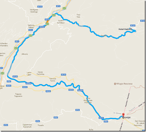
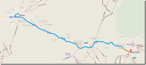
The next day—June 29 if you’re keeping score—we took a taxi down to the ski village of Ortisei.  We spent a little time walking around the town and enjoying time at a cafe near the Hotel Adler before taking a funicular up into the mountains.

ToOrtisei

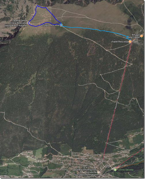
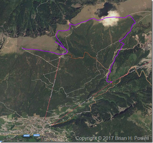
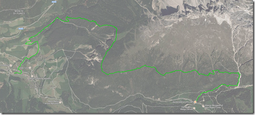
From the top of the funicular, it’s about a mile traverse (light blue route below) over to Rifugio Resciesa, where we’d stay for the evening.  Unfortunately, I fell ill with intestinal pain that afternoon, so once I got to the hut, I just rested.  As I look for a silver lining to being sick, the afternoon views were hampered by a whole lot of clouds.  My body chose a good time to demand rest.

The Resciesa hut is one of many different mountain huts scattered all over the Alps.  It’s a combination bar/restaurant and guest house.  The Resciesa hut is one of the smaller huts, with room for about 40 people.  We had a room of bunk beds for all eight of us.  Some rooms are larger; some smaller.  There were two showers and two bathrooms shared for everyone at the hut.  I was pretty pleased with the experience, and people who had been at other Alpine huts agreed that this was among the nicer ones.

Resciesa

The next morning, the weather and my health had both improved.  I decided to hike the approximately one-mile loop from the hut, to the peak, and then over to a small chapel.  (This is the darker blue route on the map above.)  The temperatures were in the 50’s and windy.  I’d typically wear three to five layers of clothes to maintain comfort.

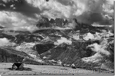
On my way up, I took this infrared photo of the Resciesa hut in the lower left, with the Langkofel Group of mountains in the distance.  There are still plenty of clouds around, but at least we could see for miles around.

_DSC6283

Click any image to enlarge.

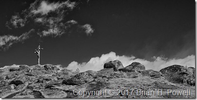
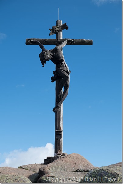
It’s pretty common for hikable mountains in this area to have wooden crosses at their summits.  Here’s an infrared view of the cross above the Resciesa hut.

_DSC6288

And a closer look from my regular camera:

_DSF0848

I turned around the other way, and took this panorama.  The Resciesa hut is on the far left of the photo, and the chapel is to the right of the sign near the middle.

_DSF0849

In the late morning, we left the hut and started a traverse eastward.  The plan was to get a better perspective on the Geislergruppe, also to our east.  We would then take a trail down to the middle station of aerial gondolas ascending up to the Seceda ski area.  We could then take the gondola down to Ortisei, where we left the day before.

LeavingResciesa1

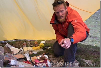
A typical lunch for us was a lunch sack prepared by our guide containing snacks and an always-excellent sandwich prepared that morning from local cheeses, meats, and vegetables.  On this day, it was more of a “build-your-own” affair.  Here’s a photo of our guide, Hayden, with the lunch preparations spread out under his tarp.

_DSF1196

We had lunch near one of the peaks above the funicular station.  We spent quite a bit of time there making time lapse videos.  Here’s an infrared time lapse of the Geislergruppe, to our east.

I would love to tell you that the rest of our day was uneventful.  But it was not to be.

The weather turned again.  Soon after we left our lunch spot, it looked like we might have a brief shower.  We put our rain covers over our packs, and donned our rain jackets.  Most of us had rain pants with us, but none of us felt like it was going to be necessary to put them on.  We were wrong.

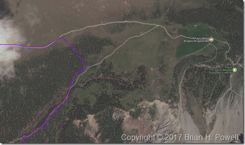
The sleet started first.  Some called it hail.  The temperatures dropped to around 40 degrees Fahrenheit.  Then rain mixed in.  And then thunder.  If it weren’t for the thunder, we might have stopped to put on our rain pants.  On the map below, our travel route enters from the upper left, and we headed due east.  We were originally aiming for the intersection of trails just right of center.  With the rain, we debated going on to the Rifugio Malga Brogles a bit further on the trail to wait out the rain and sleet.  But it was the thunder that convinced us that it was time to exit the mountain as quickly as possible.

We went off trail, heading down an embankment to take us down below tree line to pick up the return trail.  It was steep and slippery, but it was the fastest way out of danger from possible lightning.  Once we got to the return trail, the hike finally met its promise of being uneventful, except for the part about being soaked.  The thunder stopped; the rain abated.  The temperatures rose as we descended.

LeavingResciesa2

We made it to the cable car and descended to Ortisei to catch the bus to continue our journey.  We stayed overnight that night in Selva (known in German as Wolkenstein).

ToSelva

Coming up, a visit to Lago di Dobbiaco, and on to the highlight of the trip, Tres Cime.

Hiking in the Dolomites, Part 3

The next day, we took the bus to the end of the road, and went for an approximately 7-mile hike near Santa Magdalena at around 2000 meters elevation.  Here’s the trail we took, hiking from east to west:

FirstHike

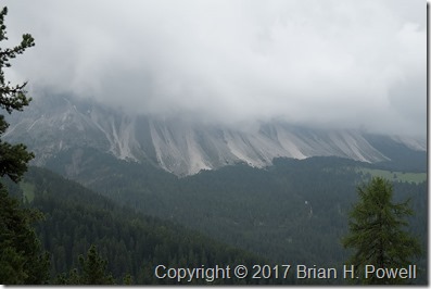
As I mentioned in my last post, the weather turned overcast with a low ceiling, and a nearly constant threat of rain.  The good news is that it didn’t actually rain much—a couple of passing showers that lasted only minutes.  The bad news is that we had to imagine what the scenery looked like:

_DSF0301

(Click on any image to enlarge.)

Once again, I turned to my infrared Nikon D300 to find elements of drama in the larger scene.  On this trip, I used the versatile Nikkor 18-200mm f/3.5-5.6 lens for all of my infrared photos.  This shot is using a focal length of 65mm (35mm equivalent of 100mm) at f/5.

_DSC6193

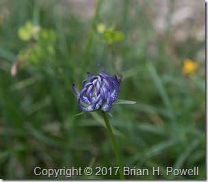
Another approach to photographing with uncooperative weather is to focus on details, such as this flower.

_DSF0300

I believe this is a Phyteuma orbiculare.
Common name: Round-headed Rampion

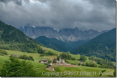
The weather improved marginally as we neared the end of our hike, descending to Santa Magdalena to catch the bus back to the hotel.  The mountains were still in the clouds, but we could at least appreciate more of the scenery.

_DSF0381_HDR

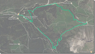
The next day, we hiked again for about five miles in the same area, heading more east:

SecondHike

The weather was slightly improved from the day before—the ceiling had lifted ever so slightly, and we saw some blue sky as the day progressed.

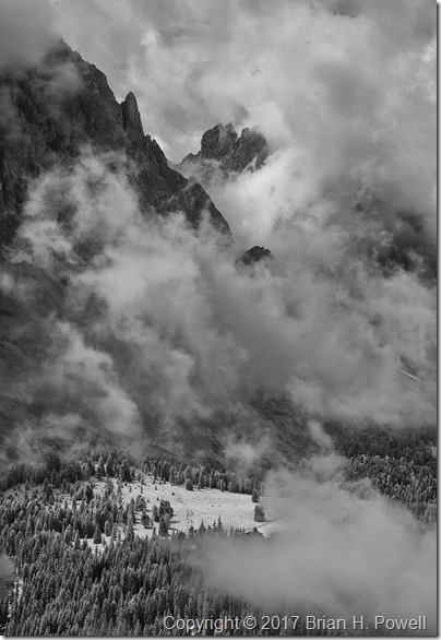
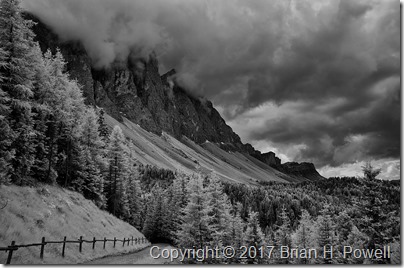
Here’s my favorite infrared photo from the day, with the brooding clouds hanging just at the top of the peaks.

_DSC6236

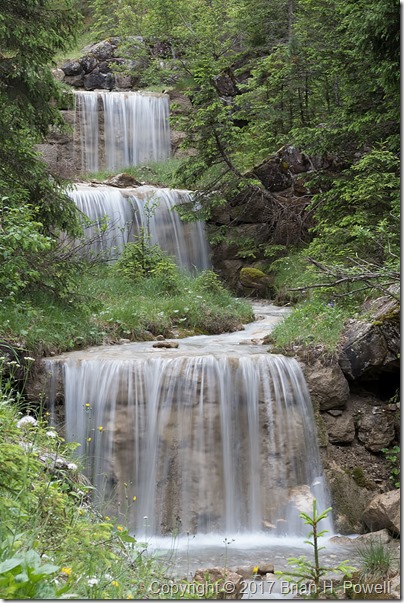
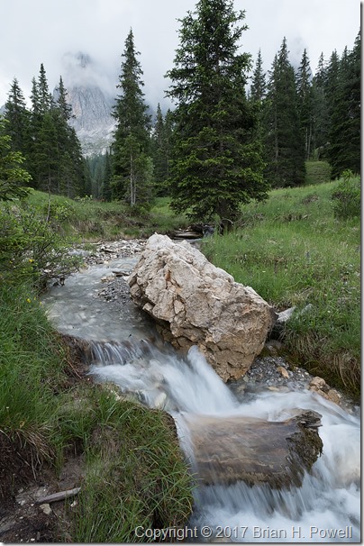
As long as the sky was cloudy, we could switch our focus to scenes that don’t include it.  I photographed these waterfalls with a 1/3 second exposure at f/22.

_DSF0603

The photo below is a 1/10 second exposure, also at f/22.

_DSF0640

If you haven’t figured it out by now, one of the themes of this week was to find different ways to photograph something interesting while having challenging weather conditions.  This led us to time-lapse photography.

Here’s a very short video of sixty time-lapse frames.  Each frame was taken 3 seconds apart, and the video below speeds it up by 36x.  I’ll have a few more examples like this in later blog posts.

Next up, an afternoon in Ortisei, on our way up to our first mountain hut, the Rifugio Resciesa.

Doe Mountain, Coconino National Forest

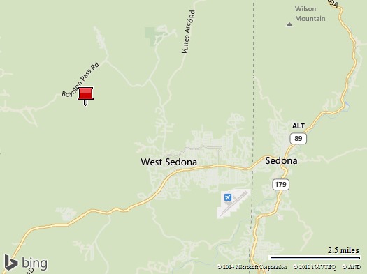
I’m in Arizona this week, starting off in Phoenix, then up to Flagstaff to visit my friends Crystal and Paul.  On a day trip from Flagstaff this past Friday, I went down to Sedona and hiked the Doe Mountain trail in Coconino National Forest.

Map of Doe Mountain


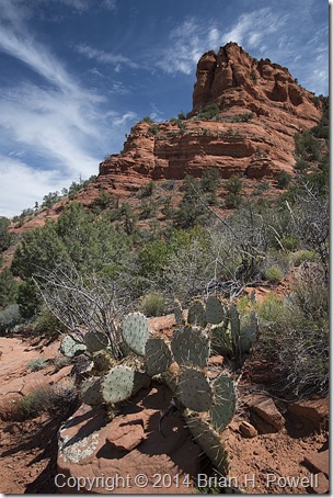
Here’s a photo from early in the hike.  I hiked up to the ridge shown in this photo.

_DSC7948


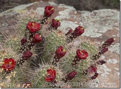
There were some nice wildflowers at the top, including this Claret Cup Cactus.  (Echinocereus triglochidiatus)

_DSC7985

Next up, Monument Valley and a trip to Hunt’s Mesa.

Summer Trip Day Ten, Lassen Volcanic National Park

A video of Bumpass Hell.  Yeah, that’s really what they call it—Bumpass Hell.  Allegedly named for a cowboy named Bumpass who burned his leg there in the 1860’s.

Lassen Volcano had a major eruption in 1914-1915, but was a national monument even before that.

The hike to Bumpass Hell is about 1.5 miles one way at about 8000 feet.  The trail had a few patches of snow on it, and I’m glad I brought my hiking polls for some of the slush/snow traversals.  The temperature was around 55 to 60 degrees Fahrenheit and sunny.  Great hiking weather.

Other than that, it was a long day of driving—both before and after Lassen.  I’m now in Oregon, contemplating getting up early for morning light at Crater Lake.

Salt Lake City Trip

Last week, I was in Utah for work, presenting at a military/aerospace trade show. I arrived in Salt Lake City early afternoon on Saturday. It was too early to go to the hotel, so as I am wont to do, I drove into the mountains for a hike. I drove to the ski town of Alta for an “easy” hike to Cecret Lake.

“Easy” is relative. The hike was at about 9000 feet elevation, and was a 1.5 mile hike with a 420 foot elevation gain. I took two SLR camera bodies, and some extra camera gear that I forgot to unload before I started on the trail.

It was a good, but slow, acclimitization hike. Here’s an infrared shot on the way up…

Here’s a view of Cecret Lake with a few other hikers on the far shore.

After this shakedown hike, I drove back to Salt Lake City to the downtown Marriott hotel where my co-workers (about 25 to 30 people) were staying. The hotel was right across from the Salt Palace Convention Center, and a block away from Temple Square.

Next to the Salt Palace is the Maurice Abravanel concert hall. I was fascinated by the 30-foot-tall glass sculpture in the lobby created for the 2002 Olympics.

Sunday, September 7
As a classical musician, it’s a treat for me to visit the regular music performances at Temple Square. Every Sunday morning (since 1929), the Mormon Tabernacle Choir (and on this Sunday, with the Orchestra at Temple Square) records a half hour TV and Radio broadcast of Music and the Spoken Word. Here’s a photo from the rehearsal just before air time.

Besides the broadcast, I skipped lunch at the trade show on Monday, Tuesday, and Wednesday, and went back to the Tabernacle for the half-hour noon organ recitals. The juxtaposition of the music and the military trade show was quite interesting.

Here’s a photo of the Mormon Temple just outside the Tabernacle.

Sunday afternoon, I drove down to visit Timpanogos Cave National Monument. To visit the cave, you have to hike from about 5700 feet elevation at the visitor’s center to 6700 feet at the cave entrance. This seemed easier than the Saturday hike—I guess because of the lower elevation and 24 hours of acclimitization. Here’s a view from the shelter at the cave entrance, looking across the valley.

And here’s one of my less blurry shots from inside the cave…

Before I left the area, I kept heading east through the National Forest and walked around Cascade Springs…

And here are a couple of panoramas from the Cascade Springs area in the Uinta National Forest. The first one is visible light, and the second one is a negative infrared photo. (Click to enlarge each.)


And then it was back to the hotel to meet up with several others for dinner at Red Rock Brewing Company.

A Little Hiking in Colorado

A friend from work and I departed Austin for Denver Friday afternoon, May 30. Our original plan was to hike primarily in Rocky Mountain National Park. But it was a little early in the season for many hikes there. We had called the park ranger the week before, and they warned us that many of the hikes were “slushy”.

So, I brought along my book Hiking Colorado’s Front Range and my trusty Trails Illustrated Trail Map for Boulder and Golden for drier hiking ideas.

Day 1: Heil Valley Ranch
Our warmup hike was in a Boulder County park called Heil Valley Ranch. It was a little over 7.5 miles, with elevation of 5900′ to 6800′.

This hike was pretty uneventful. The trail is used by a lot of mountain bikes. On the return leg, we were warned of a rattlesnake that we never saw. There were some nice wildflowers.


And here’s an infrared shot from my converted Nikon D200 camera…

Day 1: Boulder Falls
After this hike, we made a quick trip up Boulder Canyon and visited Boulder Falls…

And then we kept a mid-afternoon lunch date with an old friend at Tahona Tequila Bistro on Pearl Street in downtown Boulder.

After our late lunch, we continued walking down Pearl Street. This pedestrian mall has a lot of street performers, and we stopped to listen to a country trio. I thought they were really good—they had a good “presence”, and the lead singer had a great voice. She kind of had the style of Iris Dement. I bought a CD from them. Later, I checked out the band’s website, only to discover that they were an Austin band on tour. The band is Shotgun Party (on MySpace).

After this leisurely afternoon, we went up to the National Park to check out the situation there…

There was plenty of snow above 9000′ in the middle of the park, but it looked like we could still hike some places inside the park.

Day 2: Button Rock Preserve
On Sunday, we decided to do a couple of hikes, starting with a relatively “easy” hike near Button Rock Reservoir.

This 4.5 mile hike starts out on a gravel road at about 6000′, but moves on to a somewhat more difficult trail after about a mile.

In this photo, you can see my friend and his red daypack hiking off into the distance. This was a common occurrence, because he is in better shape than I am and dealt with the altitude better than me.

Here’s another infrared shot from the hike…

Day 2: Gem Lake Trail
Next, we drove up through Estes Park to the Lumpy Ridge Trailhead to hike to Gem Lake. This is a short hike of a little more than 3 miles, but the elevation nears 9000′ at Gem Lake.

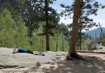
Here’s what happens when my friend got really far ahead of me. He just lays down and takes a nap…

Eventually, he managed to drag me all the way to the lake and wait patiently for me to take pictures…

Here’s another infrared shot of the lake…

And on the way down, I stop for a nice view of Estes Park…


Day 2: Trail Ridge Road
After the hike, my friend wanted to drive to the western side of the park over Trail Ridge Road. I’m a little skeptical, because it’s already mid-afternoon, but what the heck, it’s only about 150 miles to take the long way back to Boulder, and he’s paying for half the gas.

Here are a few more pictures from the trip up. Here’s a picture of the Alluvial Fan, created by the Lawn Lake flood of 1982.

And here’s an overall panorama from about the same point on the road…

And a bird hanging out at 10,000′ or so…

Day 3: Bear Peak
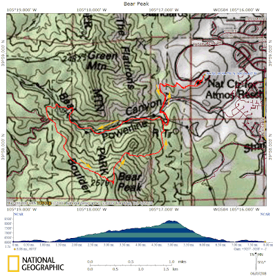
The big hike of the weekend was Bear Peak, just southwest of Boulder—almost 8 miles, starting at about 6000′, and reaching the Bear Peak summit above 8400′.

The hike starts at the National Center for Atmospheric Research, up Bear Canyon to the western ridge of Bear Peak. There are some nice views of the flatirons from there…


We took a shorter, but steeper route down through Fern Canyon. This return route was miserably steep—downhill, but very slow going because of the rocky terrain and because my knees were getting tired.

Fortunately, I had a one-hour head start on my friend. He stopped on the way up for a work-related conference call. He had to find a spot with a view towards Boulder to get cell phone coverage. Here’s the approximate location, looking down on the NCAR buildings…

While he was on the phone, I trudged ahead as the trail got steeper near the summit. The plan was for me to wait at the summit, but the bugs were too annoying there.

After descending a few hundred feet, I stopped and made my own work-related phone call. After I hung up, I decided to keep descending (and descending and descending). My friend didn’t catch up with me until the last couple of miles.

After our return to NCAR, my friend made a great suggestion to eat a late lunch at the Chautauqua Dining Hall in Boulder.