Skip to content

Posts from the ‘Travel’ Category

Hill Country Ranch Weekend

Last weekend, I had the great privilege to visit a friend’s ranch near Kerrville, Texas, with a few other photographers.

We were hoping for partly cloudy, interesting skies.  Instead, it was overcast and misty much of the time.  But this didn’t prevent us from going out and photographing.

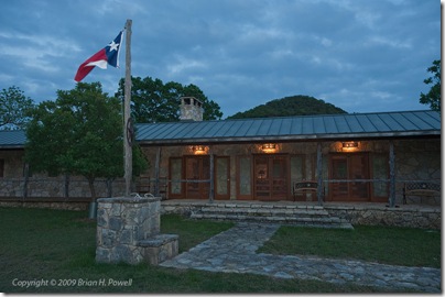
One of the tricks I learned from Bob Krist is that when the weather’s bad, you can usually wait until a few minutes after sunset, and the sky will go blue.  I also used a little flash to kick a little light onto the Texas flag.  (Click on any of the images to view them larger.)The Front of the House After Sunset

Another trick I’ve learned is that infrared can make overcast skies look pretty interesting even in the middle of the day.  I have a Nikon D200 that I’ve converted to infrared (at lifepixel.com).

I took the infrared idea a step further.  I used the intervalometer built into most Nikon DSLRs, and set it up to take a photo every couple of seconds for a few minutes, and then converted these images to a video with Adobe Photoshop Extended.  (As expected, the “HQ” button below noticeably improves the video quality.)

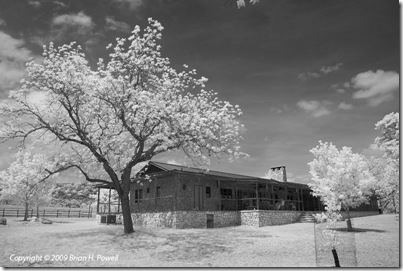
On Saturday afternoon, we had a few hours of sun, where the infrared images get really interesting.  Here’s the back porch of the ranch house…

Infrared View of the Back Porch

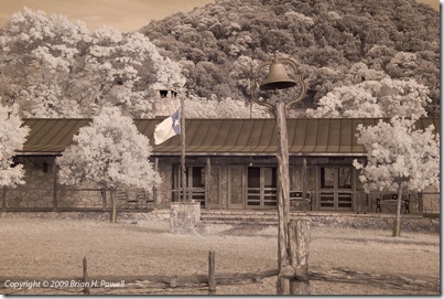
And in this infrared shot, I’ve left the colors that come straight out of the sensor.  There’s a hint of blue left in the flag, and I like the overall sepia tone. False Color Infrared View of the Front of the House

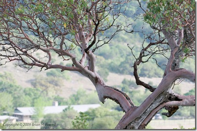
One morning, we hiked up one of the hills to an area that overlooks the ranch house.  There’s an old Madrone tree part of the way up.

Madrone Tree

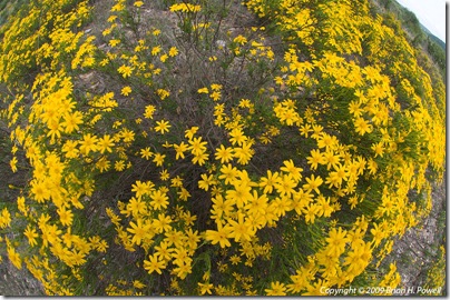
The hillside opposite the front of the house was covered in wildflowers, especially Damianita.  Here’s a fisheye view of several hundred flowers.

Damianita Daisy (Chrysactinia mexicana)

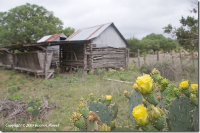
The Prickly Pear cactus were also beginning to bloom.  Here are some near the old corn cribs.Prickly Pear near the Corn Cribs

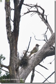
On our last morning at the ranch, we decided to try to find a golden-cheeked warbler.  We never found one, but I did get this photo of an Ash-Throated Flycatcher.

Ash-throated Flycatcher

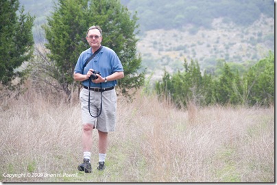
Here’s a photo of John Wheat, in search of the elusive warbler.

John Wheat

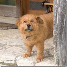
And here’s a shot of my buddy Copper.  She is a city dog who loves being a ranch dog, too.  She’s on a diet.

My Buddy Copper

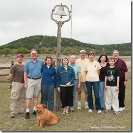
It is a tradition that every group that visits the ranch gets their picture taken by the bell, so here’s our gang.  We’re smiling, but a little disappointed that our ranch adventure had to end so soon.

Our Photography Group

Thanks for a wonderful weekend!

Bosque del Apache 2008

The day after Thanksgiving, I picked up a rental car and started driving to Socorro, New Mexico. This was an 11-hour drive, but I had committed to picking up my friend Jennifer from the Albuquerque airport about 10 AM on Saturday. The rental was a Kia Sorrento SUV, big enough to hold a bunch of photo gear. I was thankful that the price of gas had fallen well below $2/gallon, and that the SUV managed about 20 mpg.

I could have gone a variety of different routes to Socorro, but I went with the advice of my Garmin GPS, by way of San Angelo, Roswell, and Carrizozo. (Sadly, it was too late to pay my respects at Smokey the Bear’s grave on the way through Capitan.)

Saturday, November 29 – Tuesday, December 2
5:00 AM. Time to get up and start three and a half days of intense, frustrating, yet relaxing, bird photography at the Bosque del Apache National Wildlife Refuge, south of Socorro. It wasn’t long before I saw one of my photography mentors, Arthur Morris.

Artie is arguably the world’s greatest bird photographer. He leads photo tours all around the world. He’s sometimes a little rough around the edges, but a very good teacher. You can learn a lot from Artie just by being nearby as he yells advice to his workshop students, and as he weighs the options to keep shooting or move on to another spot. I also recommend his book, The Art of Bird Photography II, a 916-page book for which I did a thorough editorial review.

Favorite 2008 Artie Morris quote: “These silhouettes are the easiest situation for auto-focus. If you can’t get your camera to auto-focus here, you should take up knitting.”

I also saw a couple of other pro photographers I know, Robert O’Toole and Larry Ditto. Larry lives down in McAllen, and had his own workshop group at Bosque. I first met him on a trip to the cloud forest near Gómez Farías, Tamaulipas, Mexico. I also introduced myself to another pro I recognized, Laurie Excell, leading her own small photo tour.

My friend Jennifer and I first met on a photo workshop in Utah a few years ago, and we’ve stayed in touch and done other photo adventures together. She’s an oncologist at the Dana-Farber Cancer Institute, and an assistant professor at the Harvard Medical School.
Rounding out our trio was my friend Nicole, a great photographer and one of my best friends.

Here are a few of my favorite images. Click on each to enlarge. (More available on bhpowell.com.)

It’s kind of hard to see here, but the moon, Venus, and Jupiter are all in the sky on this Monday evening.


Here’s a silhouette of my friend Nicole, as we tried to hold on to the last bit of light.


This next shot is with an infrared fisheye, pointed straight up as snow geese flew overhead. You can see a bit of the ground at the corners.

Tuesday morning, we were up for one final dawn photo shoot, then back to the hotel to check out, and off to Albuquerque. I dropped Nicole and Jen off at the airport, and drove on to a work meeting in Albuquerque.

Salt Lake City Trip

Last week, I was in Utah for work, presenting at a military/aerospace trade show. I arrived in Salt Lake City early afternoon on Saturday. It was too early to go to the hotel, so as I am wont to do, I drove into the mountains for a hike. I drove to the ski town of Alta for an “easy” hike to Cecret Lake.

“Easy” is relative. The hike was at about 9000 feet elevation, and was a 1.5 mile hike with a 420 foot elevation gain. I took two SLR camera bodies, and some extra camera gear that I forgot to unload before I started on the trail.

It was a good, but slow, acclimitization hike. Here’s an infrared shot on the way up…

Here’s a view of Cecret Lake with a few other hikers on the far shore.

After this shakedown hike, I drove back to Salt Lake City to the downtown Marriott hotel where my co-workers (about 25 to 30 people) were staying. The hotel was right across from the Salt Palace Convention Center, and a block away from Temple Square.

Next to the Salt Palace is the Maurice Abravanel concert hall. I was fascinated by the 30-foot-tall glass sculpture in the lobby created for the 2002 Olympics.

Sunday, September 7
As a classical musician, it’s a treat for me to visit the regular music performances at Temple Square. Every Sunday morning (since 1929), the Mormon Tabernacle Choir (and on this Sunday, with the Orchestra at Temple Square) records a half hour TV and Radio broadcast of Music and the Spoken Word. Here’s a photo from the rehearsal just before air time.

Besides the broadcast, I skipped lunch at the trade show on Monday, Tuesday, and Wednesday, and went back to the Tabernacle for the half-hour noon organ recitals. The juxtaposition of the music and the military trade show was quite interesting.

Here’s a photo of the Mormon Temple just outside the Tabernacle.

Sunday afternoon, I drove down to visit Timpanogos Cave National Monument. To visit the cave, you have to hike from about 5700 feet elevation at the visitor’s center to 6700 feet at the cave entrance. This seemed easier than the Saturday hike—I guess because of the lower elevation and 24 hours of acclimitization. Here’s a view from the shelter at the cave entrance, looking across the valley.

And here’s one of my less blurry shots from inside the cave…

Before I left the area, I kept heading east through the National Forest and walked around Cascade Springs…

And here are a couple of panoramas from the Cascade Springs area in the Uinta National Forest. The first one is visible light, and the second one is a negative infrared photo. (Click to enlarge each.)


And then it was back to the hotel to meet up with several others for dinner at Red Rock Brewing Company.

Boston Trip

I was in Boston for a business trip recently. Sunday morning, I met my friend Jennifer for breakfast. Her day job is being an oncologist and Harvard professor, but she’s also passionate about wildlife and nature photography. She was leaving the next day for a two-week Alaska trip and agonizing about what equipment to take.

Sunday afternoon, I went to Fenway Park to watch the Red Sox play the Toronto Blue Jays.

I thought my seats were pretty good, but too bad the Sox gave up six runs in the first inning. It was a tough day.

On Thursday afternoon, I went to Gloucester to take a whale watching tour with Capt. Bill & Sons. Gloucester is near the top of this map, with Boston on the left. I used my new Dawn Technology GPS to geotag my images.

The first whale we saw, nicknamed “Etch-a-sketch”, was swimming around in circles creating a bubble net to trap fish. The birds, being clever, sat on the surface watching for the bubbles. When they saw them, they’d fly over and wait for the whale (and fish) to show up. So this made it easy for us to know when the whale was going to surface.

We saw several other whales, including whales that breached and slapped their fins and tails on the water…


After the whales, I drove back to Burlington, MA, and had dinner with my friend Dafna at Legal Seafood.

A Little Hiking in Colorado

A friend from work and I departed Austin for Denver Friday afternoon, May 30. Our original plan was to hike primarily in Rocky Mountain National Park. But it was a little early in the season for many hikes there. We had called the park ranger the week before, and they warned us that many of the hikes were “slushy”.

So, I brought along my book Hiking Colorado’s Front Range and my trusty Trails Illustrated Trail Map for Boulder and Golden for drier hiking ideas.

Day 1: Heil Valley Ranch
Our warmup hike was in a Boulder County park called Heil Valley Ranch. It was a little over 7.5 miles, with elevation of 5900′ to 6800′.

This hike was pretty uneventful. The trail is used by a lot of mountain bikes. On the return leg, we were warned of a rattlesnake that we never saw. There were some nice wildflowers.


And here’s an infrared shot from my converted Nikon D200 camera…

Day 1: Boulder Falls
After this hike, we made a quick trip up Boulder Canyon and visited Boulder Falls…

And then we kept a mid-afternoon lunch date with an old friend at Tahona Tequila Bistro on Pearl Street in downtown Boulder.

After our late lunch, we continued walking down Pearl Street. This pedestrian mall has a lot of street performers, and we stopped to listen to a country trio. I thought they were really good—they had a good “presence”, and the lead singer had a great voice. She kind of had the style of Iris Dement. I bought a CD from them. Later, I checked out the band’s website, only to discover that they were an Austin band on tour. The band is Shotgun Party (on MySpace).

After this leisurely afternoon, we went up to the National Park to check out the situation there…

There was plenty of snow above 9000′ in the middle of the park, but it looked like we could still hike some places inside the park.

Day 2: Button Rock Preserve
On Sunday, we decided to do a couple of hikes, starting with a relatively “easy” hike near Button Rock Reservoir.

This 4.5 mile hike starts out on a gravel road at about 6000′, but moves on to a somewhat more difficult trail after about a mile.

In this photo, you can see my friend and his red daypack hiking off into the distance. This was a common occurrence, because he is in better shape than I am and dealt with the altitude better than me.

Here’s another infrared shot from the hike…

Day 2: Gem Lake Trail
Next, we drove up through Estes Park to the Lumpy Ridge Trailhead to hike to Gem Lake. This is a short hike of a little more than 3 miles, but the elevation nears 9000′ at Gem Lake.

Here’s what happens when my friend got really far ahead of me. He just lays down and takes a nap…
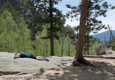
Eventually, he managed to drag me all the way to the lake and wait patiently for me to take pictures…

Here’s another infrared shot of the lake…

And on the way down, I stop for a nice view of Estes Park…


Day 2: Trail Ridge Road
After the hike, my friend wanted to drive to the western side of the park over Trail Ridge Road. I’m a little skeptical, because it’s already mid-afternoon, but what the heck, it’s only about 150 miles to take the long way back to Boulder, and he’s paying for half the gas.

Here are a few more pictures from the trip up. Here’s a picture of the Alluvial Fan, created by the Lawn Lake flood of 1982.

And here’s an overall panorama from about the same point on the road…

And a bird hanging out at 10,000′ or so…

Day 3: Bear Peak
The big hike of the weekend was Bear Peak, just southwest of Boulder—almost 8 miles, starting at about 6000′, and reaching the Bear Peak summit above 8400′.
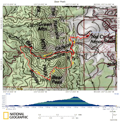
The hike starts at the National Center for Atmospheric Research, up Bear Canyon to the western ridge of Bear Peak. There are some nice views of the flatirons from there…


We took a shorter, but steeper route down through Fern Canyon. This return route was miserably steep—downhill, but very slow going because of the rocky terrain and because my knees were getting tired.

Fortunately, I had a one-hour head start on my friend. He stopped on the way up for a work-related conference call. He had to find a spot with a view towards Boulder to get cell phone coverage. Here’s the approximate location, looking down on the NCAR buildings…

While he was on the phone, I trudged ahead as the trail got steeper near the summit. The plan was for me to wait at the summit, but the bugs were too annoying there.

After descending a few hundred feet, I stopped and made my own work-related phone call. After I hung up, I decided to keep descending (and descending and descending). My friend didn’t catch up with me until the last couple of miles.

After our return to NCAR, my friend made a great suggestion to eat a late lunch at the Chautauqua Dining Hall in Boulder.
San Antonio Trip

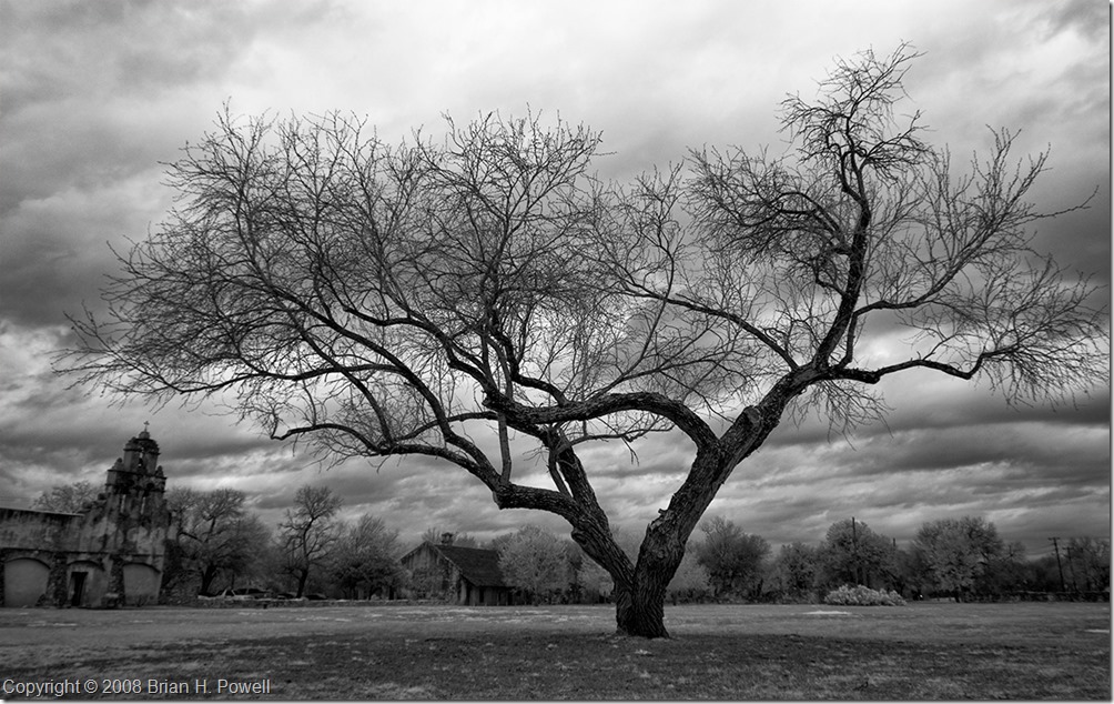
Yesterday, I traveled down to San Antonio with one of my best friends for a photography expedition.  Our goal was to just explore and play.  I took my infrared Nikon D200 (converted by LifePixel) and my visible light (unmodified) Nikon D300.

We visited several of the missions that are part of the San Antonio Missions National Historical Park.  Here’s an infrared tree portrait from Mission San Juan Capistrano.

20080309_i0068

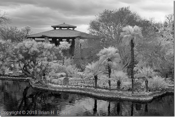
We also visited the San Antonio Japanese Tea Garden, which had completed a major renovation the day before.

20080309_i0099 copy

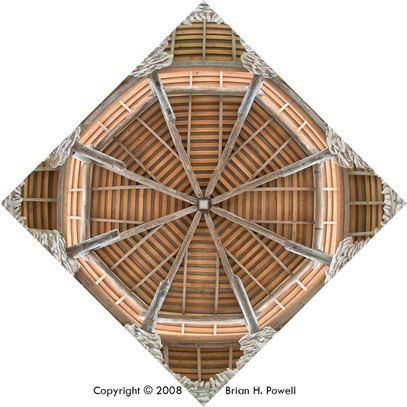
One of my favorite photos is this one looking straight up at the ceiling of the pagoda.

20080309_0085 for blog

Artists for Austin at Cowboy Harley-Davidson

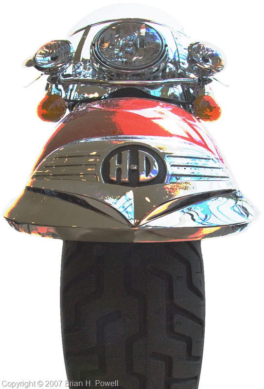
Not my usual wildlife/nature theme, but I created this print to help raise money for Artists for Austin at an event for Cowboy Harley-Davidson.

“King of the Road”

"King of the Road"

Vancouver Trip

I went to Vancouver, British Columbia, in late June to give some presentations to customers. One of my co-workers, Chris, joined me for part of this trip.

Chris had arranged for us to do some whale watching, leaving from Steveston, south of Vancouver. The whales hang out down near the San Juan Islands, so much of the 3 to 5-hour trip is the transit of the Strait of Georgia and passing among the Gulf Islands off the eastern coast of Vancouver Island.

We did, in fact, get to see whales, but we weren’t as close as either Chris or I expected us to be. It was still enjoyable.

When we got back to Steveston, we ate lunch and wandered around town a little. Chris found us the right bus to take us back to our hotel, and we planned our next adventure, the Richmond Nature Park. This park, which sounded more interesting than it was, was a few kilometers walk from our hotel. At least it gave us something healthy to do.
Friday morning, we checked out of the hotel. Chris returned to Austin, and I rented a car and drove up to Whistler. Vancouver, Whistler, and the roads in between are undergoing a lot of construction to prepare for the 2010 Olympics.
For lunch, I stopped in Squamish, a town about halfway between Vancouver and Whistler in terms of both location and size.

There are numerous provincial parks, and I stopped at a few.
Here is Nairn Falls. This image is stitched together from 17 different wide angle shots.

And here’s about 500 vertical feet of Shannon Falls

And some of the local wildlife…

On Saturday afternoon, I returned to Vancouver and stayed at a very nice hotel downtown, looking out over the harbour. I watched the cruise ships and seaplanes come and go.

Sunday was Canada Day (celebrated much like July 4 in the US), and I wanted to find something interesting to do Sunday morning before I returned to Austin.
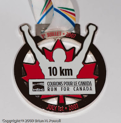
I didn’t have enough time for a seaplane tour. It didn’t look like there was going to be a parade. So instead, I got up early and did the Vancouver 10K Run for Canada. What better way to see a city than to run through it? Besides getting a running shirt, I also got the most awesome finishers’ medal.


After the run, I walked back to my hotel, showered, and drove to the airport. In Vancouver, you clear US Customs before you leave. After you check in at the airline counter, you join a really long line that winds through the duty free shop and then on to the US Customs agents. This simplifies your experience at your US arrival location.