Skip to content

Posts tagged ‘National Monuments’

Salinas Pueblo Missions National Monument and Pecos National Historical Park

One day during my time in New Mexico, I drove north to find the Ladd S. Gordon Waterfowl Complex. After exiting I-25, I took a wrong turn and missed the entrance to the Waterfowl Complex. But I saw a sign for Salinas Pueblo Missions and kept on driving east about 30 miles.

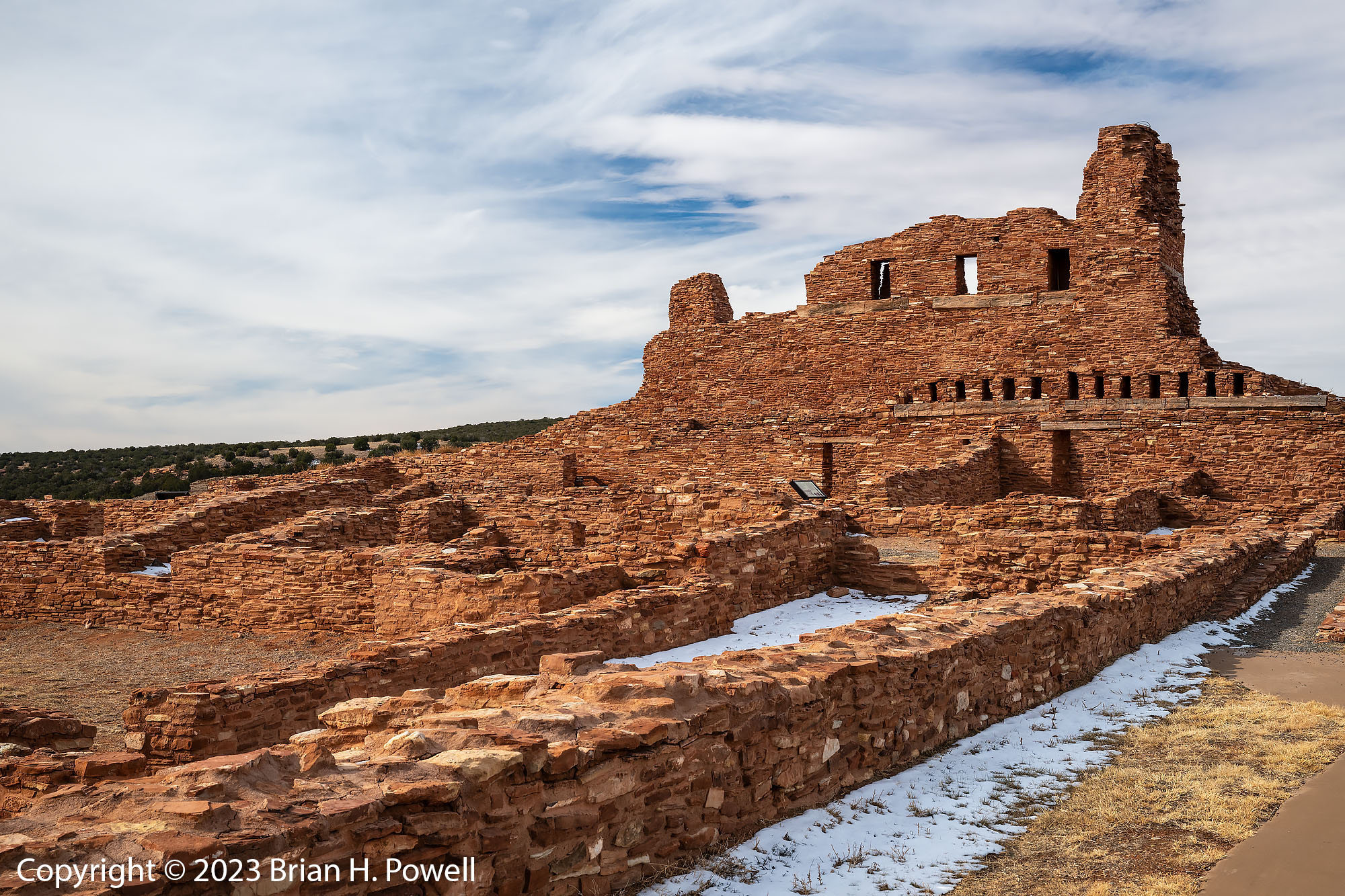
The Salinas Pueblo Missions were built as part of the Spanish influence of the 16th and 17th centuries. I visited these missions on my first trip to Bosque in 2005. There are three sets of ruins, along with a visitors center in the town of Mountainair. The area is part of the Salinas Valley, named for salt flats (Las Salinas) a few miles to the east of Mountainair. The salt was a valuable commodity for trade.

The first site I came to is is Abó.

Click any image to enlarge.

Ruins of the Mission of San Gregorio de Abó

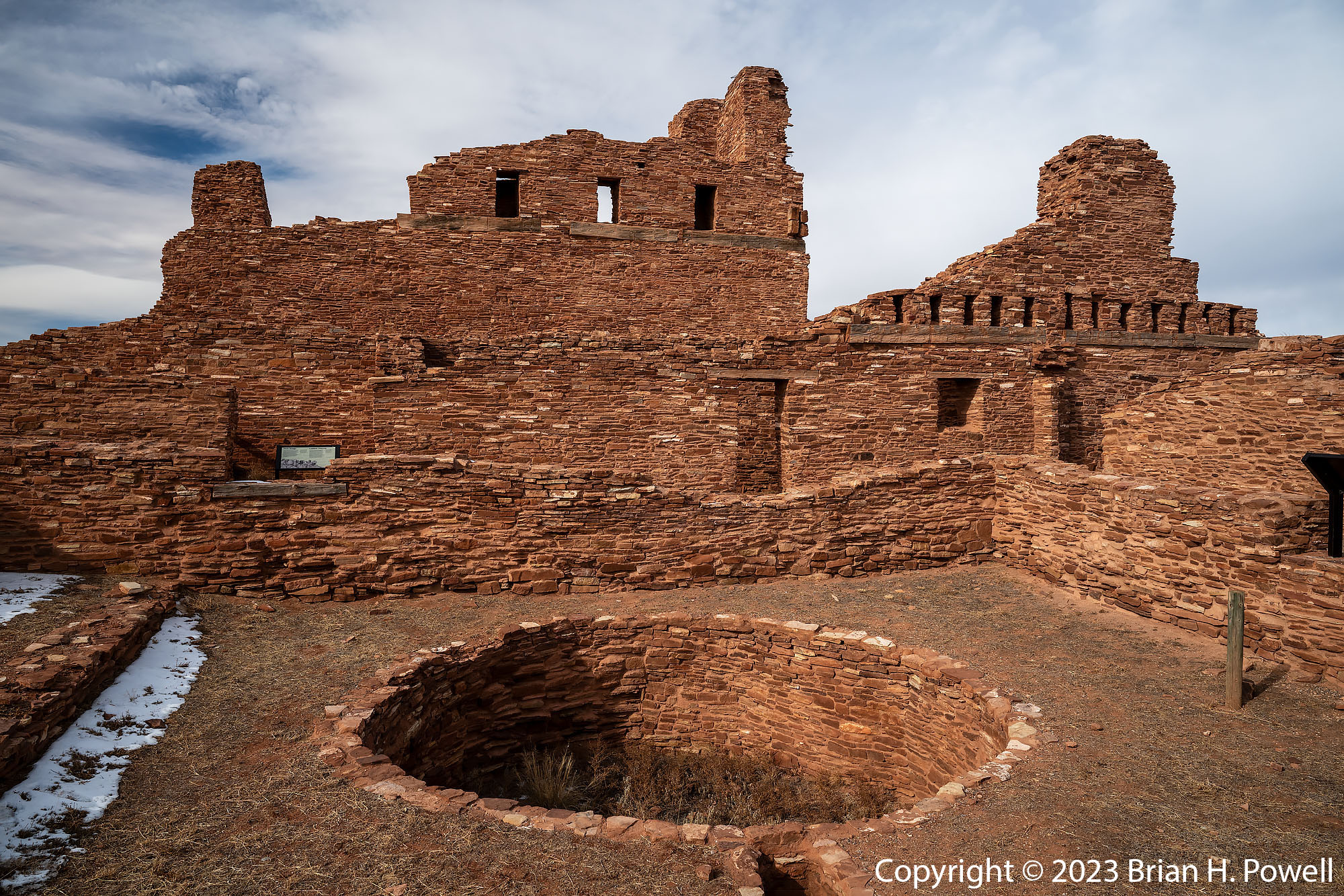
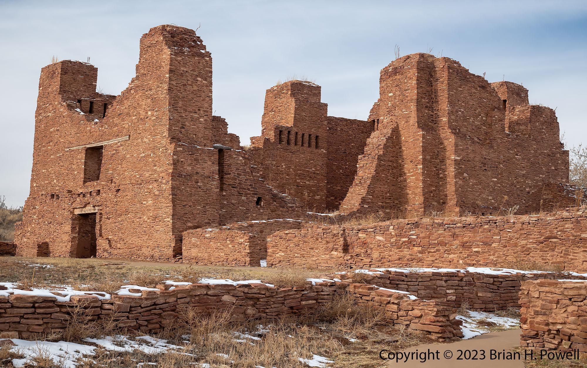
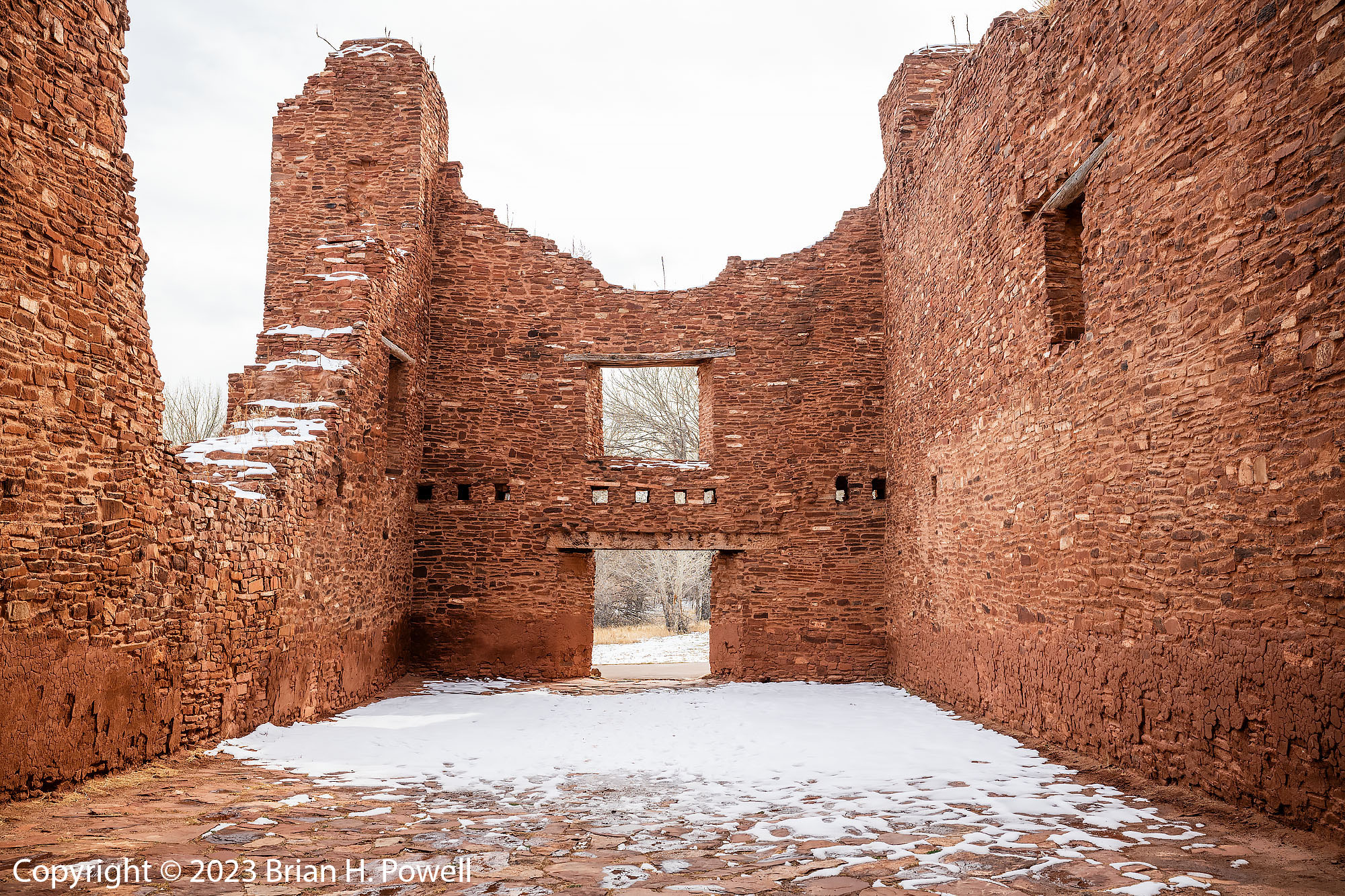
Another ten miles east is the town of Mountainair, where I visited the Visitors Center for the National Monument, and ate lunch at a small hotel nearby. Then I drove north to Quarai, another site of the National Monument.

Ruins of the church and convento of Nuestra Señora de la Purisima Concepción de Quarai

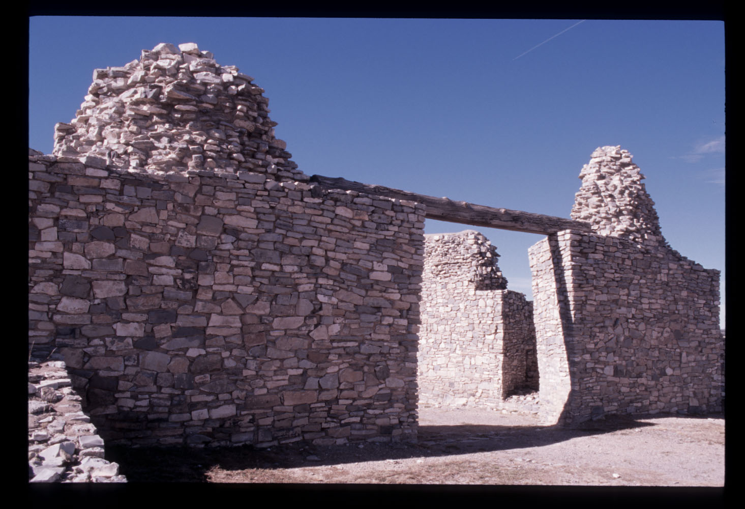
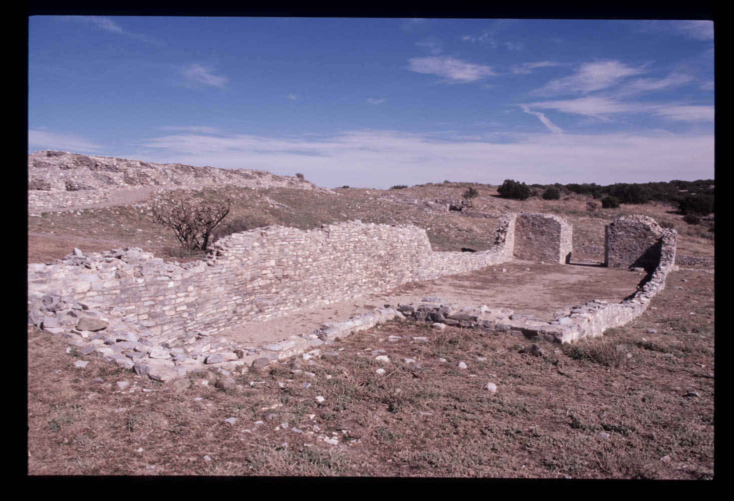
On this trip, I did not visit the third site, Gran Quivira, which was about 25 miles south of Mountainair. But I did visit that site in 2005. Here are scans of a couple of photos I took on film on that visit.

On the way back from Salinas Pueblo Missions, I did find the correct road that took me to the Ladd S. Gordon Waterflow Complex. See my earlier post for photos from the refuge.


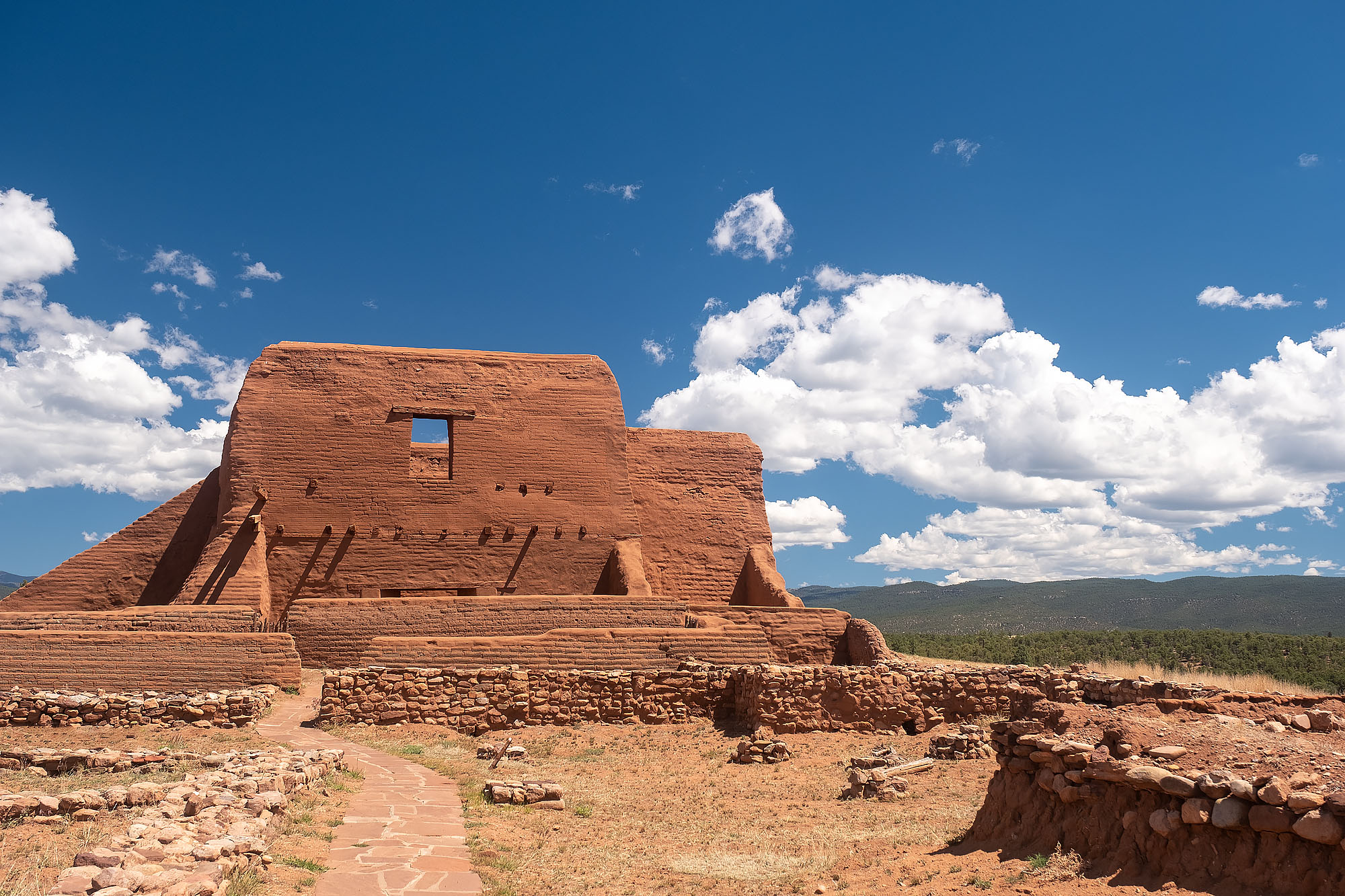
This reminds me that I never wrote about a trip I made to Pecos National Historical Park in 2021, so let me briefly write about it here.

Pecos National Historical Park is east of Santa Fe, New Mexico, along the historic Santa Fe Trail, a vital trade route between Missouri and New Mexico. The park encompasses historic pueblo ruins as well as a US Civil War battlefield. Pecos Pueblo was inhabited from the 14th to 19th centuries.

Pecos Pueblo, New Mexico
Reconstructed kiva at Pecos National Historical Park

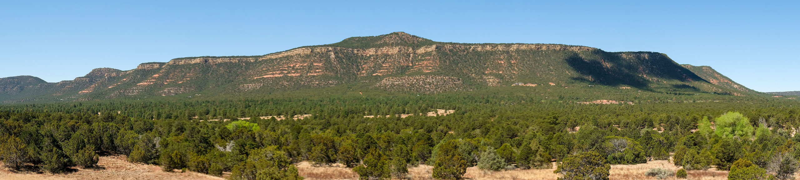
A few miles west of the pueblo is Glorieta Pass, the site of the westernmost battle of the US Civil War. It was fought mostly between Union infantry and cavalry from New Mexico and Colorado Territories and Confederate troops from Texas.

The battlefield itself is not particularly photogenic, though the mountainous area is beautiful. There’s a 2+ mile loop around the site with signage to help you imagine how the battle unfolded.

Glorieta Mesa, New Mexico

Canyon de Chelly

After a late night photographing the eclipse in Monument Valley, we awoke Tuesday ready to move a couple of hours south to Canyon de Chelly, near the town of Chinle.  There are really three canyons:  de Chelly, del Muerto, and Monument.  Native Americans have been living in these canyons for centuries.  Canyon de Chelly is unique in that it is a National Monument that is jointly administered by the National Park Service and the Navajo Nation.

As with Monument Valley, most sites require being accompanied by a Navajo guide.  Our guide helped us learn a lot about the difficult Navajo history of the canyon.  Spain, Mexico, and the United States all fought the Navajo here over many decades.

There are many ruins and significant rock formations in the canyon.  Ansel Adams made a famous photograph of the White House Ruins.  Desert varnish streaks the canyon walls in many places throughout the monument.  Here’s an infrared version I shot from the rim.

_DSC0341

Another famous location is Spider Rock, which is the legendary home of the Spider Woman.  This spire reaches 750 feet above the canyon floor.

_DSC8784

While we were there, federal fire crews were burning piles of invasive Russian Olive and Australian Tamarisk trees near the White House Ruin.  I could feel the heat on the rim as it rose from the canyon floor several hundred feet below.

_DSC8978


In the canyon, we saw many petroglyphs and pictographs.  Here are a few examples…

_DSC8799_DSC8805_DSC8852


As we worked our way up Canyon del Muerto, I made this infrared photograph of the cottonwood trees, with the cliffs in the background.

_DSC0317


Our furthest point up-canyon was Mummy Cave Ruins.  Here are two images made there.  The first is HDR, and the second one, infrared.

_DSC8900_HDR_DSC0332


After breakfast on Wednesday morning, we said goodbye and went our separate ways.  Thanks to David, Alice, and John, for making this a wonderful adventure.  Happy trails!

_DSC8938

Kasha-Katuwe Tent Rocks National Monument

tentrocks

I recently enjoyed a great visit to Kasha-Katuwe Tent Rocks National Monument.  It’s between Albuquerque and Santa Fe, New Mexico.  This monument is famous for its rock formations, but I didn’t really know what to expect.

From the moment I drove up to the gate, I felt welcomed.  “Thanks for coming here!”, said the ranger—I think because he was proud of this place.

I visited the day after a snowstorm came through.  Perhaps because I grew up reading Arizona Highways, I think that snow in the desert is a beautiful thing.

tent_rocks

Here are a couple of self-portraits, giving you an idea of the scale of the rock formations.

 brian_at_tent_rocks

Tent_Rocks_Slot_Canyon

I’ll be back, I’m sure.