Skip to content

Posts from the ‘Travel’ Category

Alaska, Days 6-10

I apologize for not posting in a few days.  Our days have been full, and the internet less than speedy and reliable, so updating the blog took a back seat.

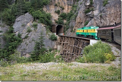
In Skagway, we took the White Pass and Yukon Route Railroad to White Pass, briefly crossing into Canada before returning to Skagway.


_DSC0947


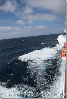
The next port of call was Sikta, where our good weather karma started to run out.  Our last day at sea met swells up to 18 feet, and winds up to 50 knots, as a large storm passed from west to east, as we went through in the opposite direction.  This same storm caused significant flooding in Sikta the day after we were there.

In the photo below from somewhere in the Gulf of Alaska, note the relationship between the horizon and the boat.  Our motion sickness patches worked great, though._DSC1017


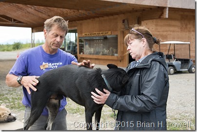
One of the highlights of our trip so far was a stop at Happy Trails Kennels, home of Martin Buser, a four time Iditarod champion.  We loved the excitement of the dogs, playing with some 10-week-old puppies, and sitting in Martin and Kathy’s home talking about dog training philosophy.

_DSC1026


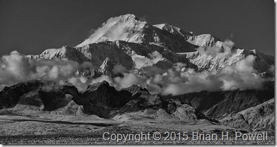
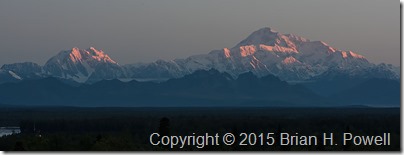
We next worked our way up to Talkeetna, where the good weather karma returned.  Denali is only visible about 30% of the time.  Many people come to Alaska and stay for days without seeing it.  Here are a couple of photos from Wednesday evening and Thursday morning.  These are from about 60 miles away.

_DSC6109

_DSC1196


Tomorrow, we will probably be off the air for a couple of days in the Denali Backcountry.  More when we return.

Alaska, Day 5

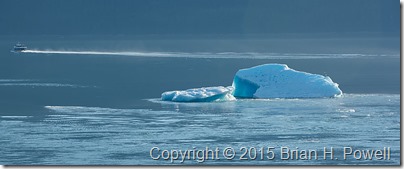
Our day started inauspiciously with an unfortunately placed iceberg._DSC0513

Said iceberg was caught on a sandbar exactly in the middle of the entrance to Tracy Arm Fjord, blocking our entrance.  Unable to get into the fjord to see more icebergs, we proceeded onto Juneau.

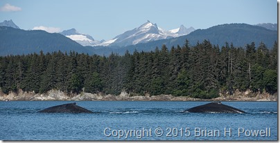
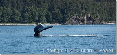
In Juneau, we went whale watching with Gastineau Guiding Company, with Captain Jen and photographer Andy Davidson.  Captain Jen’s excitement about the whale activity was contagious.  She did a great job of positioning our boat for photography, and Andy did a great job of inspiring us with our photography.

_DSC0719

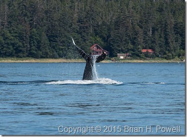
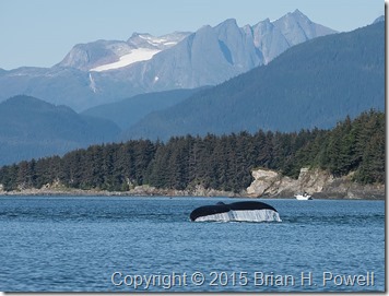
Here are some whale tails…

_DSC0604_DSC0739_DSC0774


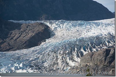
After returning to shore, we went to Mendenhall Glacier, one of the more famous glaciers only a few miles from Juneau.  It’s about 13 miles long and ends in Mendenhall Lake.

_DSC0856

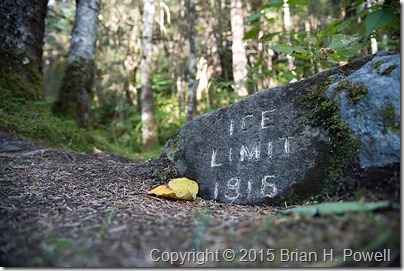
There are a few markers showing the historic locations of the edge of the ice.  This glacier has been retreating for centuries.  This marker is well over a mile from the current ice limit.

_DSC0847

More tomorrow, if connectivity allows.  Thanks for reading.

Alaska, Days 3-4

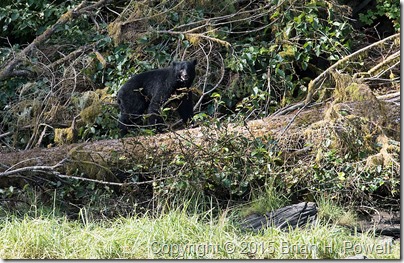
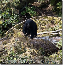
Our pilot from Alaska Seaplane Tours seemed a little concerned about how far we were from the plane as the black bear stared at us.

_DSC0391

_DSC0394

So, we slowly returned to the plane.

_DSC0381

Then we noticed a second, smaller bear—perhaps we’d found a mother and son, with mom encouraging us to move along.

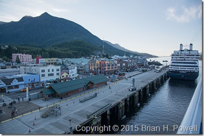
But let’s back up.  Day 3 was sailing Canada’s Inside Passage, before entering Alaska’s Inside Passage on day 4.  This morning, we docked in Ketchikan, Alaska’s fourth largest city, with almost 9,000 residents.

_DSC0346

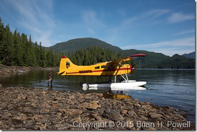
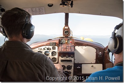
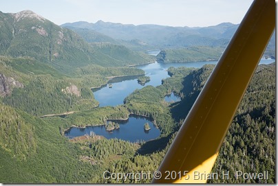
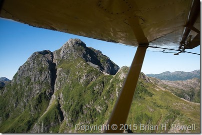
The highlight of our day was a seaplane ride to Prince of Wales Island.  We flew in a de Havilland DHC-2 Beaver, built in 1957.  These are great planes for Alaska.  Here are more photos from the flight.

_DSC0368_DSC0374_DSC0375


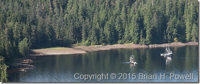
We landed near the boats in this small cove.  The boats were waiting for some fishing to open nearby.


_DSC0409

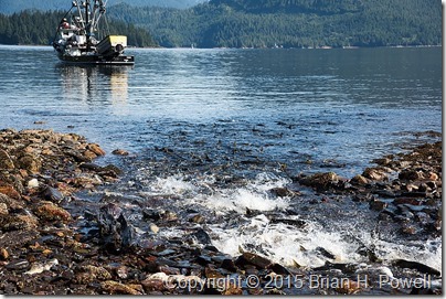
You can see the small stream cutting through the rock beach.  Once we got close, we could see all the salmon thrashing their way upstream.  It was an amazing sight. The bears thought so, too, and they were hanging out there fishing.

_DSC0385

More, soon, I hope, depending on my internet availability.

Alaska Adventure, Day 2.1

I’m posting this aboard the Seven Seas Navigator, sailing north through the Inside Passage.  This is the post I wanted to publish earlier, but the internet wasn’t reliable enough.  If you’re seeing this, I managed to get it to work well enough to publish a few photos.

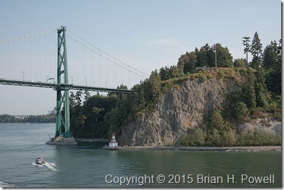
We left Vancouver yesterday evening, sailing under the Lions Gate bridge at the north end of Stanley Park.

_DSC0335

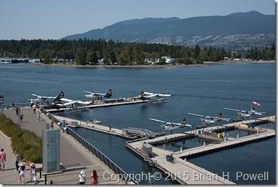
Every time I visit Vancouver, I’m fascinated by the seaplanes, and this trip is no exception.

_DSC0291


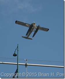
_DSC0332

Seaplane flying over Lions Gate Bridge as we sail under.


The satellite internet isn’t as reliable as I hoped, so I may not be posting everyday, and my posts (like this one) may be short.

Alaska Adventure, Day 2

I’m posting this aboard the Seven Seas Navigator, sailing north through the Inside Passage. We left Vancouver yesterday evening, sailing under the Lions Gate bridge.

The satellite internet isn’t as reliable as I hoped, so this entry is short.  If I get a better connection, I’ll post some more photos.

Alaska Adventure, Day 1

The good news is that I’m now a member of Mountain Equipment Co-op!

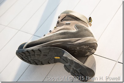
The bad news is that I had an epic boot failure that necessitated the visit to MEC.  The soles on both boots (a few years old) came unglued…

_DSC0313

Fortunately, this happened on our first day in Vancouver, rather than after we were on the boat.  The ship leaves this afternoon, heading up the inside passage.  We’ll be on the ship for a week, ending in Seward.

It’s my third time in Vancouver, which is a beautiful city.  Yesterday, we borrowed some bikes and rode around Stanley Park.

_DSC0295

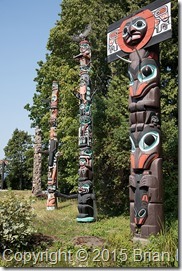
Totem Poles in Stanley Park

_DSC0304

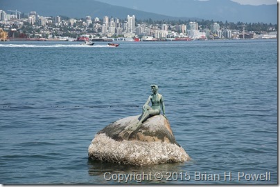
Girl in a Wetsuit (reminiscent of Den Lille Havfrue in Copenhagen)

More tomorrow!

Canyon de Chelly

After a late night photographing the eclipse in Monument Valley, we awoke Tuesday ready to move a couple of hours south to Canyon de Chelly, near the town of Chinle.  There are really three canyons:  de Chelly, del Muerto, and Monument.  Native Americans have been living in these canyons for centuries.  Canyon de Chelly is unique in that it is a National Monument that is jointly administered by the National Park Service and the Navajo Nation.

As with Monument Valley, most sites require being accompanied by a Navajo guide.  Our guide helped us learn a lot about the difficult Navajo history of the canyon.  Spain, Mexico, and the United States all fought the Navajo here over many decades.

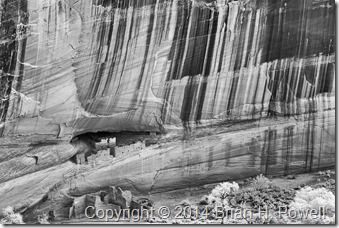
There are many ruins and significant rock formations in the canyon.  Ansel Adams made a famous photograph of the White House Ruins.  Desert varnish streaks the canyon walls in many places throughout the monument.  Here’s an infrared version I shot from the rim.

_DSC0341

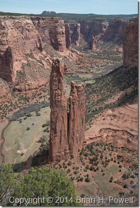
Another famous location is Spider Rock, which is the legendary home of the Spider Woman.  This spire reaches 750 feet above the canyon floor.

_DSC8784

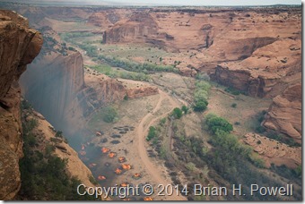
While we were there, federal fire crews were burning piles of invasive Russian Olive and Australian Tamarisk trees near the White House Ruin.  I could feel the heat on the rim as it rose from the canyon floor several hundred feet below.

_DSC8978


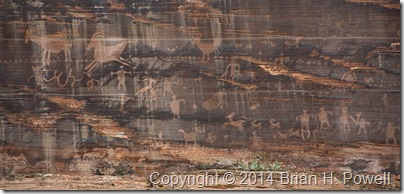
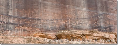
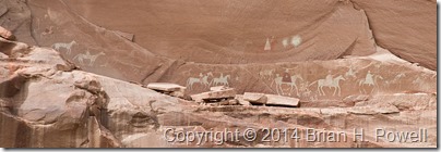
In the canyon, we saw many petroglyphs and pictographs.  Here are a few examples…

_DSC8799_DSC8805_DSC8852


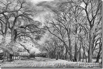
As we worked our way up Canyon del Muerto, I made this infrared photograph of the cottonwood trees, with the cliffs in the background.

_DSC0317


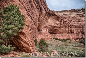
Our furthest point up-canyon was Mummy Cave Ruins.  Here are two images made there.  The first is HDR, and the second one, infrared.

_DSC8900_HDR_DSC0332


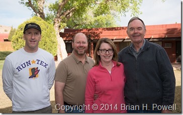
After breakfast on Wednesday morning, we said goodbye and went our separate ways.  Thanks to David, Alice, and John, for making this a wonderful adventure.  Happy trails!

_DSC8938

Hunt’s Mesa, and back to Monument Valley for a Lunar Eclipse

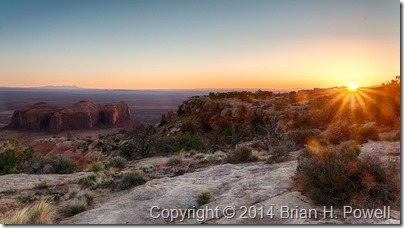
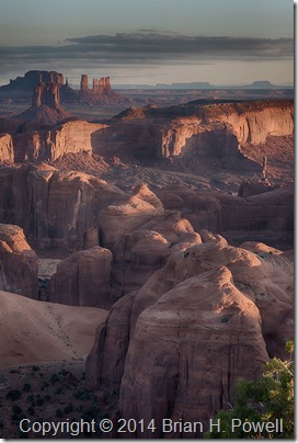
Monday morning, we awoke at 5:30 AM to subdued winds and temperatures in the high 30’s.  It wasn’t calm, but it was less windy than the evening before.  The sky was almost clear.  We drove about 2/3 of a mile east of our campsite for a good view.
_DSC8361_HDR

(Click to enlarge.)

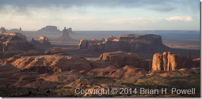
The image above and the next image are (lightly processed) HDR images, where I combined a couple of different exposures to get a little more highlight and shadow detail.  In the image below, you can see the formation called the Totem Pole on the right center of the frame.  It’s about 420 feet tall.
_DSC8470_HDR

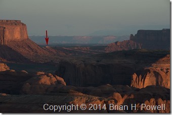
In the next image below, I’ve highlighted the view back towards The View hotel.  This was taken with my Nikkor 80-200 f/2.8 lens at 200mm.
_DSC8427

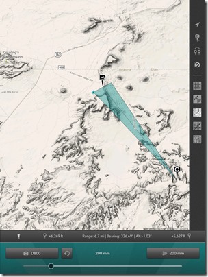
Here’s the shot in Photo Transit, which says that the hotel is about 6.7 miles away, with Utah in the distance beyond.
IMG_0232

As the sun rose higher in the sky, we packed up our photo gear and drove back to our campsite for breakfast, then packed up the camp for the long drive back to Monument Valley.  We enjoyed hot showers and a nap when we got back to the hotel.

Early Tuesday morning was another event we were looking forward to: a full lunar eclipse.  I thought about going out late to do some light painting, but couldn’t really scout out a good location for it.  (I learned light painting technique from Michael Frye in Yosemite.  He wrote a blog post about his eclipse photography.)  I ended up staying at my hotel and shooting from the balcony.

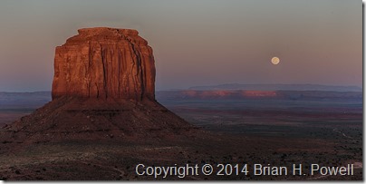
First, a shot of the full moon rising beyond Merrick Butte.
_DSC8628_HDR

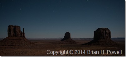
I also tried a 10-second exposure at ISO 6400 to try to capture the Mittens with the stars.  There’s a little too much light pollution for this to be effective.
_DSC8648

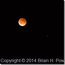
I didn’t bring my big lens on this trip; the longest I had was a 200mm.  Still, I did manage to capture this image of the “blood moon” during the eclipse.  Mars is to the lower right of the moon.
_DSC8782

The landscape lost light as more of the moon was obscured, so I decided to try to capture a video of the stars in motion.  Each of these images was a 5-second exposure at ISO 6400, and they were made about 20 seconds apart.  For best viewing, watch it on YouTube in full screen with the highest (1080p) resolution.

Stars

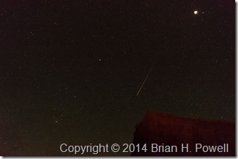
I have to admit I just started the intervalometer with the camera on a tripod and went back to bed for a while.  In the video, you’ll notice a couple of airplanes fly by.  I was lucky enough to have a meteor show up in one of the frames, seen below.
_DSC8723

The next day, we traveled to Canyon de Chelly.  More on that in the next blog post.

Mystery Valley, and on to Hunt’s Mesa

On Sunday, April 13, we began in Monument Valley and, with a Navajo guide, visited Mystery Valley before making our way up to Hunt’s Mesa.

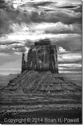
I got up for sunrise in hopes that we might get some good color.  I was playing around with HDR (high dynamic range) photography.  I didn’t get any colorful shots that I liked, but I decided to process the HDR as black and white, and I kind of like the way this turned out.  The sun is rising just behind this mitten…

_DSC8111_HDR_16bit

(Click to enlarge)

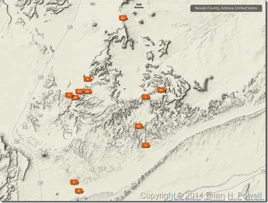
Here’s a map showing where my photos were geotagged.  We more or less worked our way in a counterclockwise fashion, starting at The View hotel at the top, Mystery Valley to the southeast, then further south as we and east as we worked our way up Hunt’s Mesa.

Sunday_Map


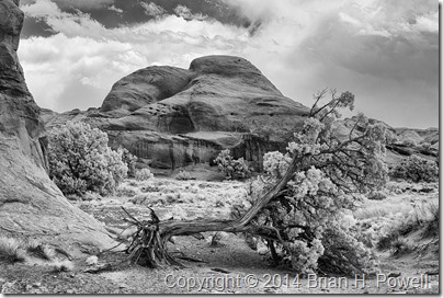
Here’s an infrared photo from Mystery Valley.  They had a bad ice storm this winter, and several trees were damaged.

_DSC0281


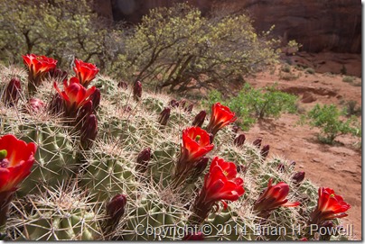
Here’s a nice claret cup cactus in bloom…

_DSC8181


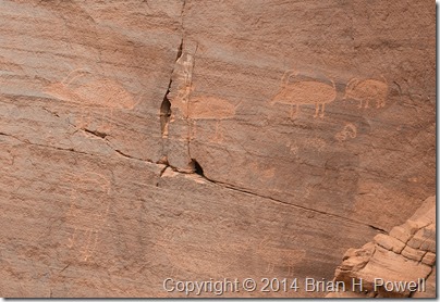
We saw plenty of pictographs and petroglyphs…

_DSC8229


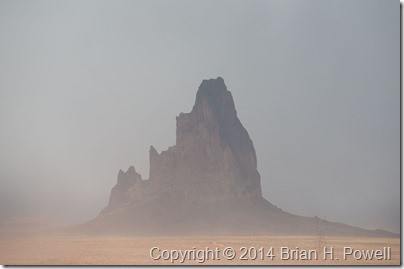
As the day wore on, it was clear that we were in for windy conditions.  This affected visibility to some extent, but it wasn’t a complete bust.  Here’s a photo of El Capitan as we worked our way around to the back side of Hunt’s Mesa.

_DSC8249

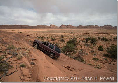
I’ll save you the story about how our vehicle got stuck in sand for about an hour and how we managed to get it unstuck.  But a little later, we reached a sandstone cliff, and our guide, Tony, admitted, “I’ve never been up this way before.”  This was our signal to get out and walk.  Tony decided it was passable, but with our confidence waning due to getting stuck in the sand, we told Tony we’d meet him at the top.  Here’s a photo of him charging up the hill…

_DSC8252


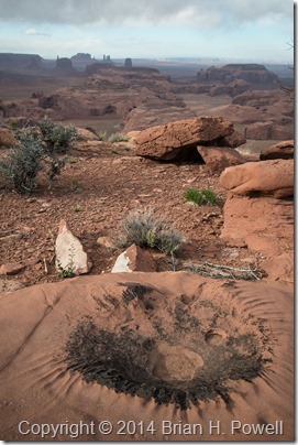
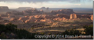
Eventually, we made it to the top of Hunt’s Mesa.  Here are a few images from late afternoon and sunset.  It was still very windy, especially as we approached the edge of the mesa to take these photos.

_DSC8281


_DSC8306


_DSC8310


We camped out on top of Hunt’s Mesa that night.  The wind died down about midnight, and it turned even colder.  I was warm in my REI +25 sleeping bag, but eventually (at 5:30 AM), it was time to get up for sunrise.  We guessed the temperature was in the mid to high 30’s on Monday morning.

In the Navajo Nation

I left Flagstaff and drove east and north through the Hopi Reservation and Navajo Nation.  Near Kayenta, I stopped to take this infrared photo of Church Rock, with El Capitan (Agathla Peak) in the background on the right.  I used my Nikon D200 converted to infrared by Life Pixel.

_DSC0244
(Click image to enlarge.)

My destination for the day was Monument Valley.  This area has been used in many films—mostly John Wayne westerns, but also Back to the Future, Thelma and Louise, and others.  Monument Valley was a frequent subject of photographer Josef Muench, the father of David Muench.  Josef’s photos were used by Harry Goulding to entice John Ford to film many of his westerns in Monument Valley. I did an oral history interview with David Muench earlier this year, so it was interesting to visit a place where he had spent so much time with his dad.

Here’s a panorama of Monument Valley, taken with my Fujifilm X-E2.

_DSF0986

On the far, far right of this photo, the farthest mesa is called Hunt’s Mesa.  That would be our destination for a cold, windy camping trip the following night.  More to come on that in my next post.
Edit:  Here’s a map showing the location of that first shot above, courtesy of the Photo Transit app. (Click to enlarge.)
Church Rock Map