Skip to content

Posts tagged ‘Infrared’

Hiking in the Dolomites, Part 3

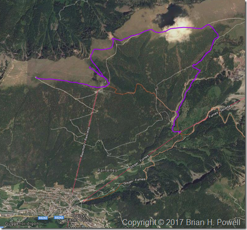
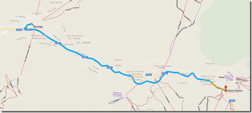
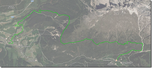
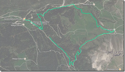
The next day, we took the bus to the end of the road, and went for an approximately 7-mile hike near Santa Magdalena at around 2000 meters elevation.  Here’s the trail we took, hiking from east to west:

FirstHike

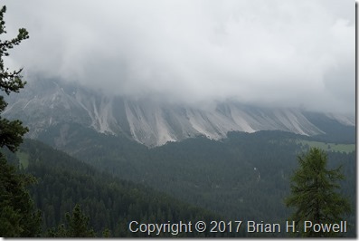
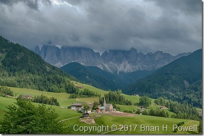
As I mentioned in my last post, the weather turned overcast with a low ceiling, and a nearly constant threat of rain.  The good news is that it didn’t actually rain much—a couple of passing showers that lasted only minutes.  The bad news is that we had to imagine what the scenery looked like:

_DSF0301

(Click on any image to enlarge.)

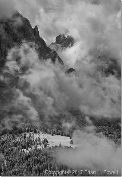
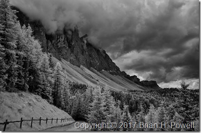
Once again, I turned to my infrared Nikon D300 to find elements of drama in the larger scene.  On this trip, I used the versatile Nikkor 18-200mm f/3.5-5.6 lens for all of my infrared photos.  This shot is using a focal length of 65mm (35mm equivalent of 100mm) at f/5.

_DSC6193

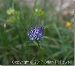
Another approach to photographing with uncooperative weather is to focus on details, such as this flower.

_DSF0300

I believe this is a Phyteuma orbiculare.
Common name: Round-headed Rampion

The weather improved marginally as we neared the end of our hike, descending to Santa Magdalena to catch the bus back to the hotel.  The mountains were still in the clouds, but we could at least appreciate more of the scenery.

_DSF0381_HDR

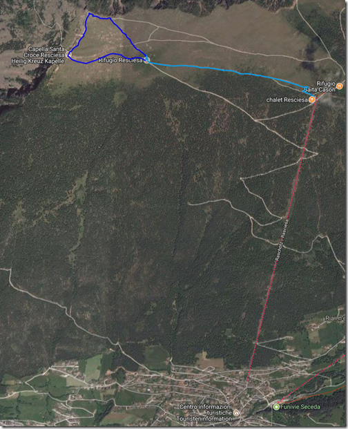
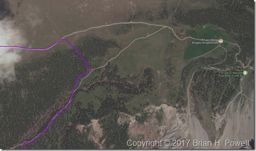
The next day, we hiked again for about five miles in the same area, heading more east:

SecondHike

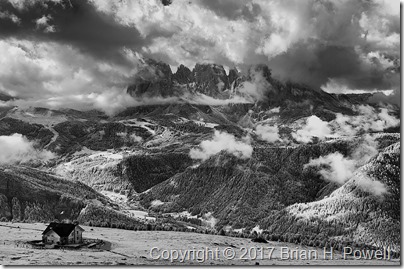
The weather was slightly improved from the day before—the ceiling had lifted ever so slightly, and we saw some blue sky as the day progressed.

Here’s my favorite infrared photo from the day, with the brooding clouds hanging just at the top of the peaks.

_DSC6236

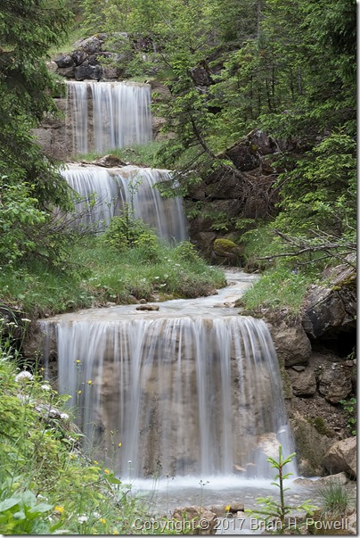
As long as the sky was cloudy, we could switch our focus to scenes that don’t include it.  I photographed these waterfalls with a 1/3 second exposure at f/22.

_DSF0603

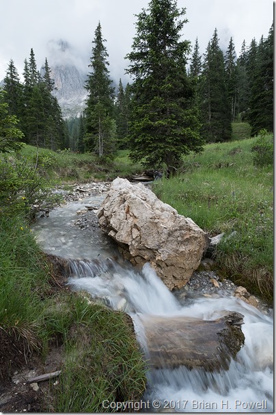
The photo below is a 1/10 second exposure, also at f/22.

_DSF0640

If you haven’t figured it out by now, one of the themes of this week was to find different ways to photograph something interesting while having challenging weather conditions.  This led us to time-lapse photography.

Here’s a very short video of sixty time-lapse frames.  Each frame was taken 3 seconds apart, and the video below speeds it up by 36x.  I’ll have a few more examples like this in later blog posts.

Next up, an afternoon in Ortisei, on our way up to our first mountain hut, the Rifugio Resciesa.

Hiking in the Dolomites, Part 2

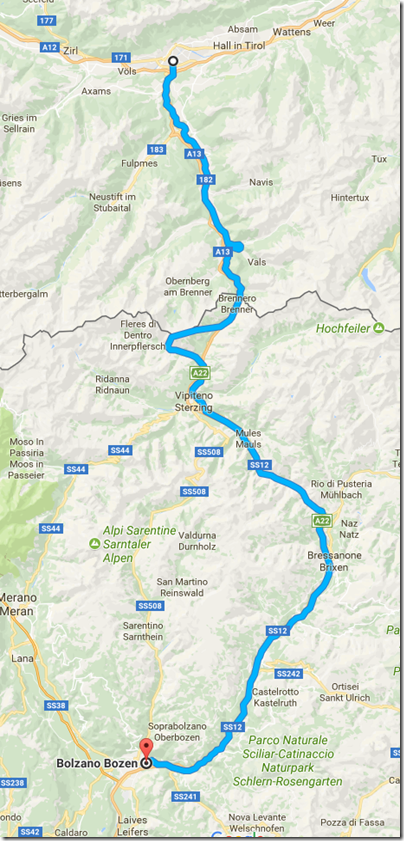
The next morning, Jennifer and I took the train from Innsbruck down to Bolzano, Italy.

This part of Italy is called the Südtirol in German and Trentino/Alto Adige in Italian.  For a thousand or so years before the end of World War I, this area was part of Austria-Hungary and its predecessor states.  The primary languages in this area are German, Italian, and Ladin.

ToBozen

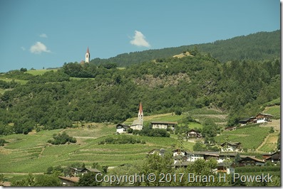
_DSF0109
View from the train to Balzano

Once in Bolzano, we met the rest of our party.  The trip was organized by our friend Kerrick James, a professional photographer and Ricoh Imaging Ambassador (Ricoh owns the well-respected camera brand Pentax).  See more about Kerrick at Ricoh Imaging Ambassadors, KerrickJames.com, and KJ Photo Safaris.  Kerrick’s fiancée, Julie, joined us, along with three other photographers who had traveled with Kerrick in the past.  Also joining us was our guide, Hayden, from our outfitter, AlpineHikers.

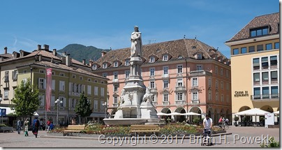
_DSF0113Statue of the poet Walther von der Vogelweide in Bolzano

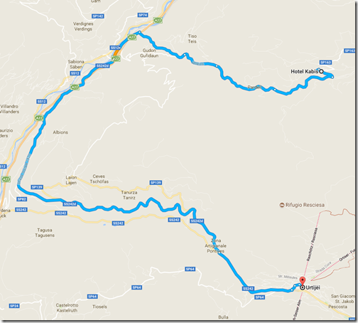
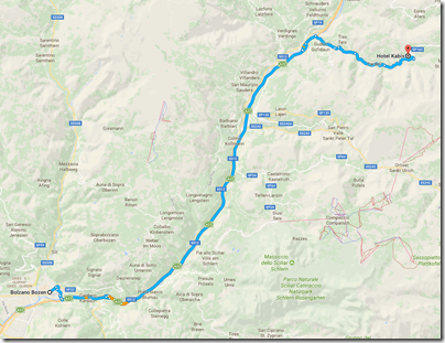
For the next three nights, we stayed at the Hotel Kabis, in Val di Funes.  Before we piled into a waiting taxi van, I ran to the grocery  store and picked up an excellent €8 bottle of wine to take with us, a Lagrein from Kellerei Bozen.

ToKabis

That evening, the weather started to turn.  The partly cloudy and warm days were giving way to overcast skies and threats of rain.

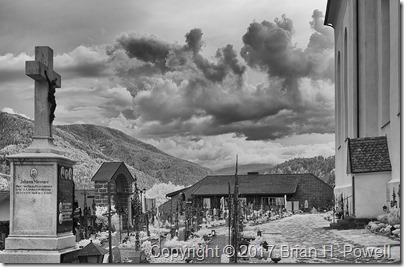
When that happens, I turn to my infrared camera.  I have a Nikon D300 that I’ve had converted to infrared by LifePixel.com.  (I encourage you to use that affiliate link if you’re interested in converting or buying an infrared camera.  I get a small credit towards a future conversion.)  The conversion process removes a filter in front of the camera sensor, and replaces it with one that only passes infrared light.  The resulting images can bring out dramatic skies and landscapes.  The image below, from the cemetery at Pfarrkirche St. Peter, is an example.

_DSC6176 v2The cemetery at Pfarrkirche St. Peter in Villnöß

Next up, hiking around Santa Magdalena.

A Few More Photos of the Alaska Range

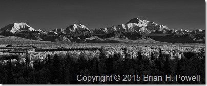
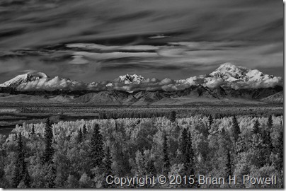
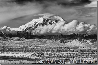
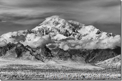
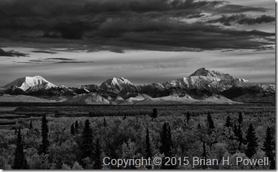
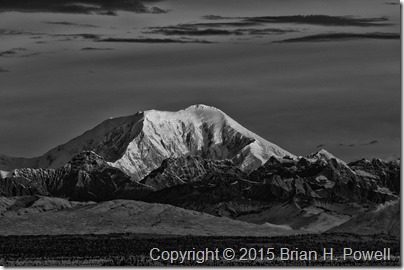
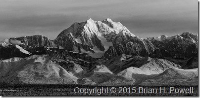
I was going back through some of my photos, and realized that I hadn’t processed some of my infrared photos of the Alaska Range.

I use a Nikon D300 that I’ve converted to infrared through LifePixel.com.  (Please use that affiliate link if you are thinking of converting one of your cameras.)

All but the last of these images are from Talkeetna, which is about 60 miles south of Denali.  I think the view from Talkeetna gives a better overview of the Alaska Range.  The weather was also a lot better when we were in Talkeetna.  I would have loved to seen Denali from Wonder Lake on the north side, but that just didn’t work out.

Anyway, I wanted to share these, and hope you enjoy them. (Click the photos to see larger versions.)


_DSC6144

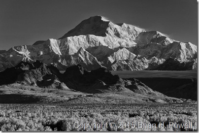
Denali


_DSC6146

Mt. Foraker (17,400 ft), Mt. Hunter (14,573 ft), and Denali (20,310 ft)

These are the three highest peaks in the Alaska Range, and the 1st, 3rd, and 10th highest in the US.


_DSC6147

Mt. Foraker, Mt. Hunter, and Denali


_DSC6150

Mt. Foraker.

The lenticular cloud above the summit indicates high winds.


_DSC6152

Denali


_DSC6156

Mt. Foraker, Mt. Hunter, and Denali


_DSC6158

Mt. Foraker


_DSC6160

Mt. Hunter


_DSC6165

Mt. Hunter, and Denali

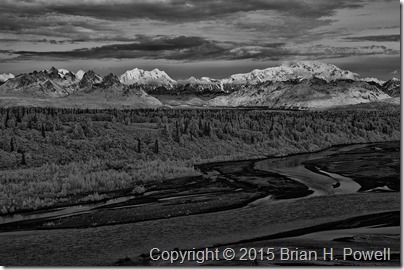
This is taken from Denali State Park (about 35 miles from Denali), with the Chulitna River in the foreground.  In Talkeetna, stop at the Denali Brewing Company for a Chuli Stout, named after this river.

Canyon de Chelly

After a late night photographing the eclipse in Monument Valley, we awoke Tuesday ready to move a couple of hours south to Canyon de Chelly, near the town of Chinle.  There are really three canyons:  de Chelly, del Muerto, and Monument.  Native Americans have been living in these canyons for centuries.  Canyon de Chelly is unique in that it is a National Monument that is jointly administered by the National Park Service and the Navajo Nation.

As with Monument Valley, most sites require being accompanied by a Navajo guide.  Our guide helped us learn a lot about the difficult Navajo history of the canyon.  Spain, Mexico, and the United States all fought the Navajo here over many decades.

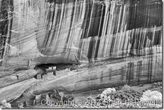
There are many ruins and significant rock formations in the canyon.  Ansel Adams made a famous photograph of the White House Ruins.  Desert varnish streaks the canyon walls in many places throughout the monument.  Here’s an infrared version I shot from the rim.

_DSC0341

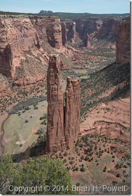
Another famous location is Spider Rock, which is the legendary home of the Spider Woman.  This spire reaches 750 feet above the canyon floor.

_DSC8784

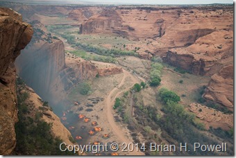
While we were there, federal fire crews were burning piles of invasive Russian Olive and Australian Tamarisk trees near the White House Ruin.  I could feel the heat on the rim as it rose from the canyon floor several hundred feet below.

_DSC8978


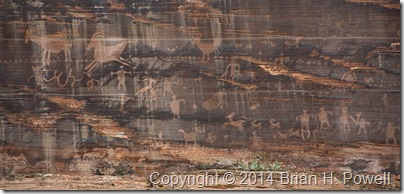
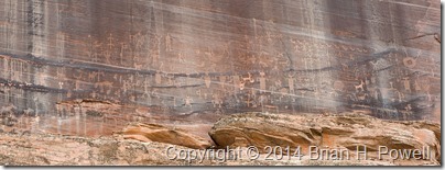
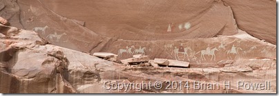
In the canyon, we saw many petroglyphs and pictographs.  Here are a few examples…

_DSC8799_DSC8805_DSC8852


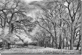
As we worked our way up Canyon del Muerto, I made this infrared photograph of the cottonwood trees, with the cliffs in the background.

_DSC0317


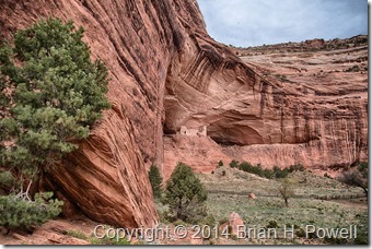
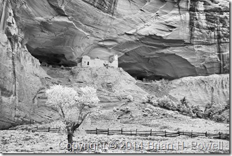
Our furthest point up-canyon was Mummy Cave Ruins.  Here are two images made there.  The first is HDR, and the second one, infrared.

_DSC8900_HDR_DSC0332


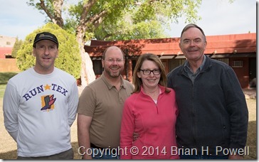
After breakfast on Wednesday morning, we said goodbye and went our separate ways.  Thanks to David, Alice, and John, for making this a wonderful adventure.  Happy trails!

_DSC8938

Mystery Valley, and on to Hunt’s Mesa

On Sunday, April 13, we began in Monument Valley and, with a Navajo guide, visited Mystery Valley before making our way up to Hunt’s Mesa.

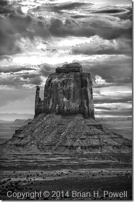
I got up for sunrise in hopes that we might get some good color.  I was playing around with HDR (high dynamic range) photography.  I didn’t get any colorful shots that I liked, but I decided to process the HDR as black and white, and I kind of like the way this turned out.  The sun is rising just behind this mitten…

_DSC8111_HDR_16bit

(Click to enlarge)

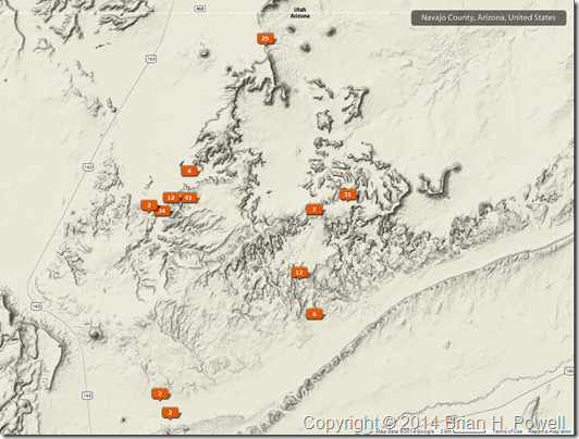
Here’s a map showing where my photos were geotagged.  We more or less worked our way in a counterclockwise fashion, starting at The View hotel at the top, Mystery Valley to the southeast, then further south as we and east as we worked our way up Hunt’s Mesa.

Sunday_Map


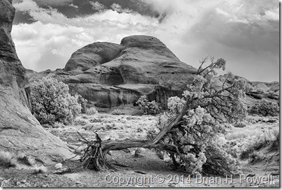
Here’s an infrared photo from Mystery Valley.  They had a bad ice storm this winter, and several trees were damaged.

_DSC0281


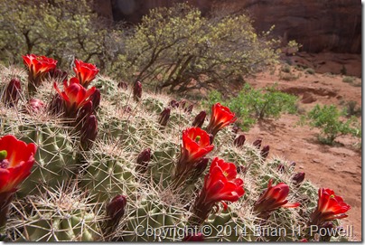
Here’s a nice claret cup cactus in bloom…

_DSC8181


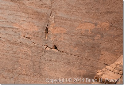
We saw plenty of pictographs and petroglyphs…

_DSC8229


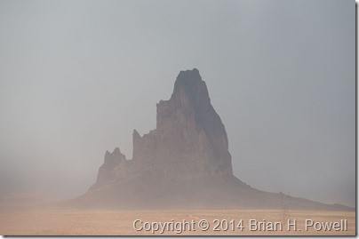
As the day wore on, it was clear that we were in for windy conditions.  This affected visibility to some extent, but it wasn’t a complete bust.  Here’s a photo of El Capitan as we worked our way around to the back side of Hunt’s Mesa.

_DSC8249

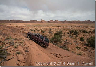
I’ll save you the story about how our vehicle got stuck in sand for about an hour and how we managed to get it unstuck.  But a little later, we reached a sandstone cliff, and our guide, Tony, admitted, “I’ve never been up this way before.”  This was our signal to get out and walk.  Tony decided it was passable, but with our confidence waning due to getting stuck in the sand, we told Tony we’d meet him at the top.  Here’s a photo of him charging up the hill…

_DSC8252


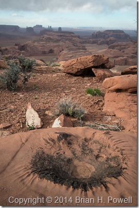
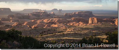
Eventually, we made it to the top of Hunt’s Mesa.  Here are a few images from late afternoon and sunset.  It was still very windy, especially as we approached the edge of the mesa to take these photos.

_DSC8281


_DSC8306


_DSC8310


We camped out on top of Hunt’s Mesa that night.  The wind died down about midnight, and it turned even colder.  I was warm in my REI +25 sleeping bag, but eventually (at 5:30 AM), it was time to get up for sunrise.  We guessed the temperature was in the mid to high 30’s on Monday morning.

In the Navajo Nation

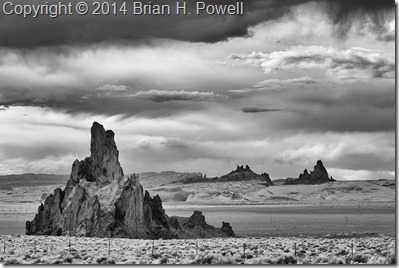
I left Flagstaff and drove east and north through the Hopi Reservation and Navajo Nation.  Near Kayenta, I stopped to take this infrared photo of Church Rock, with El Capitan (Agathla Peak) in the background on the right.  I used my Nikon D200 converted to infrared by Life Pixel.

_DSC0244
(Click image to enlarge.)

My destination for the day was Monument Valley.  This area has been used in many films—mostly John Wayne westerns, but also Back to the Future, Thelma and Louise, and others.  Monument Valley was a frequent subject of photographer Josef Muench, the father of David Muench.  Josef’s photos were used by Harry Goulding to entice John Ford to film many of his westerns in Monument Valley. I did an oral history interview with David Muench earlier this year, so it was interesting to visit a place where he had spent so much time with his dad.

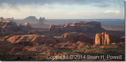
Here’s a panorama of Monument Valley, taken with my Fujifilm X-E2.

_DSF0986

On the far, far right of this photo, the farthest mesa is called Hunt’s Mesa.  That would be our destination for a cold, windy camping trip the following night.  More to come on that in my next post.

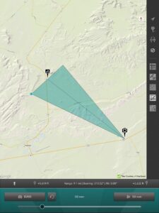
Edit:  Here’s a map showing the location of that first shot above, courtesy of the Photo Transit app. (Click to enlarge.)

Church Rock Map

Maroon Bells Recreation Area

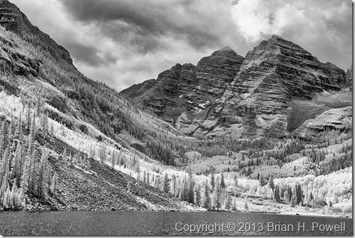
This past week, I had a chance to go up to Aspen, Colorado, and visit the Maroon Bells Recreation Area in the White River National Forest.  There had been rain all over Colorado—major flooding near Boulder, Lyons, and Estes Park—so, I stayed further south and west by visiting Aspen.  There was a mix of sun and clouds as I started hiking past Maroon Lake.

The Aspen trees are just beginning to turn to their bright yellow fall colors, and soon, this area will be inundated with photographers.  I was told it is the most photographed spot in Colorado.  Always wanting to do something a little bit different, I used my infrared camera (a Nikon D200, converted by LifePixel) to capture the image below.

By the end of my hike, the storm clouds had started to surround the peaks, light rain and thunder started, and I made it back to my car just in time.  It was a great hike.
_DSC0184

Click to enlarge.

Paris is in the Details

A few days ago, I posted a photo from la Tour Montparnasse in Paris—a broad, sweeping view of much of the city.  I hope you liked that photo.  I did, but it’s hard to express something new in this city that is constantly being photographed.

Many years ago, I took a photography workshop at the Grand Canyon Field Institute.  One of the best pieces of advice was to not try to photograph the canyon with a wide angle lens; instead, use a telephoto lens.  Rather than try to capture the vast expanse of the canyon, isolate a detail, and that will convey the spirit of place better.

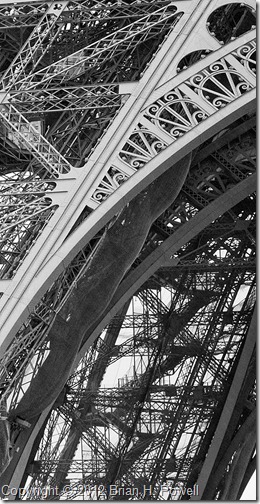
Here’s a take on that idea.  Do you know where this is?

_DSC0032

It probably helps that I’ve mentioned Paris… it’s a detail of the Eiffel Tower.  If you hadn’t already been thinking of Paris, would you have figured it out?  Recalling this earlier blog post, would you have figured out the story on your own?

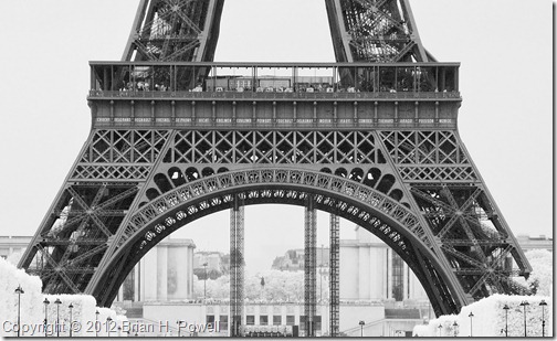
Here’s another take.  I think here, almost everyone who’s seen the Eiffel Tower (or even a photo of it), would recognize it. This detail shot even gives us a chance to read the names of the scientists and engineers which appear under the first balcony.  It’s a detail so easily missed when trying to take in the whole scene.

_DSC0034

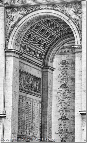
How about this?  Do you recognize the place shown below?  Hint: several of the names shown on the monument are places in Italy.

_DSC0007

It’s a detail of the Arc de Triomphe de L’Etoile.  It tells its own story of the many battles fought by French forces over the centuries, but unless you know your French military history, you might not recognize from the photo that this is Paris.

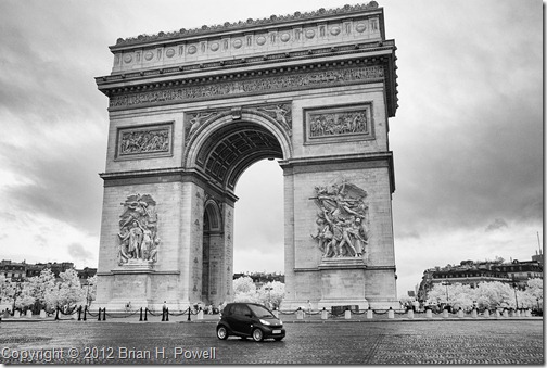
Here’s one last variation on the theme.  An infrared photo (as are all four of these photos) of the Arc de Triomphe, with a menacing sky, and… what’s that?…  a two-seater microcar driving around it.  Doesn’t that scream “grand army”?  “Military might”?  To me, it’s the detail that makes this photo work.
_DSC0012

Paris

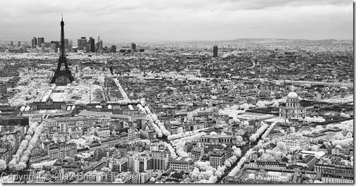
I’m in Paris for a few days, and wanted to share a photo I took today.  It’s an infrared shot of a few of the famous sites in France… La Tour D’Eiffel, École Militaire, Les Invalides, Arc de Triomphe de l’Étoile.

_DSC0014

This has been my first trip to Paris.  It’s so overwhelming all of the things I don’t have time to see, but I know I’ll be back and can’t wait to spend more time here.
Gettysburg

Today, I visited the Gettysburg National Military Park and Gettysburg National Cemetery, the site of a bloody American Civil War battle in July of 1863.  As with most of the Civil War battlefields, the park is filled with hundreds of monuments memorializing the dead and wounded soldiers.

Here’s an infrared photograph of the State of North Carolina Monument, sculpted by Gutzon Borglum (who also sculpted the heads on Mt. Rushmore and the carving on Stone Mountain).

20110924_0017