Skip to content

Posts tagged ‘water’

Hiking in the Dolomites, Part 5

(This is my 100th post on this blog.  Thank you all for reading.)

The morning of July 1, we left Selva/Wolkenstein for Lago di Dobbiaco.  I kind of think of this as a rest day between our weather-challenged hike from yesterday, and the 8000-foot-elevation hiking of tomorrow.  We also swapped out our guides–trading Hayden for Jake, who would be with us until the official end of the trip.  Both guides provided by AlpineHikers were excellent.

As we drove over to Dobbiaco, we saw many bicyclists preparing for the following day’s Maratona dles Dolomites, an 85-mile bike race with nearly 14,000 feet of elevation gain.  (The winner averaged 18.6 mph.)  Nearly 30,000 cyclists apply each year for one of the 9,000 starting positions.

ToDobbiaco

We checked into the116-year-old Hotel Baur, which sits right on the lake.

_DSF1455

(Click on any image to enlarge.)

We walked around the lake, then I settled on a view facing south for most of my images.  We played around with reflections, and slow shutter speeds as the water flowed over a dam at the north end of the lake.  Here’s an infrared photo from late in the day.

_DSC6433

Here’s a group shot of all of us on a bridge near the hotel.

_DSF1516

The next morning, we drove into the Tre Cime Natural Park and began our hike to Rifugio Locatelli.  Stay tuned for more.

ToTresCime

Hiking in the Dolomites, Part 3

The next day, we took the bus to the end of the road, and went for an approximately 7-mile hike near Santa Magdalena at around 2000 meters elevation.  Here’s the trail we took, hiking from east to west:

FirstHike

As I mentioned in my last post, the weather turned overcast with a low ceiling, and a nearly constant threat of rain.  The good news is that it didn’t actually rain much—a couple of passing showers that lasted only minutes.  The bad news is that we had to imagine what the scenery looked like:

_DSF0301

(Click on any image to enlarge.)

Once again, I turned to my infrared Nikon D300 to find elements of drama in the larger scene.  On this trip, I used the versatile Nikkor 18-200mm f/3.5-5.6 lens for all of my infrared photos.  This shot is using a focal length of 65mm (35mm equivalent of 100mm) at f/5.

_DSC6193

Another approach to photographing with uncooperative weather is to focus on details, such as this flower.

_DSF0300

I believe this is a Phyteuma orbiculare.
Common name: Round-headed Rampion

The weather improved marginally as we neared the end of our hike, descending to Santa Magdalena to catch the bus back to the hotel.  The mountains were still in the clouds, but we could at least appreciate more of the scenery.

_DSF0381_HDR

The next day, we hiked again for about five miles in the same area, heading more east:

SecondHike

The weather was slightly improved from the day before—the ceiling had lifted ever so slightly, and we saw some blue sky as the day progressed.

Here’s my favorite infrared photo from the day, with the brooding clouds hanging just at the top of the peaks.

_DSC6236

As long as the sky was cloudy, we could switch our focus to scenes that don’t include it.  I photographed these waterfalls with a 1/3 second exposure at f/22.

_DSF0603

The photo below is a 1/10 second exposure, also at f/22.

_DSF0640

If you haven’t figured it out by now, one of the themes of this week was to find different ways to photograph something interesting while having challenging weather conditions.  This led us to time-lapse photography.

Here’s a very short video of sixty time-lapse frames.  Each frame was taken 3 seconds apart, and the video below speeds it up by 36x.  I’ll have a few more examples like this in later blog posts.

Next up, an afternoon in Ortisei, on our way up to our first mountain hut, the Rifugio Resciesa.

Alaska Homestead Lodge, Silver Salmon Creek

[Updated:  See addendum at the end of this post.]

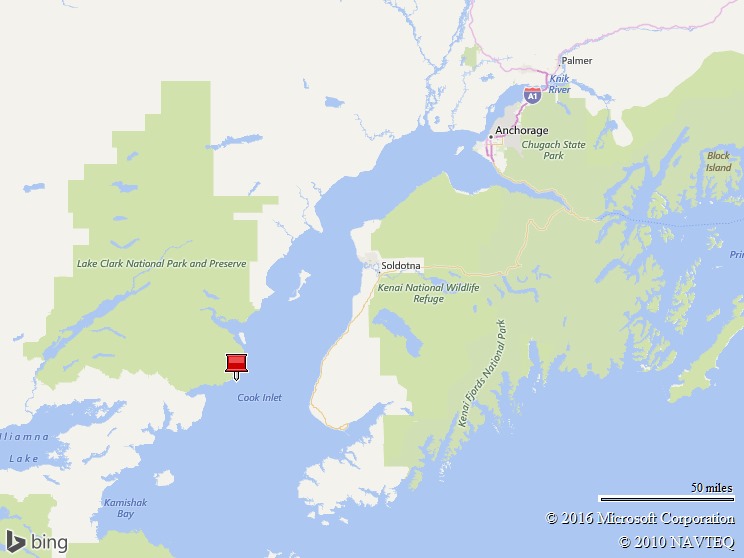
While in Alaska, we stayed at a great lodge, The Alaska Homestead Lodge.  It’s part of a small Alaskan bush community at Silver Salmon Creek.  The owners, James and Shelia Isaak, live next to the lodge and keep it in great shape.

(Click any image to enlarge.)

_DSF5754

The lodge itself is on the inland side of the tidal marshes, only a few hundred yards from the coast.  It was common to be sitting in the upstairs dining room and watching bears walk in from the beach, right past the lodge on their way into the forest.

_DSC3939

We also had a great guide, Belle, who has been guiding three years at the lodge.  There are two lodges along the coast, and the guides from both lodges cooperate with each other to share information on the radio about what the bears are doing.  The guides drive four-wheel ATVs with small trailers.  I did this trip with four of my friends, and we all rode in the trailer together up and down the beach, through the creek, and along the trails.

_DSC4475

Here’s a snapshot showing a typical morning at the beach, with a group from each lodge watching the mom and three cubs dig for clams.  We all wore rubber boots (supplied by the lodge) to keep our feet dry.

_DSF4795

A pleasant surprise was the food at the lodge.  Not just good; it was great.  Our chef’s summer job last year was at Bouchon.  Meals were prepared in the lodge’s upstairs kitchen and served at the communal dining table.  The grilled salmon was fresh and expertly prepared—I think we had it three different nights.  We also had pork tenderloin, lasagna, chicken fajitas—and fresh desserts, such as berry crisp, and chocolate pie.

_DSF5995

The lodge had a garden and greenhouse from which the salads came… lettuce, kale, broccolini, cabbage, and more.  For the most part, the bears left these alone—even the berries used in the desserts.

_DSF5755

Like much of Alaska, the only reasonable way in and out of the lodge is by plane.  We used Natron Air Taxi as our charter to get to the lodge from Anchorage.  We had cloudless, blue sky for our flight on this GA-8 Airvan.

_DSF4171

And here we are coming in for a landing on the beach.

_DSC2719

The weather continued to be great for the first five days.  The previous three weeks were rainy, and the following two weeks were predicted to be rainy—but we had five solid sunny days.  And then it turned foggy, misty, and rainy for us, too.  The lodge recommends having a buffer travel day on each side of your stay, in case you get weathered in and can’t get into or out of the lodge.  We almost were stuck at the lodge an additional day.  Tim, our pilot, persisted and was able to land further north and taxi down the beach for a couple of miles to get us.

On a positive note, the fog and clouds added some variety to our scenery and photographs.

_DSC5527

[Addendum]

It occurred to me after posting this that I didn’t describe what a typical day was like.  Each day, you work out your schedule with your guide.  We’d typically get up for an early shoot around 7:00 AM, then back to the lodge at 8:00 AM for breakfast.  Then we’d head back out after breakfast for a few hours, and return for lunch around noon.  Because of the high latitude, the quality of light stayed pretty good until 10:00 or 11:00 AM—even longer if it was a little hazy.  If something especially good is happening, our guide would radio the lodge to let them know we’d be running late.  After lunch, we’d often take a break (nap time), and head out again for a few hours before or after dinner.

A lot is dependent on the tide.  At high tide, the bears are usually in the meadow eating grass and sleeping.  At lowest tide, they are clamming.  Near low tide, they could fish.  During our week, high tide was in the afternoons, so we spent most of the time photographing in the mornings.

Just talk to your guide about the photos you want to take, and they’ll do their best to make it happen.  If you want photos of bears eating grass, you’ll love going out during high tide.  If you want photos of bears fishing, you might go out a few hours after high tide.

Coastal Brown Bears of Lake Clark

It was finally time.  We’d been planning this trip for almost two years, and still didn’t comprehend what it was going to be like to photograph these bears.  After arriving at the lodge, we unpacked our camera gear and went right out into the field to find some bears to photograph.  We remarked in the moment, “do you think we’ll make fun of ourselves later this week for taking so many photos of bears sleeping in the meadow?”  We acknowledged the answer was “yes”, but we took them anyway.  Several thousand photos of bears later, this photo doesn’t bubble up to be among the best, but here it is anyway…

_DSC2781

The excitement of watching bears graze on grass and then take a nap soon wore off, as we moved to the beach to watch the bears dig for clams.  Their keen sense of smell (and an abundance of razor clams) lets them quickly find a spot to dig into the sand with their paws and bring up a clam to eat.  Different bears have different strategies for opening the clams, but the “smush the clam on the sand, then pry it open with your teeth” technique was pretty common.

(Click any image to enlarge.)

_DSC4227

Watching the bears fish was the most exciting.  The bears would sit in or near the water, and then start running after a swimming salmon.  They failed many times, so it was sensational when they succeeded.  As you might expect, being along Silver Salmon Creek, these are Silver (Coho) Salmon.

_DSC5445

We saw three different moms with cubs.  The moms would catch fish, eat part for herself, and share with her cubs—while chasing away other bears who might try to grab the fish.

_DSF5960

Speaking of cubs, they have a lot of personality.  They can be playful.  They can be whiny.  They pick fights with their siblings.  And they are cute enough that mom (usually) puts up with it all.

_DSF4307

_DSC3446

After eating, it’s of course time to stretch out and take a nap.

_DSF4337

Lake Clark National Park and Preserve, Alaska

I just got back from hanging out with bears in Lake Clark National Park and Preserve, in southern Alaska about 125 miles southwest of Anchorage.

Map picture

These are coastal brown bears, ursus arctos horribilis. They’re genetically the same as grizzly bears—“grizzly” generally refers to inland bears.  A couple of hundred bears spend time along the coast here.

Living along Silver Salmon Creek, the bears have access to a varied diet of  salmon in the creek, clams on the beach, and sedges in the tidal marshes.

(Click any of the images to enlarge.)

_DSF5849

_DSC3840

_DSC5319

The focus of this trip was bears, but we saw a few birds, too—bald eagles, puffins, plenty of seagulls, a couple of harriers, and red-winged blackbirds, to name a few.  Here’s a bald eagle on the beach, thinking about fish.

_DSF5092

Here’s a greater yellowlegs, tringa melanoleuca, wading at the edge of Silver Salmon Creek.

_DSF5544

In upcoming posts, I’ll share a few more bear photos, talk about the lodge that served as home base, and discuss my photo gear choices.

Please comment if you have questions you’d like me to answer in upcoming posts.

A Few More Photos of the Alaska Range

I was going back through some of my photos, and realized that I hadn’t processed some of my infrared photos of the Alaska Range.

I use a Nikon D300 that I’ve converted to infrared through LifePixel.com.  (Please use that affiliate link if you are thinking of converting one of your cameras.)

All but the last of these images are from Talkeetna, which is about 60 miles south of Denali.  I think the view from Talkeetna gives a better overview of the Alaska Range.  The weather was also a lot better when we were in Talkeetna.  I would have loved to seen Denali from Wonder Lake on the north side, but that just didn’t work out.

Anyway, I wanted to share these, and hope you enjoy them. (Click the photos to see larger versions.)


_DSC6144

Denali


_DSC6146

Mt. Foraker (17,400 ft), Mt. Hunter (14,573 ft), and Denali (20,310 ft)

These are the three highest peaks in the Alaska Range, and the 1st, 3rd, and 10th highest in the US.


_DSC6147

Mt. Foraker, Mt. Hunter, and Denali


_DSC6150

Mt. Foraker.

The lenticular cloud above the summit indicates high winds.


_DSC6152

Denali


_DSC6156

Mt. Foraker, Mt. Hunter, and Denali


_DSC6158

Mt. Foraker


_DSC6160

Mt. Hunter


_DSC6165

Mt. Hunter, and Denali

This is taken from Denali State Park (about 35 miles from Denali), with the Chulitna River in the foreground.  In Talkeetna, stop at the Denali Brewing Company for a Chuli Stout, named after this river.

Alaska, Days 13-14

From the 63rd parallel in Kantishna, it took several flights and a seven and a half hour train ride to get back to Austin over the course of 24 hours.  When we left Kantishna, it was about 42 degrees.

_DSC1540

Denali Backcountry Lodge

Rather than take the six-hour bus ride from Kantishna back along the park road, we opted for a 40-minute flight with Kantishna Air Taxi.  Fortunately, the weather held out for us—cloud ceilings of 2000 to 3000 feet AGL meant that we could fly about 1500 to 2000 feet above the ground and get a good view of the tundra and wildlife on our way back to the Denali Depot.

_DSC1555

Our Cessna U206D Super Skywagon, built in 1969

_DSC1578

_DSC1600

In the lower right of the photo above, you can see the bus used by Christopher McCandless, who was attempting to live off the land by himself before he perished.  He was the subject of Jon Krakauer’s book, Into the Wild.


_DSC1626

Denali Depot and the main Visitor’s Entrance to Denali National Park


_DSC1633

Coming in for our landing at Denali Depot

After arriving at Denali Depot, we boarded the Alaska Railroad southbound for our return to Anchorage.  We had beautiful scenery along the way.

_DSC1639_DSC1673_DSC1749


We spent the night in Anchorage before our long flights to Texas.  When we arrived in Austin, it was 101.

I’ll probably create another blog post in the next few days to cover a few things that didn’t fit into my earlier posts.  Stay tuned.

Alaska, Day 12

The rain continued off and on through day 12 in Kantishna, but that didn’t stop us from hiking a bit.  In the morning, we went to Blueberry Hill, near Wonder Lake.  We tasted wild blueberries and low-bush cranberries along the way

_DSC1506

View of Wonder Lake (and behind the clouds, Mount McKinley) from Blueberry Hill

As you can see, it was overcast.  We hiked in mist and the occasional rainshower.  The cloud ceiling was only a few hundred feet.

_DSC1488


In the afternoon, we hiked to the cabin of Fannie Quigley, a woman and local legend who lived in Kantishna from 1906 (before the park) until her death in 1944.

_DSC1528

We also hiked a couple hundred extra yards to get to the official end of the road at the air strip.  Here’s proof…

_DSC1530

Next up, a long day of travel from Kantishna back to Anchorage.  More to come.

Alaska, Day 11

I’m catching up after being off the grid in the Denali backcountry.

After the great weather in Talkeetna, the rain came again.

_DSC1477

Storm approaching Eielson Visitor Center

We took a bus to the Denali Backcountry Lodge, at the end of the park road, 92 miles from the entrance.  It was a six-hour bus ride, which included stops when we saw wildlife.  Our driver/guide pretty much talked non-stop for that six hours, describing scenery, animal behavior, park history, and anything else relevant for our trip.

Along the way, we saw Dall Sheep, Moose, Caribou, Grizzly Bear, Gyrfalcons, and WIllow Ptarmigan, to name a few.

_DSC1399_DSC1455

More to come tomorrow, as I continue catching up.

Alaska, Days 6-10

I apologize for not posting in a few days.  Our days have been full, and the internet less than speedy and reliable, so updating the blog took a back seat.

In Skagway, we took the White Pass and Yukon Route Railroad to White Pass, briefly crossing into Canada before returning to Skagway.


_DSC0947


The next port of call was Sikta, where our good weather karma started to run out.  Our last day at sea met swells up to 18 feet, and winds up to 50 knots, as a large storm passed from west to east, as we went through in the opposite direction.  This same storm caused significant flooding in Sikta the day after we were there.

In the photo below from somewhere in the Gulf of Alaska, note the relationship between the horizon and the boat.  Our motion sickness patches worked great, though._DSC1017


One of the highlights of our trip so far was a stop at Happy Trails Kennels, home of Martin Buser, a four time Iditarod champion.  We loved the excitement of the dogs, playing with some 10-week-old puppies, and sitting in Martin and Kathy’s home talking about dog training philosophy.

_DSC1026


We next worked our way up to Talkeetna, where the good weather karma returned.  Denali is only visible about 30% of the time.  Many people come to Alaska and stay for days without seeing it.  Here are a couple of photos from Wednesday evening and Thursday morning.  These are from about 60 miles away.

_DSC6109

_DSC1196


Tomorrow, we will probably be off the air for a couple of days in the Denali Backcountry.  More when we return.