Skip to content

Posts tagged ‘arizona’

Canyon de Chelly

After a late night photographing the eclipse in Monument Valley, we awoke Tuesday ready to move a couple of hours south to Canyon de Chelly, near the town of Chinle.  There are really three canyons:  de Chelly, del Muerto, and Monument.  Native Americans have been living in these canyons for centuries.  Canyon de Chelly is unique in that it is a National Monument that is jointly administered by the National Park Service and the Navajo Nation.

As with Monument Valley, most sites require being accompanied by a Navajo guide.  Our guide helped us learn a lot about the difficult Navajo history of the canyon.  Spain, Mexico, and the United States all fought the Navajo here over many decades.

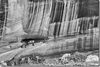
There are many ruins and significant rock formations in the canyon.  Ansel Adams made a famous photograph of the White House Ruins.  Desert varnish streaks the canyon walls in many places throughout the monument.  Here’s an infrared version I shot from the rim.

_DSC0341

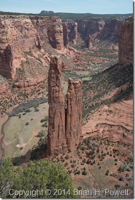
Another famous location is Spider Rock, which is the legendary home of the Spider Woman.  This spire reaches 750 feet above the canyon floor.

_DSC8784

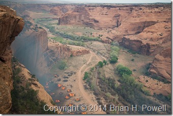
While we were there, federal fire crews were burning piles of invasive Russian Olive and Australian Tamarisk trees near the White House Ruin.  I could feel the heat on the rim as it rose from the canyon floor several hundred feet below.

_DSC8978


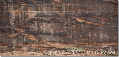
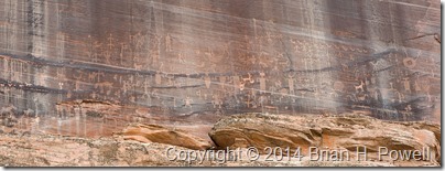
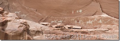
In the canyon, we saw many petroglyphs and pictographs.  Here are a few examples…

_DSC8799_DSC8805_DSC8852


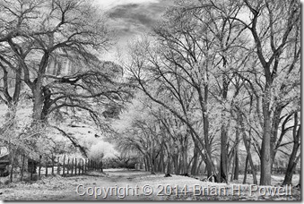
As we worked our way up Canyon del Muerto, I made this infrared photograph of the cottonwood trees, with the cliffs in the background.

_DSC0317


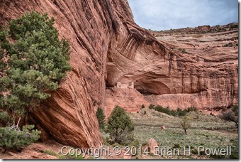
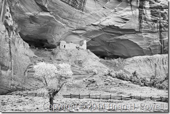
Our furthest point up-canyon was Mummy Cave Ruins.  Here are two images made there.  The first is HDR, and the second one, infrared.

_DSC8900_HDR_DSC0332


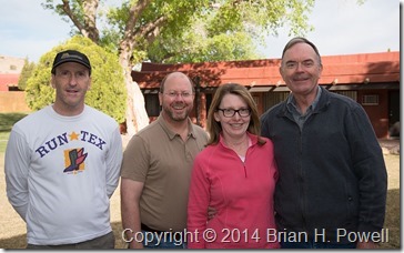
After breakfast on Wednesday morning, we said goodbye and went our separate ways.  Thanks to David, Alice, and John, for making this a wonderful adventure.  Happy trails!

_DSC8938

Hunt’s Mesa, and back to Monument Valley for a Lunar Eclipse

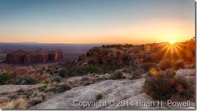
Monday morning, we awoke at 5:30 AM to subdued winds and temperatures in the high 30’s.  It wasn’t calm, but it was less windy than the evening before.  The sky was almost clear.  We drove about 2/3 of a mile east of our campsite for a good view.

_DSC8361_HDR

(Click to enlarge.)

The image above and the next image are (lightly processed) HDR images, where I combined a couple of different exposures to get a little more highlight and shadow detail.  In the image below, you can see the formation called the Totem Pole on the right center of the frame.  It’s about 420 feet tall.

_DSC8470_HDR

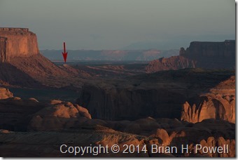
In the next image below, I’ve highlighted the view back towards The View hotel.  This was taken with my Nikkor 80-200 f/2.8 lens at 200mm.

_DSC8427

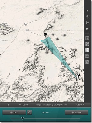
Here’s the shot in Photo Transit, which says that the hotel is about 6.7 miles away, with Utah in the distance beyond.

IMG_0232

As the sun rose higher in the sky, we packed up our photo gear and drove back to our campsite for breakfast, then packed up the camp for the long drive back to Monument Valley.  We enjoyed hot showers and a nap when we got back to the hotel.

Early Tuesday morning was another event we were looking forward to: a full lunar eclipse.  I thought about going out late to do some light painting, but couldn’t really scout out a good location for it.  (I learned light painting technique from Michael Frye in Yosemite.  He wrote a blog post about his eclipse photography.)  I ended up staying at my hotel and shooting from the balcony.

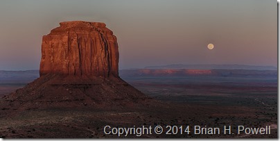
First, a shot of the full moon rising beyond Merrick Butte.

_DSC8628_HDR

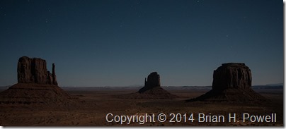
I also tried a 10-second exposure at ISO 6400 to try to capture the Mittens with the stars.  There’s a little too much light pollution for this to be effective.

_DSC8648

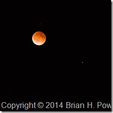
I didn’t bring my big lens on this trip; the longest I had was a 200mm.  Still, I did manage to capture this image of the “blood moon” during the eclipse.  Mars is to the lower right of the moon.

_DSC8782

The landscape lost light as more of the moon was obscured, so I decided to try to capture a video of the stars in motion.  Each of these images was a 5-second exposure at ISO 6400, and they were made about 20 seconds apart.  For best viewing, watch it on YouTube in full screen with the highest (1080p) resolution.

Stars

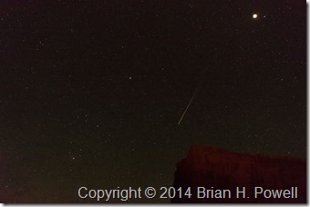
I have to admit I just started the intervalometer with the camera on a tripod and went back to bed for a while.  In the video, you’ll notice a couple of airplanes fly by.  I was lucky enough to have a meteor show up in one of the frames, seen below.

_DSC8723

The next day, we traveled to Canyon de Chelly.  More on that in the next blog post.

Mystery Valley, and on to Hunt’s Mesa

On Sunday, April 13, we began in Monument Valley and, with a Navajo guide, visited Mystery Valley before making our way up to Hunt’s Mesa.

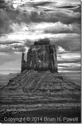
I got up for sunrise in hopes that we might get some good color.  I was playing around with HDR (high dynamic range) photography.  I didn’t get any colorful shots that I liked, but I decided to process the HDR as black and white, and I kind of like the way this turned out.  The sun is rising just behind this mitten…

_DSC8111_HDR_16bit

(Click to enlarge)

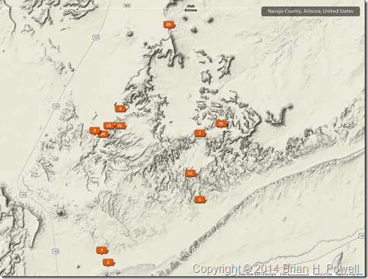
Here’s a map showing where my photos were geotagged.  We more or less worked our way in a counterclockwise fashion, starting at The View hotel at the top, Mystery Valley to the southeast, then further south as we and east as we worked our way up Hunt’s Mesa.

Sunday_Map


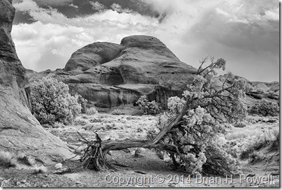
Here’s an infrared photo from Mystery Valley.  They had a bad ice storm this winter, and several trees were damaged.

_DSC0281


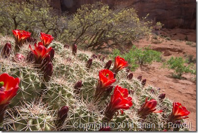
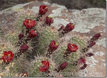
Here’s a nice claret cup cactus in bloom…

_DSC8181


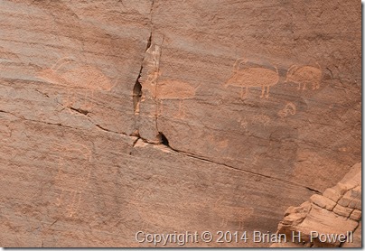
We saw plenty of pictographs and petroglyphs…

_DSC8229


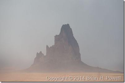
As the day wore on, it was clear that we were in for windy conditions.  This affected visibility to some extent, but it wasn’t a complete bust.  Here’s a photo of El Capitan as we worked our way around to the back side of Hunt’s Mesa.

_DSC8249

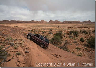
I’ll save you the story about how our vehicle got stuck in sand for about an hour and how we managed to get it unstuck.  But a little later, we reached a sandstone cliff, and our guide, Tony, admitted, “I’ve never been up this way before.”  This was our signal to get out and walk.  Tony decided it was passable, but with our confidence waning due to getting stuck in the sand, we told Tony we’d meet him at the top.  Here’s a photo of him charging up the hill…

_DSC8252


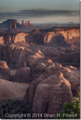
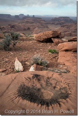
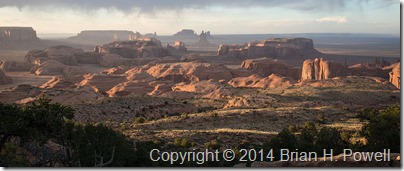
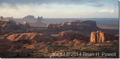
Eventually, we made it to the top of Hunt’s Mesa.  Here are a few images from late afternoon and sunset.  It was still very windy, especially as we approached the edge of the mesa to take these photos.

_DSC8281


_DSC8306


_DSC8310


We camped out on top of Hunt’s Mesa that night.  The wind died down about midnight, and it turned even colder.  I was warm in my REI +25 sleeping bag, but eventually (at 5:30 AM), it was time to get up for sunrise.  We guessed the temperature was in the mid to high 30’s on Monday morning.

In the Navajo Nation

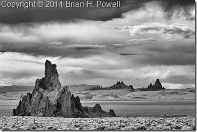
I left Flagstaff and drove east and north through the Hopi Reservation and Navajo Nation.  Near Kayenta, I stopped to take this infrared photo of Church Rock, with El Capitan (Agathla Peak) in the background on the right.  I used my Nikon D200 converted to infrared by Life Pixel.

_DSC0244
(Click image to enlarge.)

My destination for the day was Monument Valley.  This area has been used in many films—mostly John Wayne westerns, but also Back to the Future, Thelma and Louise, and others.  Monument Valley was a frequent subject of photographer Josef Muench, the father of David Muench.  Josef’s photos were used by Harry Goulding to entice John Ford to film many of his westerns in Monument Valley. I did an oral history interview with David Muench earlier this year, so it was interesting to visit a place where he had spent so much time with his dad.

Here’s a panorama of Monument Valley, taken with my Fujifilm X-E2.

_DSF0986

On the far, far right of this photo, the farthest mesa is called Hunt’s Mesa.  That would be our destination for a cold, windy camping trip the following night.  More to come on that in my next post.

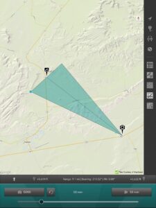
Edit:  Here’s a map showing the location of that first shot above, courtesy of the Photo Transit app. (Click to enlarge.)

Church Rock Map

Doe Mountain, Coconino National Forest

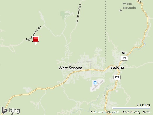
I’m in Arizona this week, starting off in Phoenix, then up to Flagstaff to visit my friends Crystal and Paul.  On a day trip from Flagstaff this past Friday, I went down to Sedona and hiked the Doe Mountain trail in Coconino National Forest.

Map of Doe Mountain


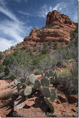
Here’s a photo from early in the hike.  I hiked up to the ridge shown in this photo.

_DSC7948


There were some nice wildflowers at the top, including this Claret Cup Cactus.  (Echinocereus triglochidiatus)

_DSC7985

Next up, Monument Valley and a trip to Hunt’s Mesa.

Christmas at El Tovar, Grand Canyon National Park

Merry Christmas to all of you.

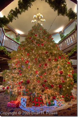
Here’s another HDR image, of the Christmas tree in the lobby of the grand hotel El Tovar, on the south rim of the Grand Canyon. (Click the image to enlarge.)

El Tovar Christmas Tree

Christmas at San Xavier del Bac

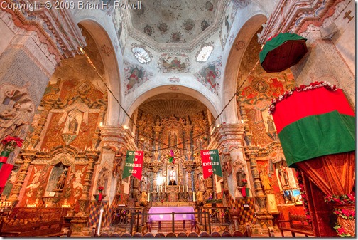
While in Tucson last week, I visited Mission San Xavier del Bac, south of the city.  The beautiful church was decorated for Christmas.

This was another challenging exposure, so I took three different exposures and combined them into a single high dynamic range (HDR) photograph.  (Click to enlarge.)

Interior of San Xavier del Bac Mission

Devil’s Bridge, Sedona

While traveling last week, I consulted Volume 2 (Arizona) of Laurent Martrès’ book series, Photographing the Southwest.

As their name implies, the books describe a variety of locations for photography in the southwest, including directions and good times of day to photograph.  I’ve learned of places I probably never would have found on my own.

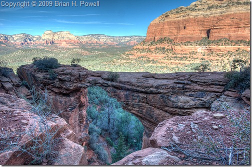
One place recommended by the book was Devil’s Bridge, a stone arch in the Coconino National Forest, near Sedona.  I drove a mile and a half down a rough 4WD road, and then hiked about one mile to get to the arch.  (I wasn’t going to let my injured leg dissuade me.)

When I arrived at the arch, it was still in morning shadow, but the rest of the valley was in full sun.  There was too much contrast to render the scene with a single image in my camera.  So, I tried my hand at some high-dynamic range (HDR) photography.  I’ve tried HDR in the past, without much success.  But I recently met Trey Ratcliff, an HDR expert and author of the blog http://www.stuckincustoms.com/.  I decided to try again.

So here’s a merged set of three different exposures of Devil’s Bridge.  (Click the image to enlarge.)

Devil's Bridge

I plan to post a couple more HDR photos in the next few days.

Wupatki National Monument

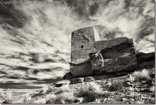
Wukoki_Pueblo 

I spent the weekend with my good friends Crystal and Paul. On Saturday, we went to Sunset Crater and Wupatki National Monuments.  The image above is an infrared shot of the Wukoki Pueblo (approximately 800 years old) at the Wupatki National Monument.

Grand Canyon, South Rim

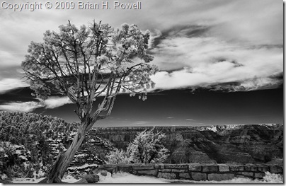
On Friday, I drove up to the south rim of the Grand Canyon, driving from east to west. There were a few inches of snow along the rim, but with a little care, I managed to get to some of the overlooks. Here’s an infrared shot from Grandview Point. (To see more detail in each image, click on them to enlarge.)

grandview_point

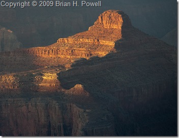
For sunset, I drove to Pima Point, which is along Hermit Road almost all the way to Hermit’s Rest. Here’s some of the last of the evening light falling on the Tower of Ra [see the comments].

Tower of Ra

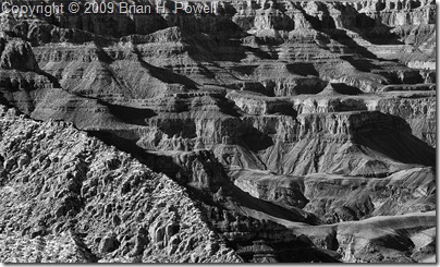
Here’s another infrared photo.  I think this does a good job of showing the variety of textures and layers in the rock.grand_canyon_infrared