Skip to content

Posts tagged ‘Clouds’

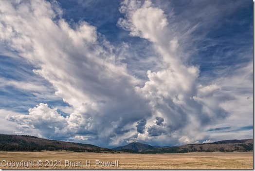
Valles Caldera

A couple of weeks ago, I spent a week in New Mexico.  I flew by way of Dallas.  Thanks to the pandemic, it was my first time on a plane in over a year. The flights were terrible—two were delayed, the flight from DFW to ABQ was diverted to El Paso for the night, and the final return leg to Austin was cancelled entirely.  I don’t think that everything in the airline industry is ready for our return.

I’ve been to New Mexico many times in the past.  In winter, I’m usually visiting the Bosque del Apache National Wildlife Refuge, but I love summertime, too, for hiking, for opera, for shopping, for food.  I still have several places in New Mexico I’ve wanted to visit and photograph.  One of them is the Valles Caldera.

(Click on any image to enlarge.)

Read more

Joshua Tree National Park

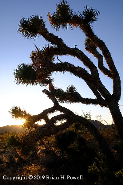
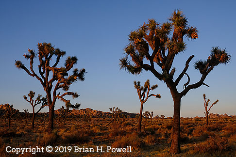
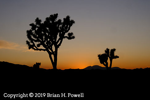
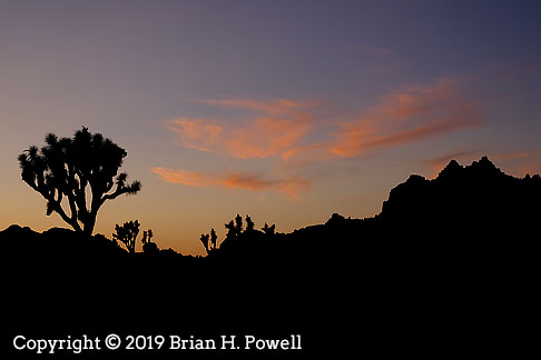
I was in southern California recently, and had an afternoon to drive over to Joshua Tree National Park. I first visited there in 2007, when I was in Palm Springs for a NANPA photography summit.

I planned my trip to arrive for sunset light. There weren’t many clouds in the sky, but I still managed to get a little sunset color. I just had a great time quietly hanging out among the Joshua Trees and watching the sun set.

Afterwards, I drove down to the town of Joshua Tree and had dinner before driving back west towards the city. It was an incredibly short visit, but I loved every moment.

A Final Night and Morning in the Grand Tetons

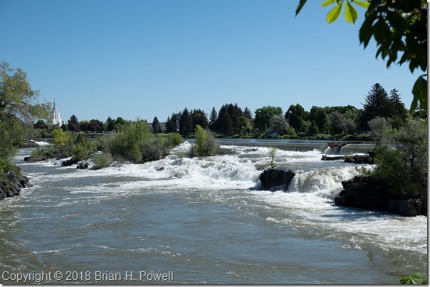
I got up early on Friday to drive the three hours from Canyon Village in Yellowstone, through West Yellowstone, and then down to Idaho Falls.  Why?  Because of some upcoming international travel, I needed a Yellow Fever immunization.  Due to timing, and a nationwide shortage of said vaccines, it was most convenient for me to make an appointment with Eastern Idaho Public Health.

I arrived early (as planned, just in case), so I went down to see the eponymous falls.  A Mormon Temple is in the background on the left.

Click any image to enlarge.

_DSF5238

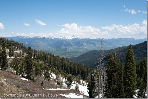
After my immunization, I had lunch, and headed eastward to go over Teton Pass.  From the top, you can see a nice view of Jackson Hole.

_DSF5239

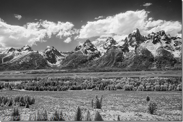
I drove on down to Jackson and got settled into the Jackson Lake Lodge in Grand Teton National Park for my final night.  I did a little infrared photography in the bright afternoon sun, before heading back to Jackson to meet with a couple of friends for one final night.

_DSC6561


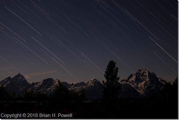
Because of the great location and view from near my hotel room, I set up my camera for star trails.  I did a couple of 35-minute captures from about 11 PM to a little after midnight..  Here’s one of the photos.  The moon was waxing gibbous, and provided plenty of illumination for the snow on the mountains.

merge 2

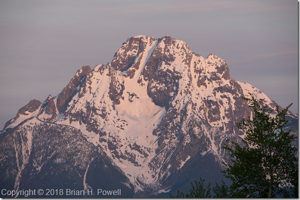
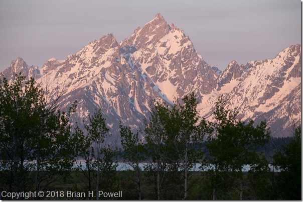
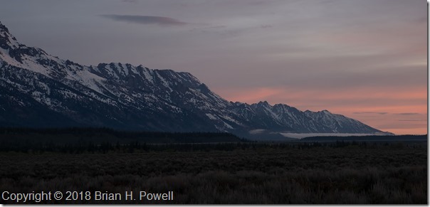
Despite the late night, I rose early in hopes of great color at sunrise.  I got a little bit of pink in the sky, much like earlier in the week.  Here are a couple of photos—one of Mount Moran, and one of Mount St. John.

_DSF5471


_DSF5475

Before I knew it, it was time to leave for the airport and fly home.

The general consensus at the Nature Photography Celebration (organized by The North American Nature Photography Association) is that it was a successful event that we should repeat in new locations in the future.  We heard from great photographers presenting about their latest projects, and we had plenty of free time to go out and photograph great locations on our own.  (And we even had a small trade show with support from many camera manufacturers, camera stores–especially Gary Farber at Hunt’s Photo & Video–and other organizations.)

A big thank you to my friend Charlotte for sharing wine, cheese, and a hyperactive dog in her beautiful home, and for including me in her network of friends, who all made me feel welcome a long way from home.

I am grateful for the beautiful places like the Grand Tetons and Yellowstone, and all the other National Parks and National Monuments we are blessed to protect for future generations.

More Time in the Grand Tetons

I’m back in Austin now.  I chose not to keep up with the blog as I went.  A combination of 16+ hours of light for photography each day, lots of travel time, time with friends, and a little bit of allergies all conspired to help me choose sleep instead of half-hearted writing into the night.  But I’m back, and have four more blog posts in the works after this one.

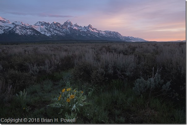
Sunrise each morning was about 5:50 AM, so I’d get up every morning about 5:00 and head out to see what the sunrise would bring.  We never had any truly spectacular colors in the morning, but it was still beautiful to be in this amazing place to see how the sun would first light the mountains.

Click on any image to enlarge.

_DSF4263

Balsam Root, the yellow flower in the foreground of the photo below, was blooming in many places in the valley.

_DSF4272

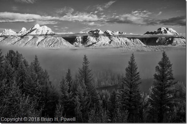
Some mornings would start with fog in low-lying areas.  Clouds in the mountains were constantly changing.  This infrared photo is from the same day as those in my earlier blog post about the Snake River Overlook.  It was taken about fifteen or twenty minutes before the images I posted last week.

_DSC6548


I dropped by another couple of famous places for photography.

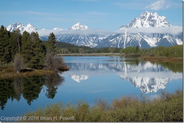
Oxbow Bend, below Jackson Lake on the Snake River often has still water in the mornings, great for reflections of Mount Moran, and to its left, the mountain known, at least for now, as Mount Woodring.  (And further left are Mount St. John and Rockchuck Peak.)

_DSF4250


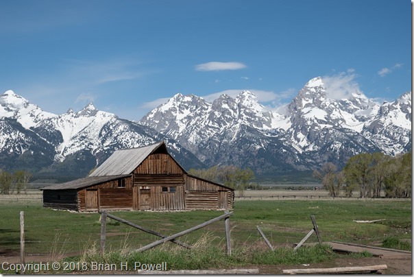
Mormon Row is a section of Grand Teton National Park that I suspect most people don’t visit, but is famous among photographers.  A group of Mormons from Idaho homesteaded here beginning in the late 1800’s, and lived here through the mid-1900’s before being sold to the National Park Service.

Perhaps most famous is the Thomas Alma Moulton barn, shown below.

_DSF4714


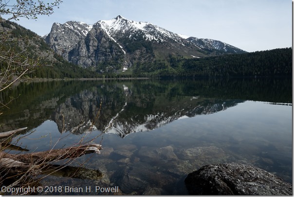
I didn’t do much hiking this trip, but I did take an easy five-mile hike on Tuesday up to Phelps Lake.  This is where I saw the moose in my earlier blog post about Grand Teton Wildlife.

_DSF4764


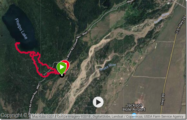
Here’s the GPS track for the hike.  It’s part of the Laurance S. Rockefeller Preserve in the southernmost section of Grand Teton National Park.  This section was donated by Laurance S. Rockefeller to the National Park Service in 2001.

phelpslake

Grand Teton National Park

I flew to Jackson, Wyoming, today.  I’m here, in part, for a North American Nature Photography Association Nature Photography Celebration.

Today’s forecast called for an 80% chance of rain, but that can lead to some nice dramatic photos.  I headed north into the Grand Teton National Park, stopping at the Moose Junction Visitor Center to find out about trail conditions during this early part of the season.  I continued driving north, to get my bearings.  It’s been over twenty years since I was last here.

The weather held out just fine.  It was mostly cloudy, with intermittent rain showers that never lasted more than a few minutes.  I think the weather will improve somewhat during my stay.

Here are a few images to give you a taste of what it was like today.  Click on any of them to enlarge.

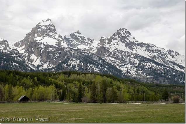
Grand Teton, Mount Owen, and Teewinot Mountain:

_DSF4119

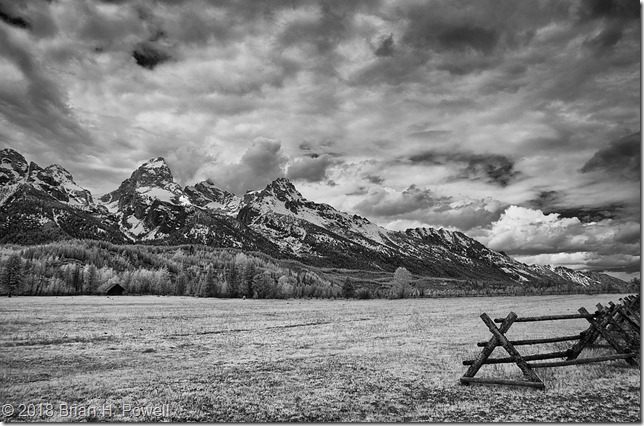
_DSC6536-Edit

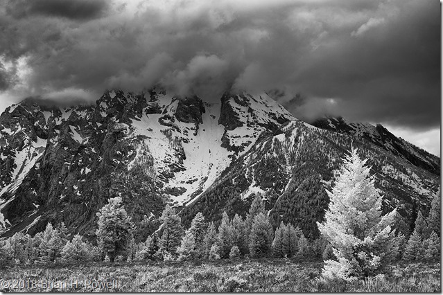
Mount Moran, in the clouds:

_DSC6540-Edit

The first image was taken with a Fujifilm X-T2, with a Fujifilm 18-55 lens.

The second and third images were taken with a Nikon D300 and Nikkor 18-200 lens.  Camera converted to infrared by LifePixel.

More coming up later this week.

Hiking in the Dolomites, Part 6

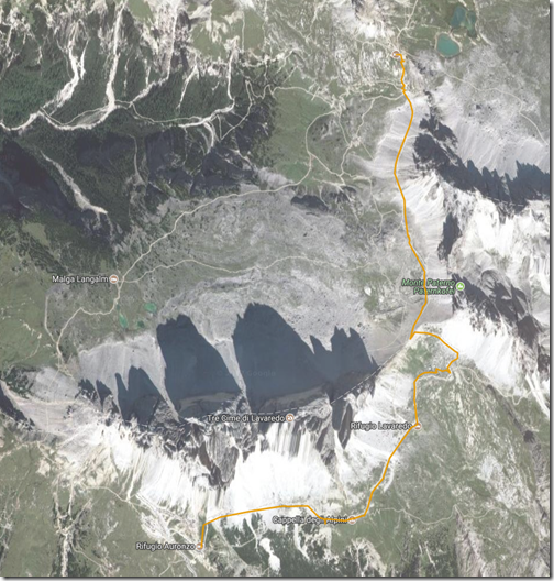
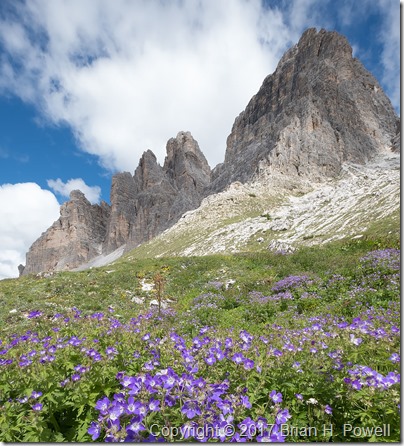
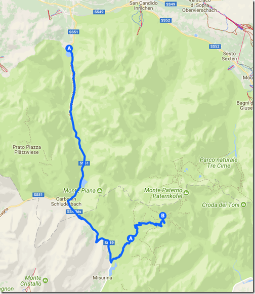
The Tre Cime de Lavaredo are the three mountain peaks that are the highlight of the Tre Cime Natural Park.  (In German, they are called Drei Zinnen.)  From the end of the road at Rifugio Auronzo, we began our three mile hike around Tre Cime to Rifugio Locatelli.  The hike took us up to 8000 feet, to a saddle between Tre Cime and the nearby Monte Paterno (Paternkofel), where we had lunch.  The trail descended from the pass back down a few hundred feet, before ascending again to Locatelli, back at 8000 feet elevation.  Temperatures were in the 50’s, and it was somewhat windy.

TreCimeHike

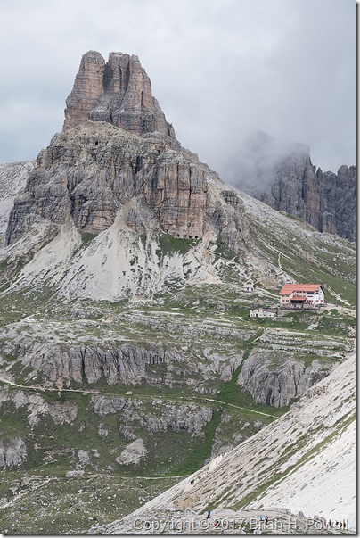
Shown below, the Locatelli hut, with the Torre di Toblin behind it.

(Click any image to enlarge.)

_DSF1594

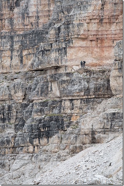
On the side of the Monte Paterno, we saw some climbers on a Via Ferrata (Italian for “Iron Road”).  These are hiking and climbing routes that have a cable, fixed to the rock every few meters.  You wear a harness with two carabiners.  As you reach one of the iron stays in the rock, you unclip one carabiner and reattach it to the cable on the other side of the stay, then follow with the other carabiner.  Thus, you are always attached to the cable.

Many of the Via Ferrata in the Dolomites are left from World War I.  The Dolomites were a major battleground in the war between Austria-Hungary and Italy.

In the photo below, you see a couple of people on a fairly flat, easy section of Via Ferrata on Monte Paterno.

_DSF1602

We continued on to the Locatelli hut.  This is a much larger hut than the Resciesa hut we stayed in earlier—I’d guess they have room for over 100 people.  But note that they only have one shower, and it costs €5 to use it for six minutes.  (None of our group bothered with a shower that night.)

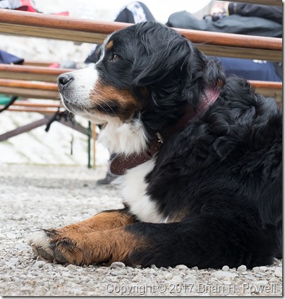
Many dayhikers come for lunch or dinner in the cafe.  Along with a lot of people, we saw a few dogs of all sizes on the trail.  Here’s a photo of a beautiful Bernese Mountain Dog.

_DSF1613

That night, the barometric pressure began to rise, and we set our alarms in hopes of clear skies for night photography.  We got started a little bit late, so this turned into a bit of night photography combined with pre-dawn photography.  Here’s a time-lapse sequence showing the transition from night to twilight.

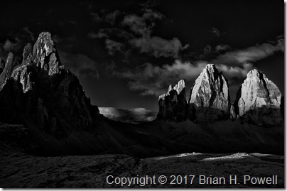
We returned to bed for an hour of sleep before heading out for sunrise.  Here’s one of my favorite infrared images of the dawn light hitting Monte Paterno and the Tre Cime.

_DSC6473

We returned again to bed for another hour of sleep before breakfast, and then began our hike back to Rifugio Auronzo, where we waited for our taxi that would take us to Cortina.

_DSF1803

Up next, Cortina and Venice.

Hiking in the Dolomites, Part 5

(This is my 100th post on this blog.  Thank you all for reading.)

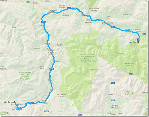
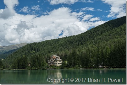
The morning of July 1, we left Selva/Wolkenstein for Lago di Dobbiaco.  I kind of think of this as a rest day between our weather-challenged hike from yesterday, and the 8000-foot-elevation hiking of tomorrow.  We also swapped out our guides–trading Hayden for Jake, who would be with us until the official end of the trip.  Both guides provided by AlpineHikers were excellent.

As we drove over to Dobbiaco, we saw many bicyclists preparing for the following day’s Maratona dles Dolomites, an 85-mile bike race with nearly 14,000 feet of elevation gain.  (The winner averaged 18.6 mph.)  Nearly 30,000 cyclists apply each year for one of the 9,000 starting positions.

ToDobbiaco

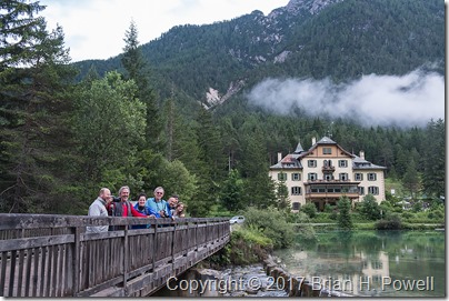
We checked into the116-year-old Hotel Baur, which sits right on the lake.

_DSF1455

(Click on any image to enlarge.)

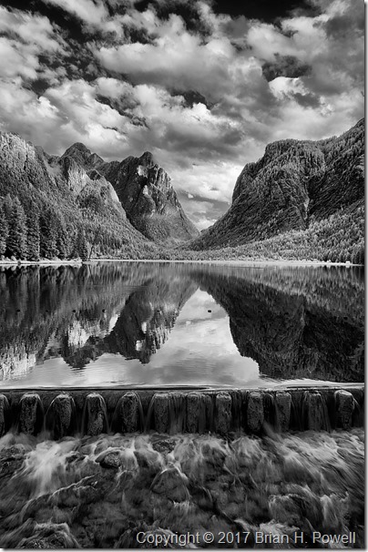
We walked around the lake, then I settled on a view facing south for most of my images.  We played around with reflections, and slow shutter speeds as the water flowed over a dam at the north end of the lake.  Here’s an infrared photo from late in the day.

_DSC6433

Here’s a group shot of all of us on a bridge near the hotel.

_DSF1516

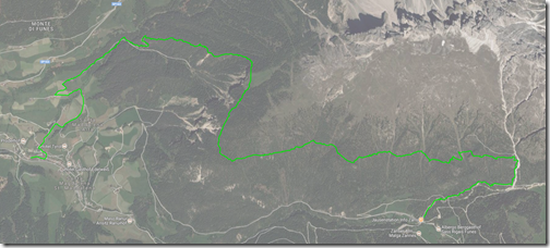
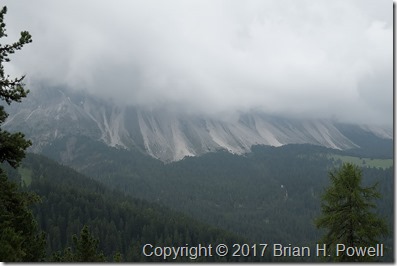
The next morning, we drove into the Tre Cime Natural Park and began our hike to Rifugio Locatelli.  Stay tuned for more.

ToTresCime

Hiking in the Dolomites, Part 4

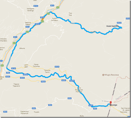
The next day—June 29 if you’re keeping score—we took a taxi down to the ski village of Ortisei.  We spent a little time walking around the town and enjoying time at a cafe near the Hotel Adler before taking a funicular up into the mountains.
ToOrtisei

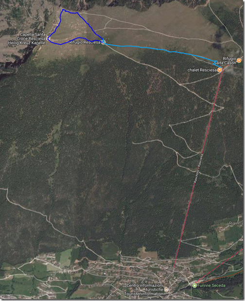
From the top of the funicular, it’s about a mile traverse (light blue route below) over to Rifugio Resciesa, where we’d stay for the evening.  Unfortunately, I fell ill with intestinal pain that afternoon, so once I got to the hut, I just rested.  As I look for a silver lining to being sick, the afternoon views were hampered by a whole lot of clouds.  My body chose a good time to demand rest.

The Resciesa hut is one of many different mountain huts scattered all over the Alps.  It’s a combination bar/restaurant and guest house.  The Resciesa hut is one of the smaller huts, with room for about 40 people.  We had a room of bunk beds for all eight of us.  Some rooms are larger; some smaller.  There were two showers and two bathrooms shared for everyone at the hut.  I was pretty pleased with the experience, and people who had been at other Alpine huts agreed that this was among the nicer ones.
Resciesa

The next morning, the weather and my health had both improved.  I decided to hike the approximately one-mile loop from the hut, to the peak, and then over to a small chapel.  (This is the darker blue route on the map above.)  The temperatures were in the 50’s and windy.  I’d typically wear three to five layers of clothes to maintain comfort.

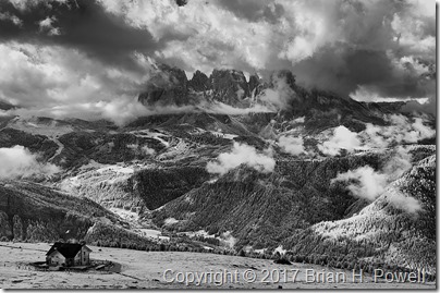
On my way up, I took this infrared photo of the Resciesa hut in the lower left, with the Langkofel Group of mountains in the distance.  There are still plenty of clouds around, but at least we could see for miles around.
_DSC6283

Click any image to enlarge.

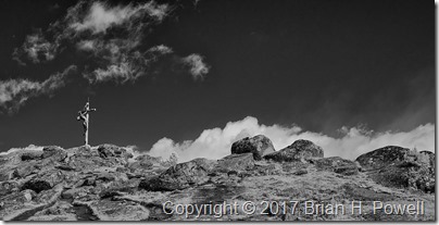
It’s pretty common for hikable mountains in this area to have wooden crosses at their summits.  Here’s an infrared view of the cross above the Resciesa hut.
_DSC6288

And a closer look from my regular camera:
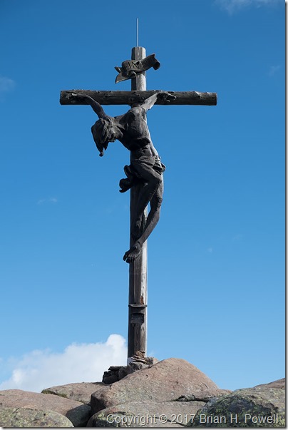
_DSF0848

I turned around the other way, and took this panorama.  The Resciesa hut is on the far left of the photo, and the chapel is to the right of the sign near the middle.

_DSF0849

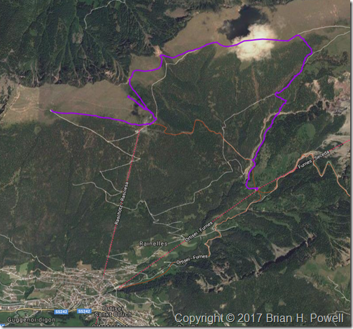
In the late morning, we left the hut and started a traverse eastward.  The plan was to get a better perspective on the Geislergruppe, also to our east.  We would then take a trail down to the middle station of aerial gondolas ascending up to the Seceda ski area.  We could then take the gondola down to Ortisei, where we left the day before.
LeavingResciesa1

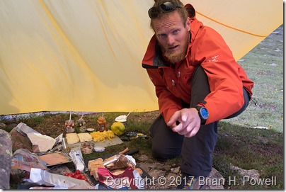
A typical lunch for us was a lunch sack prepared by our guide containing snacks and an always-excellent sandwich prepared that morning from local cheeses, meats, and vegetables.  On this day, it was more of a “build-your-own” affair.  Here’s a photo of our guide, Hayden, with the lunch preparations spread out under his tarp.
_DSF1196

We had lunch near one of the peaks above the funicular station.  We spent quite a bit of time there making time lapse videos.  Here’s an infrared time lapse of the Geislergruppe, to our east.

I would love to tell you that the rest of our day was uneventful.  But it was not to be.

The weather turned again.  Soon after we left our lunch spot, it looked like we might have a brief shower.  We put our rain covers over our packs, and donned our rain jackets.  Most of us had rain pants with us, but none of us felt like it was going to be necessary to put them on.  We were wrong.

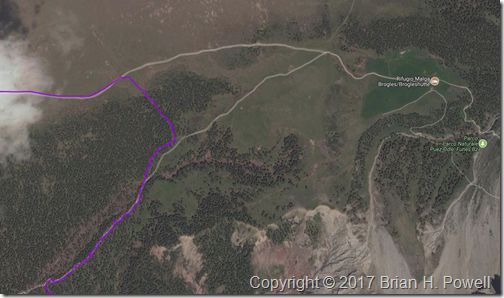
The sleet started first.  Some called it hail.  The temperatures dropped to around 40 degrees Fahrenheit.  Then rain mixed in.  And then thunder.  If it weren’t for the thunder, we might have stopped to put on our rain pants.  On the map below, our travel route enters from the upper left, and we headed due east.  We were originally aiming for the intersection of trails just right of center.  With the rain, we debated going on to the Rifugio Malga Brogles a bit further on the trail to wait out the rain and sleet.  But it was the thunder that convinced us that it was time to exit the mountain as quickly as possible.

We went off trail, heading down an embankment to take us down below tree line to pick up the return trail.  It was steep and slippery, but it was the fastest way out of danger from possible lightning.  Once we got to the return trail, the hike finally met its promise of being uneventful, except for the part about being soaked.  The thunder stopped; the rain abated.  The temperatures rose as we descended.
LeavingResciesa2

We made it to the cable car and descended to Ortisei to catch the bus to continue our journey.  We stayed overnight that night in Selva (known in German as Wolkenstein).
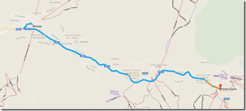
ToSelva

Coming up, a visit to Lago di Dobbiaco, and on to the highlight of the trip, Tres Cime.

Hiking in the Dolomites, Part 3

The next day, we took the bus to the end of the road, and went for an approximately 7-mile hike near Santa Magdalena at around 2000 meters elevation.  Here’s the trail we took, hiking from east to west:

FirstHike

As I mentioned in my last post, the weather turned overcast with a low ceiling, and a nearly constant threat of rain.  The good news is that it didn’t actually rain much—a couple of passing showers that lasted only minutes.  The bad news is that we had to imagine what the scenery looked like:

_DSF0301

(Click on any image to enlarge.)

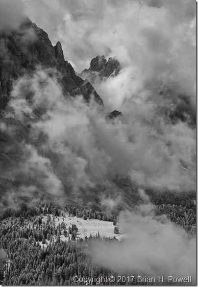
Once again, I turned to my infrared Nikon D300 to find elements of drama in the larger scene.  On this trip, I used the versatile Nikkor 18-200mm f/3.5-5.6 lens for all of my infrared photos.  This shot is using a focal length of 65mm (35mm equivalent of 100mm) at f/5.
_DSC6193

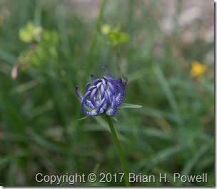
Another approach to photographing with uncooperative weather is to focus on details, such as this flower.

_DSF0300

I believe this is a Phyteuma orbiculare.
Common name: Round-headed Rampion

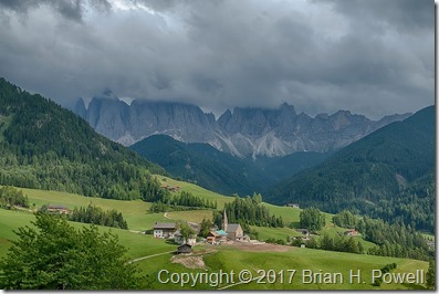
The weather improved marginally as we neared the end of our hike, descending to Santa Magdalena to catch the bus back to the hotel.  The mountains were still in the clouds, but we could at least appreciate more of the scenery.

_DSF0381_HDR

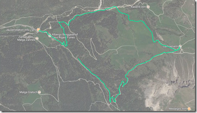
The next day, we hiked again for about five miles in the same area, heading more east:

SecondHike

The weather was slightly improved from the day before—the ceiling had lifted ever so slightly, and we saw some blue sky as the day progressed.

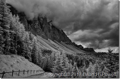
Here’s my favorite infrared photo from the day, with the brooding clouds hanging just at the top of the peaks.

_DSC6236

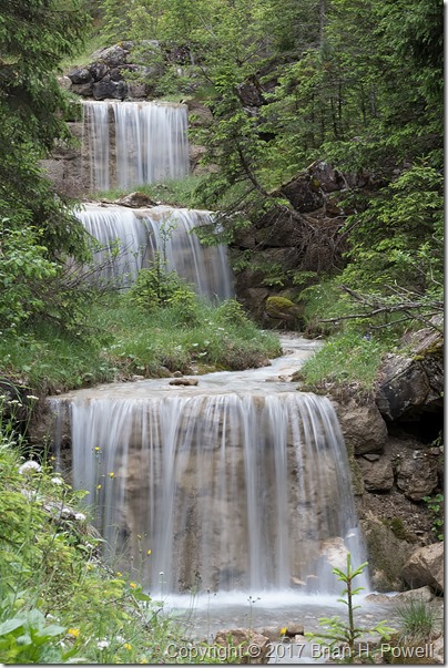
As long as the sky was cloudy, we could switch our focus to scenes that don’t include it.  I photographed these waterfalls with a 1/3 second exposure at f/22.

_DSF0603

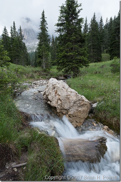
The photo below is a 1/10 second exposure, also at f/22.

_DSF0640

If you haven’t figured it out by now, one of the themes of this week was to find different ways to photograph something interesting while having challenging weather conditions.  This led us to time-lapse photography.

Here’s a very short video of sixty time-lapse frames.  Each frame was taken 3 seconds apart, and the video below speeds it up by 36x.  I’ll have a few more examples like this in later blog posts.

Next up, an afternoon in Ortisei, on our way up to our first mountain hut, the Rifugio Resciesa.

Alaska Homestead Lodge, Silver Salmon Creek

[Updated:  See addendum at the end of this post.]

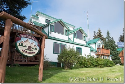
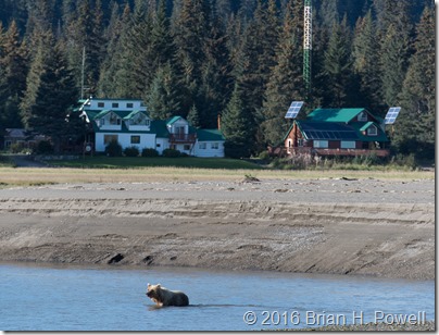
While in Alaska, we stayed at a great lodge, The Alaska Homestead Lodge.  It’s part of a small Alaskan bush community at Silver Salmon Creek.  The owners, James and Shelia Isaak, live next to the lodge and keep it in great shape.

(Click any image to enlarge.)

_DSF5754

The lodge itself is on the inland side of the tidal marshes, only a few hundred yards from the coast.  It was common to be sitting in the upstairs dining room and watching bears walk in from the beach, right past the lodge on their way into the forest.

_DSC3939

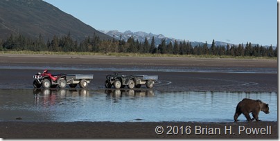
We also had a great guide, Belle, who has been guiding three years at the lodge.  There are two lodges along the coast, and the guides from both lodges cooperate with each other to share information on the radio about what the bears are doing.  The guides drive four-wheel ATVs with small trailers.  I did this trip with four of my friends, and we all rode in the trailer together up and down the beach, through the creek, and along the trails.

_DSC4475

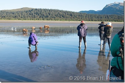
Here’s a snapshot showing a typical morning at the beach, with a group from each lodge watching the mom and three cubs dig for clams.  We all wore rubber boots (supplied by the lodge) to keep our feet dry.

_DSF4795

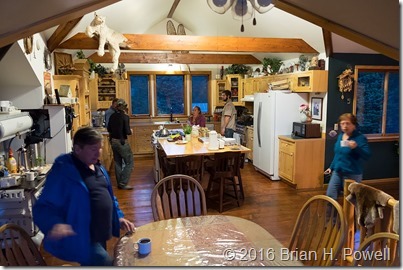
A pleasant surprise was the food at the lodge.  Not just good; it was great.  Our chef’s summer job last year was at Bouchon.  Meals were prepared in the lodge’s upstairs kitchen and served at the communal dining table.  The grilled salmon was fresh and expertly prepared—I think we had it three different nights.  We also had pork tenderloin, lasagna, chicken fajitas—and fresh desserts, such as berry crisp, and chocolate pie.

_DSF5995

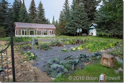
The lodge had a garden and greenhouse from which the salads came… lettuce, kale, broccolini, cabbage, and more.  For the most part, the bears left these alone—even the berries used in the desserts.

_DSF5755

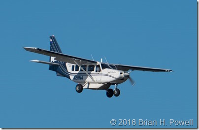
Like much of Alaska, the only reasonable way in and out of the lodge is by plane.  We used Natron Air Taxi as our charter to get to the lodge from Anchorage.  We had cloudless, blue sky for our flight on this GA-8 Airvan.

_DSF4171

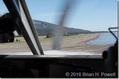
And here we are coming in for a landing on the beach.

_DSC2719

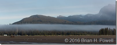
The weather continued to be great for the first five days.  The previous three weeks were rainy, and the following two weeks were predicted to be rainy—but we had five solid sunny days.  And then it turned foggy, misty, and rainy for us, too.  The lodge recommends having a buffer travel day on each side of your stay, in case you get weathered in and can’t get into or out of the lodge.  We almost were stuck at the lodge an additional day.  Tim, our pilot, persisted and was able to land further north and taxi down the beach for a couple of miles to get us.

On a positive note, the fog and clouds added some variety to our scenery and photographs.

_DSC5527

[Addendum]

It occurred to me after posting this that I didn’t describe what a typical day was like.  Each day, you work out your schedule with your guide.  We’d typically get up for an early shoot around 7:00 AM, then back to the lodge at 8:00 AM for breakfast.  Then we’d head back out after breakfast for a few hours, and return for lunch around noon.  Because of the high latitude, the quality of light stayed pretty good until 10:00 or 11:00 AM—even longer if it was a little hazy.  If something especially good is happening, our guide would radio the lodge to let them know we’d be running late.  After lunch, we’d often take a break (nap time), and head out again for a few hours before or after dinner.

A lot is dependent on the tide.  At high tide, the bears are usually in the meadow eating grass and sleeping.  At lowest tide, they are clamming.  Near low tide, they could fish.  During our week, high tide was in the afternoons, so we spent most of the time photographing in the mornings.

Just talk to your guide about the photos you want to take, and they’ll do their best to make it happen.  If you want photos of bears eating grass, you’ll love going out during high tide.  If you want photos of bears fishing, you might go out a few hours after high tide.